TopoQuest Logo
Do you find TopoQuest useful?
Help keep TopoQuest running and adding new maps/features by donating!
Bitcoin:  19c7KJd3qBynnjoSw5npx9KScwjBe4ifkT
Litecoin:  LXs6TkuXGGXo1vDsWCkWVdjQX94eUKd6ui
Home View Maps Find Maps Find Places Resources & Links


Long Island, Virginia Topographic Map

USGS Map Title: Long Island, VA
USGS Map MRC: 37079A1
DRG (GeoTIFF) Download: o37079a1.tif


Neighboring USGS Topographic Map Quads:


  Castle Craig, VA  
37079B2
 

  Gladys, VA  
37079B1
 

  Mike, VA  
37078B8
 

  Straightstone, VA  
37079A2
 

  Long Island, VA  
37079A1
 

  Brookneal, VA  
37078A8
 

  Mount Airy, VA  
36079H2
 

  Republican Grove, VA  
36079H1
 

  Nathalie, VA  
36078H8


Map MRC Location:

N38°
W80°
N38°
W79°
H8 H7 H6 H5 H4 H3 H2 H1
G8 G7 G6 G5 G4 G3 G2 G1
F8 F7 F6 F5 F4 F3 F2 F1
E8 E7 E6 E5 E4 E3 E2 E1
D8 D7 D6 D5 D4 D3 D2 D1
C8 C7 C6 C5 C4 C3 C2 C1
B8 B7 B6 B5 B4 B3 B2 B1
A8 A7 A6 A5 A4 A3 A2 A1
N37°
W80°
N37°
W79°

Long Island, VA USGS 1:24K Topographic Map Preview:
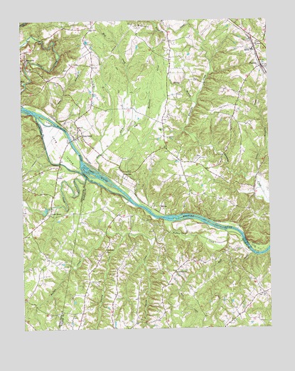
Long Island, VA USGS Topographic Map
Click on map above to begin viewing in our Map Viewer.

This topographic map contains these locations and features:
Feature Name Type Latitude Longitude GNIS ID View Map
Buck BranchStreamN37.0999°W79.1228°1463979View Map
Buffalo ChurchChurchN37.0301°W79.0850°1464031View Map
Buffalo CreekStreamN37.0363°W79.0139°1464036View Map
Bull CreekStreamN37.0296°W79.0078°1464061View Map
Cedar ForestPopulated PlaceN37.0465°W79.1106°1477190View Map
Cedar Forest Mill DamDamN37.0485°W79.1114°1490595View Map
Cherry CreekStreamN37.0360°W79.0597°1464774View Map
Dry MountainSummitN37.1196°W79.0661°1466002View Map
Dry Mountain CreekStreamN37.0782°W79.0736°1466003View Map
Edge ChurchChurchN37.0804°W79.0528°1466172View Map
Evergreen ChurchChurchN37.1151°W79.0053°1466362View Map
First Buffalo ChurchChurchN37.0313°W79.0828°1466580View Map
Franklin CemeteryCemeteryN37.0718°W79.0508°1674945View Map
Goat IslandIslandN37.0846°W79.1128°1467172View Map
Green HillPopulated PlaceN37.0618°W79.0725°1495612View Map
Hale IslandsIslandN37.0624°W79.0867°1467648View Map
Hill Creek ChurchChurchN37.1213°W79.0892°1468047View Map
Little Whipping CreekStreamN37.0610°W79.0067°1469684View Map
Long BranchStreamN37.0826°W79.1056°1469770View Map
Long IslandIslandN37.0732°W79.1050°1469818View Map
Long IslandPopulated PlaceN37.0785°W79.0942°1495868View Map
Long Island Post OfficePost OfficeN37.0780°W79.0954°2766239View Map
MarysvillePopulated PlaceN37.1090°W79.1222°1495906View Map
MelrosePopulated PlaceN37.0496°W79.0550°1495929View Map
NarunaPopulated PlaceN37.1060°W79.0025°1471326View Map
Naruna Post OfficePost OfficeN37.1050°W79.0011°2766397View Map
Pannel School (historical)SchoolN37.0271°W79.0734°1496747View Map
Rocky BranchStreamN37.0910°W79.0359°1473426View Map
Second Buffalo ChurchChurchN37.0226°W79.0478°1474140View Map
Seneca CreekStreamN37.0901°W79.1231°1474166View Map
Straightstone CreekStreamN37.0613°W79.0922°1475235View Map
Tinsley CreekStreamN37.0371°W79.0742°1475736View Map
William Campbell Combined SchoolSchoolN37.1132°W79.0069°1464373View Map

Note: Coordinates in the location and feature list above are referenced to NAD83 datum.


Copyright (C) 2008-2025 Ryan Niemi / Sunset Dynamics ... All Rights Reserved