TopoQuest Logo
Do you find TopoQuest useful?
Help keep TopoQuest running and adding new maps/features by donating!
Bitcoin:  19c7KJd3qBynnjoSw5npx9KScwjBe4ifkT
Litecoin:  LXs6TkuXGGXo1vDsWCkWVdjQX94eUKd6ui
Home View Maps Find Maps Find Places Resources & Links


Republican Grove, Virginia Topographic Map

USGS Map Title: Republican Grove, VA
USGS Map MRC: 36079H1
DRG (GeoTIFF) Download: o36079h1.tif


Neighboring USGS Topographic Map Quads:


  Straightstone, VA  
37079A2
 

  Long Island, VA  
37079A1
 

  Brookneal, VA  
37078A8
 

  Mount Airy, VA  
36079H2
 

  Republican Grove, VA  
36079H1
 

  Nathalie, VA  
36078H8
 

  Java, VA  
36079G2
 

  Vernon Hill, VA  
36079G1
 

  Halifax, VA  
36078G8


Map MRC Location:

N37°
W80°
N37°
W79°
H8 H7 H6 H5 H4 H3 H2 H1
G8 G7 G6 G5 G4 G3 G2 G1
F8 F7 F6 F5 F4 F3 F2 F1
E8 E7 E6 E5 E4 E3 E2 E1
D8 D7 D6 D5 D4 D3 D2 D1
C8 C7 C6 C5 C4 C3 C2 C1
B8 B7 B6 B5 B4 B3 B2 B1
A8 A7 A6 A5 A4 A3 A2 A1
N36°
W80°
N36°
W79°

Republican Grove, VA USGS 1:24K Topographic Map Preview:
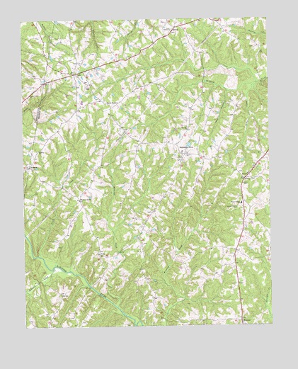
Republican Grove, VA USGS Topographic Map
Click on map above to begin viewing in our Map Viewer.

This topographic map contains these locations and features:
Feature Name Type Latitude Longitude GNIS ID View Map
AlchiePopulated PlaceN36.8924°W79.0164°1499047View Map
Brush CreekStreamN36.9037°W79.1164°1463943View Map
Buffalo School (historical)SchoolN36.9993°W79.0356°1496671View Map
Clover Bottom CemeteryCemeteryN36.9951°W79.0489°1690108View Map
Clover Bottom ChurchChurchN36.9949°W79.0486°1464999View Map
Cluster Pines ChurchChurchN36.9693°W79.1211°1465010View Map
CodyPopulated PlaceN36.9776°W79.0984°1477212View Map
Cow CreekStreamN36.9743°W79.0056°1465339View Map
District 1CivilN36.9456°W79.0103°1927181View Map
Duncan DamDamN36.9501°W79.0414°1489997View Map
Elkhorn CreekStreamN36.8987°W79.1100°1466233View Map
First Baptist Church of MillstoneChurchN36.8779°W79.0147°1690115View Map
Green Valley School (historical)SchoolN36.9271°W79.0136°1496702View Map
HermosaPopulated PlaceN36.9401°W79.1214°1477410View Map
Hickory GrovePopulated PlaceN36.9268°W79.0961°1477411View Map
Hickory Grove ChurchChurchN36.9265°W79.0967°1496713View Map
Hickory Grove School (historical)SchoolN36.9501°W79.0825°1496714View Map
LedaPopulated PlaceN36.9043°W79.0861°1477481View Map
Leda School (historical)SchoolN36.8990°W79.0661°1496723View Map
Long BranchStreamN36.9707°W79.0203°1469763View Map
Memorial ChurchChurchN36.9346°W79.0089°1470357View Map
MillstonePopulated PlaceN36.8768°W79.0153°1499748View Map
Millstone CemeteryCemeteryN36.8771°W79.0147°1690127View Map
Millstone School (historical)SchoolN36.8757°W79.0183°1496730View Map
Mulberry CemeteryCemeteryN36.9465°W79.1181°1690131View Map
Mulberry ChurchChurchN36.9465°W79.1172°1471244View Map
North Halifax Volunteer Fire DepartmentBuildingN36.9424°W79.0454°2075367View Map
North StantonPopulated PlaceN36.9663°W79.0828°1499806View Map
Oak Ridge ChurchChurchN36.9551°W79.0406°1471765View Map
Oak Ridge School (historical)SchoolN36.9379°W79.0411°1496742View Map
Republican GrovePopulated PlaceN36.9451°W79.0439°1477676View Map
Runaway CreekStreamN36.8829°W79.0775°1473629View Map
Spider CreekStreamN36.9726°W79.0078°1474948View Map
StovallPopulated PlaceN36.9968°W79.0464°1500174View Map
Sydnor Jennings Elementary SchoolSchoolN36.9248°W79.0141°1475410View Map
VolensPopulated PlaceN36.9351°W79.0122°1477846View Map
Volens Elementary School (historical)SchoolN36.9369°W79.0107°1496764View Map

Note: Coordinates in the location and feature list above are referenced to NAD83 datum.


Copyright (C) 2008-2025 Ryan Niemi / Sunset Dynamics ... All Rights Reserved