TopoQuest Logo
Do you find TopoQuest useful?
Help keep TopoQuest running and adding new maps/features by donating!
Bitcoin:  19c7KJd3qBynnjoSw5npx9KScwjBe4ifkT
Litecoin:  LXs6TkuXGGXo1vDsWCkWVdjQX94eUKd6ui
Home View Maps Find Maps Find Places Resources & Links


Lookout Pass, Utah Topographic Map

USGS Map Title: Lookout Pass, UT
USGS Map MRC: 40112A5
DRG (GeoTIFF) Download: o40112a5.tif


Neighboring USGS Topographic Map Quads:


  Davis Knolls, UT  
40112B6
 

  Onaqui Mountains South, UT  
40112B5
 

  Faust, UT  
40112B4
 

  Indian Peaks, UT  
40112A6
 

  Lookout Pass, UT  
40112A5
 

  Vernon, UT  
40112A4
 

  Indian Springs, UT  
39112H6
 

  Erickson Knoll, UT  
39112H5
 

  Dutch Peak, UT  
39112H4


Map MRC Location:

N41°
W113°
N41°
W112°
H8 H7 H6 H5 H4 H3 H2 H1
G8 G7 G6 G5 G4 G3 G2 G1
F8 F7 F6 F5 F4 F3 F2 F1
E8 E7 E6 E5 E4 E3 E2 E1
D8 D7 D6 D5 D4 D3 D2 D1
C8 C7 C6 C5 C4 C3 C2 C1
B8 B7 B6 B5 B4 B3 B2 B1
A8 A7 A6 A5 A4 A3 A2 A1
N40°
W113°
N40°
W112°

Lookout Pass, UT USGS 1:24K Topographic Map Preview:
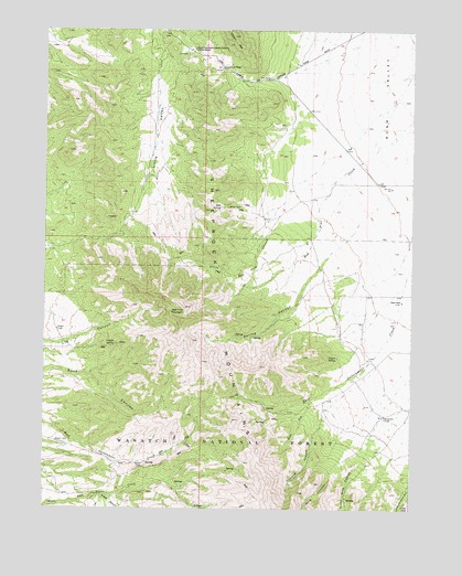
Lookout Pass, UT USGS Topographic Map
Click on map above to begin viewing in our Map Viewer.

This topographic map contains these locations and features:
Feature Name Type Latitude Longitude GNIS ID View Map
Copper SpringSpringN40.0430°W112.6016°1439946View Map
Coyote SpringSpringN40.0397°W112.5258°1440123View Map
Hill SpringSpringN40.0788°W112.5663°1441771View Map
Little Red Pine CanyonValleyN40.0738°W112.5463°1442770View Map
Log CanyonValleyN40.0430°W112.6236°1442842View Map
Lookout PassGapN40.1149°W112.5661°1442944View Map
Lookout Pass Pony Express StationLocaleN40.1197°W112.5766°1442945View Map
Middle CanyonValleyN40.0027°W112.6069°1443329View Map
North Pine CanyonValleyN40.0108°W112.5197°1443966View Map
Red Pine MountainSummitN40.0524°W112.5775°1444827View Map
Rock CanyonValleyN40.0091°W112.5288°1445046View Map
South Fork East Government CreekStreamN40.0286°W112.5350°1445842View Map
Spring CanyonValleyN40.0658°W112.5294°1445984View Map
Stepladder TroughFlatN40.0244°W112.5100°1446133View Map
Talawag CanyonValleyN40.0188°W112.5336°1446324View Map
West WellWellN40.0544°W112.5044°1437278View Map

Note: Coordinates in the location and feature list above are referenced to NAD83 datum.


Copyright (C) 2008-2024 Ryan Niemi / Sunset Dynamics ... All Rights Reserved