TopoQuest Logo
Do you find TopoQuest useful?
Help keep TopoQuest running and adding new maps/features by donating!
Bitcoin:  19c7KJd3qBynnjoSw5npx9KScwjBe4ifkT
Litecoin:  LXs6TkuXGGXo1vDsWCkWVdjQX94eUKd6ui
Home View Maps Find Maps Find Places Resources & Links


Lopez Point, California Topographic Map

USGS Map Title: Lopez Point, CA
USGS Map MRC: 36121A5
DRG (GeoTIFF) Download: o36121a5.tif


Neighboring USGS Topographic Map Quads:


  Partington Ridge, CA  
36121B6
 

  Zigzag Creek, CA  
36121B5
 

  Junipero Serra Peak, CA  
36121B4


  Lopez Point, CA  
36121A5
 

  Cone Peak, CA  
36121A4


  Cape San Martin, CA  
35121H4


Map MRC Location:

N37°
W122°
N37°
W121°
H8 H7 H6 H5 H4 H3 H2 H1
G8 G7 G6 G5 G4 G3 G2 G1
F8 F7 F6 F5 F4 F3 F2 F1
E8 E7 E6 E5 E4 E3 E2 E1
D8 D7 D6 D5 D4 D3 D2 D1
C8 C7 C6 C5 C4 C3 C2 C1
B8 B7 B6 B5 B4 B3 B2 B1
A8 A7 A6 A5 A4 A3 A2 A1
N36°
W122°
N36°
W121°

Lopez Point, CA USGS 1:24K Topographic Map Preview:
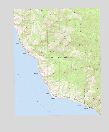
Lopez Point, CA USGS Topographic Map
Click on map above to begin viewing in our Map Viewer.

This topographic map contains these locations and features:
Feature Name Type Latitude Longitude GNIS ID View Map
Big CreekStreamN36.0700°W121.5999°269818View Map
Devils CanyonValleyN36.0772°W121.5949°270850View Map
Dolan RockIslandN36.0847°W121.6183°270892View Map
Gamboa CampgroundLocaleN36.0602°W121.5224°275447View Map
Gamboa PointCapeN36.0497°W121.5911°271263View Map
Gamboa TrailTrailN36.0566°W121.5222°242584View Map
Goat CampgroundLocaleN36.0427°W121.5224°275448View Map
Hare CanyonValleyN36.0105°W121.5163°271494View Map
Harlan RockIslandN36.0111°W121.5352°271496View Map
Limekiln Beach Redwoods CampgroundLocaleN36.0088°W121.5197°1703255View Map
Limekiln CanyonValleyN36.0091°W121.5191°1703615View Map
Limekiln CreekStreamN36.0088°W121.5197°272042View Map
Limekiln State ParkParkN36.0100°W121.5182°2570607View Map
Limekiln State WildernessReserveN36.0263°W121.5229°2741259View Map
Lopez PointCapeN36.0205°W121.5674°272210View Map
Lopez RockIslandN36.0264°W121.5802°272211View Map
Lower Bee CampLocaleN36.1227°W121.5836°272253View Map
LuciaPopulated PlaceN36.0208°W121.5505°1660963View Map
Lucia Post Office (historical)Post OfficeN36.0250°W121.5513°1670897View Map
Middle Fork Devils CanyonValleyN36.0775°W121.5677°272439View Map
Mining RidgeRidgeN36.0908°W121.5611°272493View Map
North Coast Ridge TrailTrailN36.1033°W121.5302°272665View Map
North Fork Big CreekStreamN36.0989°W121.5777°272675View Map
North Fork Devils CanyonValleyN36.0775°W121.5677°272683View Map
Ojito CampgroundLocaleN36.0666°W121.5333°275446View Map
Rat CreekStreamN36.0916°W121.6194°273206View Map
Redwood School (historical)SchoolN36.0311°W121.5513°1670899View Map
Rockland LandingLocaleN36.0080°W121.5194°1661322View Map
Round Tree HillSummitN36.0841°W121.5185°253320View Map
South Fork Devils CanyonValleyN36.0736°W121.5566°273821View Map
Square Black RockIslandN36.0727°W121.6077°273877View Map
Trail Spring CampLocaleN36.0583°W121.5024°274183View Map
Twin PeakSummitN36.0527°W121.5083°274248View Map
Vicente CreekStreamN36.0441°W121.5858°274335View Map
West Fork Limekiln CreekStreamN36.0130°W121.5169°274435View Map

Note: Coordinates in the location and feature list above are referenced to NAD83 datum.


Copyright (C) 2008-2025 Ryan Niemi / Sunset Dynamics ... All Rights Reserved