TopoQuest Logo
Do you find TopoQuest useful?
Help keep TopoQuest running and adding new maps/features by donating!
Bitcoin:  19c7KJd3qBynnjoSw5npx9KScwjBe4ifkT
Litecoin:  LXs6TkuXGGXo1vDsWCkWVdjQX94eUKd6ui
Home View Maps Find Maps Find Places Resources & Links


Lorimor South, Iowa Topographic Map

USGS Map Title: Lorimor South, IA
USGS Map MRC: 41094A1
DRG (GeoTIFF) Download: o41094a1.tif


Neighboring USGS Topographic Map Quads:


  Macksburg, IA  
41094B2
 

  Lorimor North, IA  
41094B1
 

  East Peru, IA  
41093B8
 

  Afton, IA  
41094A2
 

  Lorimor South, IA  
41094A1
 

  Murray, IA  
41093A8
 

  Arispe, IA  
40094H2
 

  Tingley NE, IA  
40094H1
 

  Hopeville, IA  
40093H8


Map MRC Location:

N42°
W95°
N42°
W94°
H8 H7 H6 H5 H4 H3 H2 H1
G8 G7 G6 G5 G4 G3 G2 G1
F8 F7 F6 F5 F4 F3 F2 F1
E8 E7 E6 E5 E4 E3 E2 E1
D8 D7 D6 D5 D4 D3 D2 D1
C8 C7 C6 C5 C4 C3 C2 C1
B8 B7 B6 B5 B4 B3 B2 B1
A8 A7 A6 A5 A4 A3 A2 A1
N41°
W95°
N41°
W94°

Lorimor South, IA USGS 1:24K Topographic Map Preview:
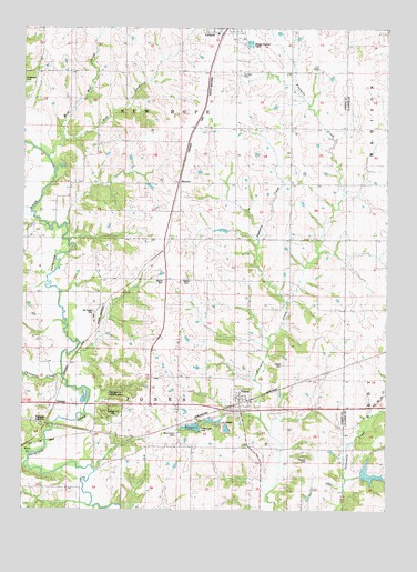
Lorimor South, IA USGS Topographic Map
Click on map above to begin viewing in our Map Viewer.

This topographic map contains these locations and features:
Feature Name Type Latitude Longitude GNIS ID View Map
Afton Junction (historical)Populated PlaceN41.0167°W94.1236°464292View Map
Bethel CemeteryCemeteryN41.0599°W94.0691°454547View Map
Beulah CemeteryCemeteryN41.0594°W94.0766°1822959View Map
Beulah ChurchChurchN41.0600°W94.0758°454590View Map
Brown Family CemeteryCemeteryN41.0500°W94.1002°1969545View Map
City of ThayerCivilN41.0290°W94.0497°2396045View Map
Claypool CemeteryCemeteryN41.0131°W94.0270°1822955View Map
First White Settlement in Union County Historical MarkerParkN41.0500°W94.1005°1969565View Map
Groesbeck CemeteryCemeteryN41.1106°W94.1242°1969567View Map
Kings Post Office (historical)Post OfficeN41.0167°W94.0705°1969511View Map
Lorimor CemeteryCemeteryN41.1130°W94.0514°458618View Map
MonettePopulated PlaceN41.0847°W94.0722°464658View Map
Monette (historical)LocaleN41.0853°W94.0722°1969514View Map
Monette Post Office (historical)Post OfficeN41.0847°W94.0722°1969513View Map
Mount Pisgah CemeteryCemeteryN41.0511°W94.1011°459327View Map
Mount Pisgah ParkParkN41.0500°W94.1005°1969566View Map
New Hope Post Office (historical)Post OfficeN41.1000°W94.0725°1969515View Map
Patriot Post Office (historical)Post OfficeN41.0194°W94.0613°1969520View Map
Petersville Post Office (historical)Post OfficeN41.0055°W94.1169°1969521View Map
Riverdale SchoolSchoolN41.0564°W94.1097°460654View Map
Star BranchStreamN41.0147°W94.1219°1822962View Map
TalmagePopulated PlaceN41.0269°W94.1119°464771View Map
Talmage Hill ParkParkN41.0255°W94.0933°1822957View Map
Talmage Hill Wildlife AreaParkN41.0297°W94.0975°1822958View Map
Talmage JunctionLocaleN41.0225°W94.1169°1822956View Map
Talmage Post Office (historical)Post OfficeN41.0269°W94.1119°1969526View Map
ThayerPopulated PlaceN41.0280°W94.0508°462202View Map
ThayerLocaleN41.0278°W94.0474°1969528View Map
Thayer CemeteryCemeteryN41.0377°W94.0357°455586View Map
Thayer LakeReservoirN41.0214°W94.0665°458738View Map
Thayer Lake ParkParkN41.0222°W94.0655°1822954View Map
Thayer Ponds Public Hunting AreaAreaN41.0228°W94.0641°464353View Map
Thayer Post OfficePost OfficeN41.0280°W94.0508°1969527View Map
Threemile CreekStreamN41.0361°W94.1116°462232View Map
Township of JonesCivilN41.0270°W94.0716°468155View Map
Township of New HopeCivilN41.1135°W94.0713°468433View Map
Twomile CreekStreamN41.0542°W94.0347°1822961View Map
West Long CreekStreamN41.0078°W94.0141°462883View Map
West Union CemeteryCemeteryN41.0196°W94.0721°462923View Map
West Wolf CreekStreamN41.0964°W94.1119°462929View Map
Wolf CreekStreamN41.0914°W94.1175°463159View Map

Note: Coordinates in the location and feature list above are referenced to NAD83 datum.


Copyright (C) 2008-2024 Ryan Niemi / Sunset Dynamics ... All Rights Reserved