TopoQuest Logo
Do you find TopoQuest useful?
Help keep TopoQuest running and adding new maps/features by donating!
Bitcoin:  19c7KJd3qBynnjoSw5npx9KScwjBe4ifkT
Litecoin:  LXs6TkuXGGXo1vDsWCkWVdjQX94eUKd6ui
Home View Maps Find Maps Find Places Resources & Links


Murray, Iowa Topographic Map

USGS Map Title: Murray, IA
USGS Map MRC: 41093A8
DRG (GeoTIFF) Download: o41093a8.tif


Neighboring USGS Topographic Map Quads:


  Lorimor North, IA  
41094B1
 

  East Peru, IA  
41093B8
 

  Truro, IA  
41093B7
 

  Lorimor South, IA  
41094A1
 

  Murray, IA  
41093A8
 

  Osceola, IA  
41093A7
 

  Tingley NE, IA  
40094H1
 

  Hopeville, IA  
40093H8
 

  Lacelle, IA  
40093H7


Map MRC Location:

N42°
W94°
N42°
W93°
H8 H7 H6 H5 H4 H3 H2 H1
G8 G7 G6 G5 G4 G3 G2 G1
F8 F7 F6 F5 F4 F3 F2 F1
E8 E7 E6 E5 E4 E3 E2 E1
D8 D7 D6 D5 D4 D3 D2 D1
C8 C7 C6 C5 C4 C3 C2 C1
B8 B7 B6 B5 B4 B3 B2 B1
A8 A7 A6 A5 A4 A3 A2 A1
N41°
W94°
N41°
W93°

Murray, IA USGS 1:24K Topographic Map Preview:
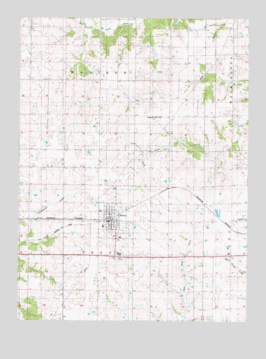
Murray, IA USGS Topographic Map
Click on map above to begin viewing in our Map Viewer.

This topographic map contains these locations and features:
Feature Name Type Latitude Longitude GNIS ID View Map
Church of ChristChurchN41.0394°W93.9511°1969807View Map
City of MurrayCivilN41.0414°W93.9489°2395142View Map
Milford Post Office (historical)Post OfficeN41.0333°W93.9961°1969746View Map
MurrayPopulated PlaceN41.0417°W93.9494°459410View Map
MurrayLocaleN41.0425°W93.9502°1969800View Map
Murray Baptist ChurchChurchN41.0394°W93.9505°1969806View Map
Murray CemeteryCemeteryN41.0278°W93.9458°459412View Map
Murray City hallBuildingN41.0414°W93.9491°1969803View Map
Murray Elementary SchoolSchoolN41.0386°W93.9541°1969809View Map
Murray Fire DepartmentBuildingN41.0416°W93.9505°1969801View Map
Murray Junior / Senior High SchoolSchoolN41.0393°W93.9541°2720042View Map
Murray Medical ClinicHospitalN41.0417°W93.9497°1969805View Map
Murray Post OfficePost OfficeN41.0414°W93.9491°1969802View Map
Murray Public LibraryBuildingN41.0414°W93.9491°1969804View Map
Murray Roadside Rest AreaLocaleN41.0261°W93.9474°1969744View Map
Murray United Methodist ChurchChurchN41.0439°W93.9502°1969808View Map
Township of MadisonCivilN41.1135°W93.9566°468319View Map
Township of TroyCivilN41.0269°W93.9568°468796View Map
Troy CemeteryCemeteryN41.0194°W93.9836°1969810View Map

Note: Coordinates in the location and feature list above are referenced to NAD83 datum.


Copyright (C) 2008-2024 Ryan Niemi / Sunset Dynamics ... All Rights Reserved