TopoQuest Logo
Do you find TopoQuest useful?
Help keep TopoQuest running and adding new maps/features by donating!
Bitcoin:  19c7KJd3qBynnjoSw5npx9KScwjBe4ifkT
Litecoin:  LXs6TkuXGGXo1vDsWCkWVdjQX94eUKd6ui
Home View Maps Find Maps Find Places Resources & Links


Los Viejos, California Topographic Map

USGS Map Title: Los Viejos, CA
USGS Map MRC: 35119H8
DRG (GeoTIFF) Download: o35119h8.tif


Neighboring USGS Topographic Map Quads:


  La Cima, CA  
36120A1
 

  Kettleman City, CA  
36119A8
 

  Stratford SE, CA  
36119A7
 

  Kettleman Plain, CA  
35120H1
 

  Los Viejos, CA  
35119H8
 

  Dudley Ridge, CA  
35119H7
 

  Pyramid Hills, CA  
35120G1
 

  Avenal Gap, CA  
35119G8
 

  West Camp, CA  
35119G7


Map MRC Location:

N36°
W120°
N36°
W119°
H8 H7 H6 H5 H4 H3 H2 H1
G8 G7 G6 G5 G4 G3 G2 G1
F8 F7 F6 F5 F4 F3 F2 F1
E8 E7 E6 E5 E4 E3 E2 E1
D8 D7 D6 D5 D4 D3 D2 D1
C8 C7 C6 C5 C4 C3 C2 C1
B8 B7 B6 B5 B4 B3 B2 B1
A8 A7 A6 A5 A4 A3 A2 A1
N35°
W120°
N35°
W119°

Los Viejos, CA USGS 1:24K Topographic Map Preview:
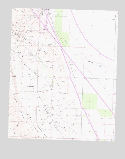
Los Viejos, CA USGS Topographic Map
Click on map above to begin viewing in our Map Viewer.

This topographic map contains these locations and features:
Feature Name Type Latitude Longitude GNIS ID View Map
Arroyo CulebrinoStreamN35.9491°W119.9071°255281View Map
Arroyo del ConejoStreamN35.9311°W119.9585°255271View Map
Arroyo del PasoStreamN35.9455°W119.9626°255272View Map
Arroyo EstrechoStreamN35.9711°W119.9249°255287View Map
Arroyo PinoStreamN35.9875°W119.9387°255296View Map
Arroyo RecodoStreamN35.8977°W119.9190°255300View Map
Broken HillSummitN35.9733°W119.9804°255375View Map
El BultoSummitN35.9341°W119.9974°241871View Map
El CaballeteRidgeN35.8838°W119.9682°254080View Map
El ColladoSummitN35.9652°W119.9987°1660592View Map
El PortilloGapN35.9200°W119.9412°241911View Map
Kettleman StationPopulated PlaceN35.9988°W119.9637°1660835View Map
La BajadaSlopeN35.9244°W119.9768°244380View Map
La BrechaGapN35.8938°W119.9779°255525View Map
La CubaSummitN35.9513°W119.9804°1660850View Map
La EscudillaBasinN35.9083°W119.9593°252094View Map
La LlanuraFlatN35.9277°W119.9535°255532View Map
La LomicaSummitN35.9494°W119.9587°255535View Map
La MorraSummitN35.9183°W119.9935°255538View Map
La PorteríaGapN35.8977°W119.9196°255542View Map
La RamblaFlatN35.9500°W119.9093°255543View Map
La SalidaGapN35.9319°W119.9385°255544View Map
Las AlturasRangeN35.9338°W119.9849°1660893View Map
Los MédanosRidgeN35.9800°W119.9607°1660950View Map
Los ViejosRangeN35.9505°W119.9512°1660954View Map
Mid RidgeRidgeN35.9700°W119.9957°245848View Map
Middle DomeRidgeN35.8897°W119.9549°245858View Map
Mustang HillSummitN35.9819°W119.9871°255654View Map
Parejo HillSummitN35.9008°W119.9387°254128View Map
Pipe HillSummitN35.9638°W119.9918°1661234View Map

Note: Coordinates in the location and feature list above are referenced to NAD83 datum.


Copyright (C) 2008-2025 Ryan Niemi / Sunset Dynamics ... All Rights Reserved