TopoQuest Logo
Do you find TopoQuest useful?
Help keep TopoQuest running and adding new maps/features by donating!
Bitcoin:  19c7KJd3qBynnjoSw5npx9KScwjBe4ifkT
Litecoin:  LXs6TkuXGGXo1vDsWCkWVdjQX94eUKd6ui
Home View Maps Find Maps Find Places Resources & Links


Kettleman Plain, California Topographic Map

USGS Map Title: Kettleman Plain, CA
USGS Map MRC: 35120H1
DRG (GeoTIFF) Download: o35120h1.tif


Neighboring USGS Topographic Map Quads:


  Avenal, CA  
36120A2
 

  La Cima, CA  
36120A1
 

  Kettleman City, CA  
36119A8
 

  Garza Peak, CA  
35120H2
 

  Kettleman Plain, CA  
35120H1
 

  Los Viejos, CA  
35119H8
 

  Tent Hills, CA  
35120G2
 

  Pyramid Hills, CA  
35120G1
 

  Avenal Gap, CA  
35119G8


Map MRC Location:

N36°
W121°
N36°
W120°
H8 H7 H6 H5 H4 H3 H2 H1
G8 G7 G6 G5 G4 G3 G2 G1
F8 F7 F6 F5 F4 F3 F2 F1
E8 E7 E6 E5 E4 E3 E2 E1
D8 D7 D6 D5 D4 D3 D2 D1
C8 C7 C6 C5 C4 C3 C2 C1
B8 B7 B6 B5 B4 B3 B2 B1
A8 A7 A6 A5 A4 A3 A2 A1
N35°
W121°
N35°
W120°

Kettleman Plain, CA USGS 1:24K Topographic Map Preview:
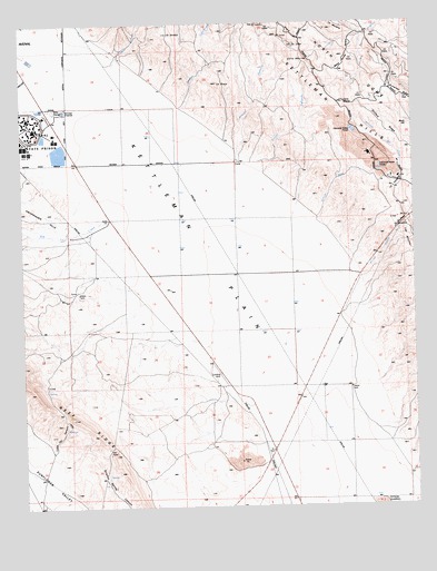
Kettleman Plain, CA USGS Topographic Map
Click on map above to begin viewing in our Map Viewer.

This topographic map contains these locations and features:
Feature Name Type Latitude Longitude GNIS ID View Map
Arroyo ChicoStreamN36.0000°W120.1049°255277View Map
Arroyo ConchosoStreamN35.9769°W120.0754°255279View Map
Arroyo del CaminoStreamN35.9997°W120.1229°238737View Map
Arroyo DelgadoStreamN35.9530°W120.0518°255283View Map
Arroyo EscasoStreamN35.9350°W120.0187°255285View Map
Arroyo MelladoStreamN35.9888°W120.0957°255291View Map
Arroyo RamosoStreamN35.9580°W120.0576°255298View Map
Arroyo RasoStreamN35.9447°W120.0346°255299View Map
Arroyo SomeroStreamN35.9986°W120.1057°255306View Map
Avenal DivisionCivilN35.9044°W120.0818°1935021View Map
Avenal State PrisonBuildingN35.9755°W120.1199°2739940View Map
Avenal State Prison Fire DepartmentBuildingN35.9744°W120.1172°2624690View Map
Big Tar CreekStreamN35.9530°W120.0918°239315View Map
Block HillSummitN35.9733°W120.0021°1660346View Map
Bullwheel RidgeRidgeN35.9841°W120.0110°255382View Map
Cerro AltoSummitN35.9905°W120.0351°1660460View Map
Cerro UltimoSummitN35.9794°W120.0229°1660463View Map
Drillers RidgeRidgeN35.9733°W120.0101°254048View Map
El CampoGapN35.9852°W120.0074°254081View Map
El DomboSummitN35.9977°W120.0782°252130View Map
El LeónSummitN35.9997°W120.0504°1660594View Map
El LoboSummitN35.9944°W120.0382°254084View Map
El LoroSummitN35.9966°W120.0435°1660595View Map
El MiradorSummitN35.9475°W120.0035°1660597View Map
El PasoGapN35.9500°W120.0037°254087View Map
Kettleman PlainPlainN35.9308°W120.0554°255517View Map
La CalderaBasinN35.9572°W120.0068°255526View Map
La OvejaSummitN35.9844°W120.0629°255540View Map
Little Tar CanyonValleyN35.8916°W120.1163°252567View Map
Mesa RoidaSummitN35.9911°W120.0224°1661012View Map
Reef StationPopulated PlaceN35.9016°W120.0549°1661298View Map

Note: Coordinates in the location and feature list above are referenced to NAD83 datum.


Copyright (C) 2008-2025 Ryan Niemi / Sunset Dynamics ... All Rights Reserved