TopoQuest Logo
Do you find TopoQuest useful?
Help keep TopoQuest running and adding new maps/features by donating!
Bitcoin:  19c7KJd3qBynnjoSw5npx9KScwjBe4ifkT
Litecoin:  LXs6TkuXGGXo1vDsWCkWVdjQX94eUKd6ui
Home View Maps Find Maps Find Places Resources & Links


Lost Trail Pass, Montana Topographic Map

USGS Map Title: Lost Trail Pass, MT
USGS Map MRC: 45113F8
DRG (GeoTIFF) Download: o45113f8.tif


Neighboring USGS Topographic Map Quads:


  Medicine Hot Springs, MT  
45114G1
 

  Sula, MT  
45113G8
 

  Schultz Saddle, MT  
45113G7
 

  Overwhich Falls, MT  
45114F1
 

  Lost Trail Pass, MT  
45113F8
 

  Elk Creek, MT  
45113F7
 

  Allan Mountain, ID  
45114E1
 

  Gibbonsville, ID  
45113E8
 

  Big Hole Pass, ID  
45113E7


Map MRC Location:

N46°
W114°
N46°
W113°
H8 H7 H6 H5 H4 H3 H2 H1
G8 G7 G6 G5 G4 G3 G2 G1
F8 F7 F6 F5 F4 F3 F2 F1
E8 E7 E6 E5 E4 E3 E2 E1
D8 D7 D6 D5 D4 D3 D2 D1
C8 C7 C6 C5 C4 C3 C2 C1
B8 B7 B6 B5 B4 B3 B2 B1
A8 A7 A6 A5 A4 A3 A2 A1
N45°
W114°
N45°
W113°

Lost Trail Pass, MT USGS 1:24K Topographic Map Preview:
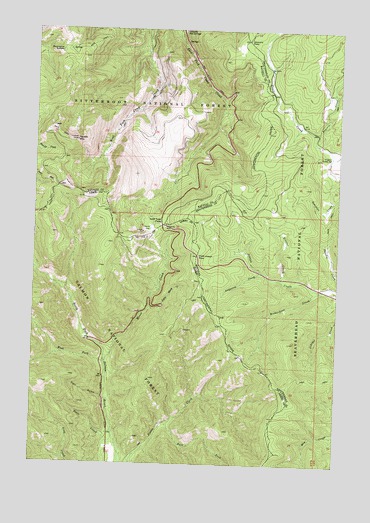
Lost Trail Pass, MT USGS Topographic Map
Click on map above to begin viewing in our Map Viewer.

This topographic map contains these locations and features:
Feature Name Type Latitude Longitude GNIS ID View Map
Anderson CreekStreamN45.6805°W113.9070°779031View Map
B-2 Ski TrailTrailN45.6930°W113.9523°1803252View Map
Big Hole National Recreation TrailTrailN45.7471°W113.9317°794932View Map
Chicken Out Ski TrailTrailN45.6930°W113.9523°1803260View Map
Chief Joseph PassGapN45.6846°W113.9331°781220View Map
Cool GulchValleyN45.6444°W113.9717°379652View Map
Drifter Ski TrailTrailN45.6930°W113.9523°1803255View Map
East Fork Pierce CreekStreamN45.6369°W113.9451°381154View Map
Far Out Ski TrailTrailN45.6930°W113.9523°1803264View Map
Gallogly Hot SpringsSpringN45.7499°W113.9404°2785593View Map
Gallogly SpringSpringN45.7496°W113.9412°783814View Map
Gibbons PassGapN45.7469°W113.9142°783919View Map
Hideout Ski TrailTrailN45.6930°W113.9523°1803250View Map
Hogans Guard StationLocaleN45.7135°W113.8792°784922View Map
Lewis and Clark RidgeRidgeN45.7030°W113.9706°1891150View Map
Lightning Ski TrailTrailN45.6930°W113.9523°1803256View Map
Little Moose CreekStreamN45.6699°W113.9531°384898View Map
Lost Trail PassGapN45.6938°W113.9481°386189View Map
Lost Trail Pass Picnic AreaLocaleN45.6927°W113.9470°394684View Map
Lost Trail Powder MountainLocaleN45.6930°W113.9523°1803247View Map
Lost Trail Sports AreaLocaleN45.6930°W113.9540°794926View Map
Lost Trail Sprots AreaLocaleN45.6933°W113.9531°801945View Map
Meadow Run Ski TrailTrailN45.6930°W113.9523°1803262View Map
Meadow Trail Ski TrailTrailN45.6930°W113.9523°1803263View Map
Moose CreekStreamN45.6544°W113.9709°387167View Map
North Bowl Ski TrailTrailN45.6930°W113.9523°1803251View Map
North Face Ski TrailTrailN45.6930°W113.9523°1803253View Map
Porcupine SaddleGapN45.7433°W113.9915°789110View Map
Porcupine Saddle TrailheadLocaleN45.7438°W113.9792°801942View Map
Powder Bowl Ski TrailTrailN45.6930°W113.9523°1803249View Map
Prairie CreekStreamN45.7166°W113.8842°789170View Map
Richardson CreekStreamN45.6752°W113.8826°789571View Map
Saddle MountainSummitN45.7177°W113.9842°789892View Map
Saddle Mountain Fire Area Poin of InterestLocaleN45.7171°W113.9490°801946View Map
Salmon Ski TrailTrailN45.6930°W113.9523°1803259View Map
Scooter CreekStreamN45.6783°W113.8990°790152View Map
South Face Ski TrailTrailN45.6930°W113.9523°1803254View Map
Southern Comfort Ski TrailTrailN45.6930°W113.9523°1803261View Map
Speedway Ski TrailTrailN45.6930°W113.9523°1803248View Map
State CreekStreamN45.6338°W113.9673°391365View Map
Thunder Ski TrailTrailN45.6930°W113.9523°1803257View Map
Upper Far Out Ski TrailTrailN45.6930°W113.9523°1803265View Map
West Fork North Fork Salmon RiverStreamN45.6541°W113.9712°393159View Map
West Meadow Ski TrailTrailN45.6930°W113.9523°1803258View Map

Note: Coordinates in the location and feature list above are referenced to NAD83 datum.


Copyright (C) 2008-2025 Ryan Niemi / Sunset Dynamics ... All Rights Reserved