TopoQuest Logo
Do you find TopoQuest useful?
Help keep TopoQuest running and adding new maps/features by donating!
Bitcoin:  19c7KJd3qBynnjoSw5npx9KScwjBe4ifkT
Litecoin:  LXs6TkuXGGXo1vDsWCkWVdjQX94eUKd6ui
Home View Maps Find Maps Find Places Resources & Links


Gibbonsville, Idaho Topographic Map

USGS Map Title: Gibbonsville, ID
USGS Map MRC: 45113E8
DRG (GeoTIFF) Download: o45113e8.tif


Neighboring USGS Topographic Map Quads:


  Overwhich Falls, MT  
45114F1
 

  Lost Trail Pass, MT  
45113F8
 

  Elk Creek, MT  
45113F7
 

  Allan Mountain, ID  
45114E1
 

  Gibbonsville, ID  
45113E8
 

  Big Hole Pass, ID  
45113E7
 

  Ulysses Mountain, ID  
45114D1
 

  North Fork, ID  
45113D8
 

  Shewag Lake, ID  
45113D7


Map MRC Location:

N46°
W114°
N46°
W113°
H8 H7 H6 H5 H4 H3 H2 H1
G8 G7 G6 G5 G4 G3 G2 G1
F8 F7 F6 F5 F4 F3 F2 F1
E8 E7 E6 E5 E4 E3 E2 E1
D8 D7 D6 D5 D4 D3 D2 D1
C8 C7 C6 C5 C4 C3 C2 C1
B8 B7 B6 B5 B4 B3 B2 B1
A8 A7 A6 A5 A4 A3 A2 A1
N45°
W114°
N45°
W113°

Gibbonsville, ID USGS 1:24K Topographic Map Preview:
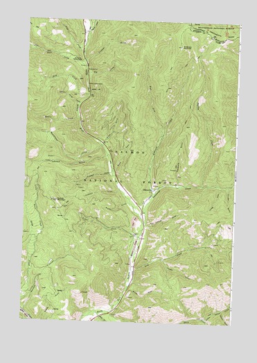
Gibbonsville, ID USGS Topographic Map
Click on map above to begin viewing in our Map Viewer.

This topographic map contains these locations and features:
Feature Name Type Latitude Longitude GNIS ID View Map
Anderson CreekStreamN45.5533°W113.9248°376614View Map
Anderson MountainSummitN45.6146°W113.9104°376625View Map
Bloise GulchValleyN45.5491°W113.9401°377870View Map
Brown GulchValleyN45.5130°W113.9381°378271View Map
Buster GulchValleyN45.5630°W113.9481°378588View Map
Chinese GulchValleyN45.5560°W113.8848°399826View Map
Crone GulchValleyN45.5746°W113.9542°380071View Map
Cruiser GulchValleyN45.5563°W113.8790°380111View Map
Cyanide GulchValleyN45.5405°W113.9281°380201View Map
Dahlonega CreekStreamN45.5410°W113.9295°380210View Map
Deep CreekStreamN45.5938°W113.9651°380391View Map
Elk CreekStreamN45.6033°W113.9656°381338View Map
Elkhorn GulchValleyN45.5046°W113.8806°381416View Map
Friedorf GulchValleyN45.5616°W113.9512°382085View Map
GibbonsvillePopulated PlaceN45.5555°W113.9231°396546View Map
Gibbonsville Volunteer Fire Department Station 1BuildingN45.5550°W113.9232°2619154View Map
Glacier GulchValleyN45.5955°W113.9637°382281View Map
Granite MountainSummitN45.5499°W113.9812°382544View Map
Granite Mountain Guard StationLocaleN45.5474°W113.9767°394364View Map
Hammerean CreekStreamN45.5730°W113.9559°382852View Map
Johnson GulchValleyN45.5688°W113.9515°397826View Map
Keystone GulchValleyN45.5577°W113.9098°384200View Map
Lick CreekStreamN45.5152°W113.9367°384615View Map
Little Deep CreekStreamN45.5902°W113.9698°384801View Map
Little Ditch CreekStreamN45.5252°W113.9956°384809View Map
Little Sheep CreekStreamN45.5016°W113.8909°384944View Map
Pierce CreekStreamN45.6205°W113.9648°388433View Map
Powder GulchValleyN45.5258°W113.9176°388832View Map
Quartz CreekStreamN45.5844°W113.9698°388966View Map
Ransack CreekStreamN45.5027°W113.9987°389097View Map
Smithy CreekStreamN45.5566°W113.8965°390707View Map
Trapper GulchValleyN45.6082°W113.9650°392359View Map
Twin CreekStreamN45.6080°W113.9670°392512View Map
Twin Creek CampgroundLocaleN45.6083°W113.9698°392516View Map
Vine CreekStreamN45.6113°W113.9687°392739View Map
Vineyard GulchValleyN45.5546°W113.9445°392741View Map
Votler CreekStreamN45.5269°W113.9367°392752View Map
West Fork Anderson CreekStreamN45.5763°W113.9206°393039View Map

Note: Coordinates in the location and feature list above are referenced to NAD83 datum.


Copyright (C) 2008-2024 Ryan Niemi / Sunset Dynamics ... All Rights Reserved