TopoQuest Logo
Do you find TopoQuest useful?
Help keep TopoQuest running and adding new maps/features by donating!
Bitcoin:  19c7KJd3qBynnjoSw5npx9KScwjBe4ifkT
Litecoin:  LXs6TkuXGGXo1vDsWCkWVdjQX94eUKd6ui
Home View Maps Find Maps Find Places Resources & Links


Lott Lake, Texas Topographic Map

USGS Map Title: Lott Lake, TX
USGS Map MRC: 28097E2
DRG (GeoTIFF) Download: o28097e2.tif


Neighboring USGS Topographic Map Quads:


  Hensley Lake, TX  
28097F3
 

  Fannin, TX  
28097F2
 

  Raisin, TX  
28097F1
 

  Live Oak Lake, TX  
28097E3
 

  Lott Lake, TX  
28097E2
 

  McFaddin, TX  
28097E1


Map MRC Location:

N29°
W98°
N29°
W97°
H8 H7 H6 H5 H4 H3 H2 H1
G8 G7 G6 G5 G4 G3 G2 G1
F8 F7 F6 F5 F4 F3 F2 F1
E8 E7 E6 E5 E4 E3 E2 E1
D8 D7 D6 D5 D4 D3 D2 D1
C8 C7 C6 C5 C4 C3 C2 C1
B8 B7 B6 B5 B4 B3 B2 B1
A8 A7 A6 A5 A4 A3 A2 A1
N28°
W98°
N28°
W97°

Lott Lake, TX USGS 1:24K Topographic Map Preview:
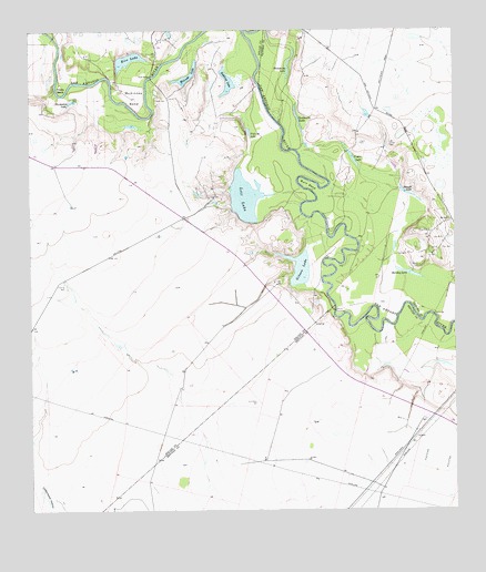
Lott Lake, TX USGS Topographic Map
Click on map above to begin viewing in our Map Viewer.

This topographic map contains these locations and features:
Feature Name Type Latitude Longitude GNIS ID View Map
Burn BendBendN28.5853°W97.1683°1353336View Map
Duke BridgeBridgeN28.6131°W97.2144°1356426View Map
Fagan CemeteryCemeteryN28.5959°W97.1525°1357158View Map
Fagan LakeLakeN28.5919°W97.1550°1357159View Map
Flemming LakeLakeN28.6152°W97.1740°1357475View Map
Fulcrod LakeLakeN28.5974°W97.1856°1357797View Map
Gaffney Oil FieldOilfieldN28.5706°W97.1317°1373790View Map
Gibson LakeLakeN28.5634°W97.1711°1357999View Map
Hardaman LakeLakeN28.6067°W97.2375°1358762View Map
Holiday LakeLakeN28.5621°W97.1394°1359400View Map
Hovey BendBendN28.6100°W97.2408°1359730View Map
Lott CemeteryCemeteryN28.6069°W97.2128°1361859View Map
Lott LakeLakeN28.5818°W97.1862°1361863View Map
McKinney BendBendN28.6075°W97.2183°1362499View Map
Milinda LakeLakeN28.6130°W97.2039°1362841View Map
Mount Zion ChurchChurchN28.5758°W97.1264°1363343View Map
Raisin Volunteer Fire Department Station 3BuildingN28.6088°W97.1507°2552452View Map
Redding LakeLakeN28.6115°W97.1917°1366270View Map
Rice LakeLakeN28.6182°W97.2211°1366414View Map
Sample CemeteryCemeteryN28.5633°W97.1350°1367469View Map
Sample LakeLakeN28.5829°W97.1395°1367471View Map
Simms FootbridgeBridgeN28.5522°W97.1605°1384667View Map
Summers LakeLakeN28.6011°W97.1707°1369385View Map
Terrell CemeteryCemeteryN28.5938°W97.1412°1369733View Map

Note: Coordinates in the location and feature list above are referenced to NAD83 datum.


Copyright (C) 2008-2025 Ryan Niemi / Sunset Dynamics ... All Rights Reserved