TopoQuest Logo
Do you find TopoQuest useful?
Help keep TopoQuest running and adding new maps/features by donating!
Bitcoin:  19c7KJd3qBynnjoSw5npx9KScwjBe4ifkT
Litecoin:  LXs6TkuXGGXo1vDsWCkWVdjQX94eUKd6ui
Home View Maps Find Maps Find Places Resources & Links


Louise Mountain, Maine Topographic Map

USGS Map Title: Louise Mountain, ME
USGS Map MRC: 45070D7
DRG (GeoTIFF) Download: o45070d7.tif


Neighboring USGS Topographic Map Quads:


  Boundary Pond, ME  
45070E6


  Louise Mountain, ME  
45070D7
 

  Merrill Mountain, ME  
45070D6
 

  Twin Peaks, ME  
45070C8
 

  Northwest Pond, ME  
45070C7
 

  Chain of Ponds, ME  
45070C6


Map MRC Location:

N46°
W71°
N46°
W70°
H8 H7 H6 H5 H4 H3 H2 H1
G8 G7 G6 G5 G4 G3 G2 G1
F8 F7 F6 F5 F4 F3 F2 F1
E8 E7 E6 E5 E4 E3 E2 E1
D8 D7 D6 D5 D4 D3 D2 D1
C8 C7 C6 C5 C4 C3 C2 C1
B8 B7 B6 B5 B4 B3 B2 B1
A8 A7 A6 A5 A4 A3 A2 A1
N45°
W71°
N45°
W70°

Louise Mountain, ME USGS 1:24K Topographic Map Preview:
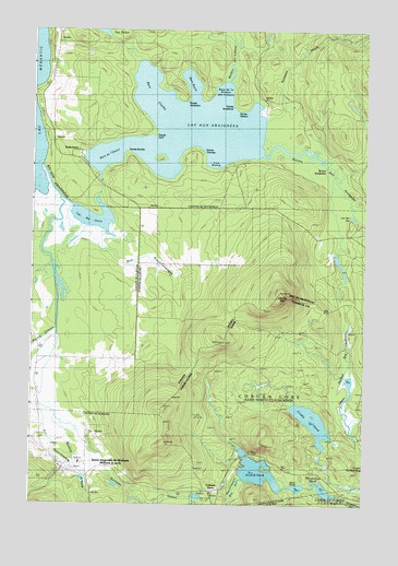
Louise Mountain, ME USGS Topographic Map
Click on map above to begin viewing in our Map Viewer.

This topographic map contains these locations and features:
Feature Name Type Latitude Longitude GNIS ID View Map
Arnold PondReservoirN45.3836°W70.7892°561297View Map
Arnold Pond DamDamN45.3794°W70.7797°1774617View Map
Arnold Pond Inlet DamDamN45.3882°W70.7938°1774615View Map
Arnold TrailTrailN45.3878°W70.7876°561299View Map
Coburn GoreCivilN45.3921°W70.7705°2748762View Map
Coburn GorePopulated PlaceN45.3792°W70.8034°579048View Map
Crosby PondLakeN45.3970°W70.7691°564561View Map
Horseshoe PondLakeN45.3791°W70.7648°568321View Map
Louise MountainSummitN45.4309°W70.7817°570431View Map
Lower Hathan BogSwampN45.3850°W70.7506°570503View Map
Massachusetts Bog StreamStreamN45.3820°W70.7954°570880View Map
Moosehorn (historical)Populated PlaceN45.3856°W70.7942°579537View Map
Mud PondLakeN45.3797°W70.7743°571918View Map
Tr-Arnold PondReservoirN45.3884°W70.7929°1774616View Map
Upper Hathan BogLakeN45.3996°W70.7576°577614View Map

Note: Coordinates in the location and feature list above are referenced to NAD83 datum.


Copyright (C) 2008-2025 Ryan Niemi / Sunset Dynamics ... All Rights Reserved