TopoQuest Logo
Do you find TopoQuest useful?
Help keep TopoQuest running and adding new maps/features by donating!
Bitcoin:  19c7KJd3qBynnjoSw5npx9KScwjBe4ifkT
Litecoin:  LXs6TkuXGGXo1vDsWCkWVdjQX94eUKd6ui
Home View Maps Find Maps Find Places Resources & Links


Loup City, Nebraska Topographic Map

USGS Map Title: Loup City, NE
USGS Map MRC: 41098C8
DRG (GeoTIFF) Download: o41098c8.tif


Neighboring USGS Topographic Map Quads:


  Arcadia East, NE  
41099D1
 

  Loup City NW, NE  
41098D8
 

  North Loup, NE  
41098D7
 

  Arcadia SE, NE  
41099C1
 

  Loup City, NE  
41098C8
 

  Loup City SE, NE  
41098C7
 

  Litchfield NE, NE  
41099B1
 

  Ravenna NW, NE  
41098B8
 

  Ashton, NE  
41098B7


Map MRC Location:

N42°
W99°
N42°
W98°
H8 H7 H6 H5 H4 H3 H2 H1
G8 G7 G6 G5 G4 G3 G2 G1
F8 F7 F6 F5 F4 F3 F2 F1
E8 E7 E6 E5 E4 E3 E2 E1
D8 D7 D6 D5 D4 D3 D2 D1
C8 C7 C6 C5 C4 C3 C2 C1
B8 B7 B6 B5 B4 B3 B2 B1
A8 A7 A6 A5 A4 A3 A2 A1
N41°
W99°
N41°
W98°

Loup City, NE USGS 1:24K Topographic Map Preview:
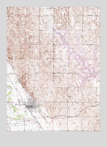
Loup City, NE USGS Topographic Map
Click on map above to begin viewing in our Map Viewer.

This topographic map contains these locations and features:
Feature Name Type Latitude Longitude GNIS ID View Map
Ash Canyon Area CampgroundLocaleN41.2917°W98.9156°1849748View Map
Big Thunder IslandIslandN41.3306°W98.8959°1849753View Map
Bowman LakeLakeN41.2782°W98.9926°2761355View Map
City of Loup CityCivilN41.2767°W98.9677°2395773View Map
Cob CreekStreamN41.2608°W98.9790°828227View Map
Dead Horse CreekStreamN41.2625°W98.9718°828621View Map
Dead Horse Creek Area CampgroundLocaleN41.3383°W98.8823°1849754View Map
Dead Horse Creek Historical MarkerParkN41.2695°W98.9684°1849799View Map
Evergreen CemeteryCemeteryN41.2997°W98.9856°829172View Map
First Baptist ChurchChurchN41.2770°W98.9662°1849769View Map
Fishermans BridgeBridgeN41.3528°W98.9373°1849756View Map
Fishermans Bridge Area CampgroundLocaleN41.3528°W98.9373°1849757View Map
Immanuel Lutheran ChurchChurchN41.2761°W98.9590°1849770View Map
Jenners ParkParkN41.2750°W98.9587°1849798View Map
Loup CityPopulated PlaceN41.2756°W98.9668°830919View Map
Loup City (historical)LocaleN41.2750°W98.9731°1849772View Map
Loup City Elementary SchoolSchoolN41.2808°W98.9662°1849777View Map
Loup City FairgroundsLocaleN41.2806°W98.9837°1849773View Map
Loup City Golf ClubLocaleN41.2833°W98.9962°1849774View Map
Loup City High SchoolSchoolN41.2750°W98.9623°1849776View Map
Loup City LibraryBuildingN41.2761°W98.9670°1849763View Map
Loup City Medical ClinicHospitalN41.2753°W98.9654°1849765View Map
Loup City Middle SchoolSchoolN41.2822°W98.9679°1849775View Map
Loup City Municipal AirportAirportN41.2862°W98.9880°837627View Map
Loup City Post OfficePost OfficeN41.2739°W98.9676°1849761View Map
Loup City Recreation AreaParkN41.2756°W98.9915°830920View Map
Loup City Riot Historical MarkerParkN41.2753°W98.9668°1849803View Map
Loup City Volunteer Fire DepartmentBuildingN41.2740°W98.9684°2553409View Map
Marina Bay CampgroundLocaleN41.3145°W98.8759°1849751View Map
Muddy PointSummitN41.3222°W98.9129°1849752View Map
North Loup City Election PrecinctCivilN41.3399°W98.9365°2397416View Map
Oak Creek Area CampgroundLocaleN41.3578°W98.9365°1849755View Map
Redwood Area CampgroundLocaleN41.2917°W98.8990°1849747View Map
Rose Lane Nursing HomeHospitalN41.2856°W98.9712°1849762View Map
Saint Josaphat ConventBuildingN41.2806°W98.9698°1849771View Map
Saint Josaphats ChurchChurchN41.2820°W98.9698°1849768View Map
Saint Josephats CemeteryCemeteryN41.3022°W98.9851°832949View Map
School Number 31SchoolN41.3233°W98.9409°836565View Map
School Number 41SchoolN41.3664°W98.8859°836711View Map
School Number 52SchoolN41.3736°W98.9379°836839View Map
School Number 56SchoolN41.2847°W98.9190°836877View Map
School Number 57SchoolN41.3370°W98.8893°836890View Map
School Number 81SchoolN41.3347°W98.9654°837118View Map
Shaughnessy BayBayN41.3389°W98.9087°1849749View Map
Sherman County CourthouseBuildingN41.2753°W98.9668°1849801View Map
Sherman County Historical MuseumBuildingN41.2756°W98.9668°1849800View Map
Sherman County Medical ClinicHospitalN41.2753°W98.9654°1849764View Map
Sherman County Sheriff's OfficeBuildingN41.2753°W98.9665°1849802View Map
Sherman DamDamN41.3027°W98.8824°1768816View Map
Sherman ReservoirReservoirN41.3205°W98.8993°834983View Map
Sherman Reservoir State Recreation AreaParkN41.3222°W98.8976°1849758View Map
Sherman Reservoir State Wildlife Management AreaParkN41.3225°W98.8979°1849759View Map
Thunder Bay Area CampgroundLocaleN41.2922°W98.8920°1849746View Map
Township of LoganCivilN41.3500°W98.9170°1849816View Map
Trade Winds Marina and CampgroundLocaleN41.3139°W98.8759°1849750View Map
United Methodist ChurchChurchN41.2781°W98.9662°1849766View Map
United Presbyterian ChurchChurchN41.2772°W98.9684°1849767View Map

Note: Coordinates in the location and feature list above are referenced to NAD83 datum.


Copyright (C) 2008-2024 Ryan Niemi / Sunset Dynamics ... All Rights Reserved