TopoQuest Logo
Do you find TopoQuest useful?
Help keep TopoQuest running and adding new maps/features by donating!
Bitcoin:  19c7KJd3qBynnjoSw5npx9KScwjBe4ifkT
Litecoin:  LXs6TkuXGGXo1vDsWCkWVdjQX94eUKd6ui
Home View Maps Find Maps Find Places Resources & Links


North Loup, Nebraska Topographic Map

USGS Map Title: North Loup, NE
USGS Map MRC: 41098D7
DRG (GeoTIFF) Download: o41098d7.tif


Neighboring USGS Topographic Map Quads:


  Ord, NE  
41098E8
 

  Ord SE, NE  
41098E7
 

  Horace, NE  
41098E6
 

  Loup City NW, NE  
41098D8
 

  North Loup, NE  
41098D7
 

  Scotia, NE  
41098D6
 

  Loup City, NE  
41098C8
 

  Loup City SE, NE  
41098C7
 

  Cotesfield, NE  
41098C6


Map MRC Location:

N42°
W99°
N42°
W98°
H8 H7 H6 H5 H4 H3 H2 H1
G8 G7 G6 G5 G4 G3 G2 G1
F8 F7 F6 F5 F4 F3 F2 F1
E8 E7 E6 E5 E4 E3 E2 E1
D8 D7 D6 D5 D4 D3 D2 D1
C8 C7 C6 C5 C4 C3 C2 C1
B8 B7 B6 B5 B4 B3 B2 B1
A8 A7 A6 A5 A4 A3 A2 A1
N41°
W99°
N41°
W98°

North Loup, NE USGS 1:24K Topographic Map Preview:
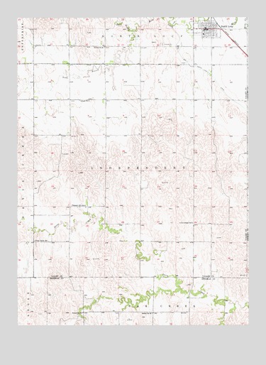
North Loup, NE USGS Topographic Map
Click on map above to begin viewing in our Map Viewer.

This topographic map contains these locations and features:
Feature Name Type Latitude Longitude GNIS ID View Map
Davis Creek Dam CampgroundLocaleN41.4250°W98.7804°1849720View Map
Davis Creek ReservoirReservoirN41.4269°W98.7629°1849882View Map
Davis Creek State Wildlife Management AreaParkN41.4333°W98.7526°1849662View Map
Deer Creek SchoolSchoolN41.4095°W98.8659°828663View Map
Hickman Dam Number 1DamN41.3917°W98.8437°1767864View Map
Hickman Reservoir Number 1ReservoirN41.3917°W98.8437°1767865View Map
Hillside CemeteryCemeteryN41.4892°W98.7965°830019View Map
North Branch Mira CreekStreamN41.4947°W98.8140°831664View Map
North LoupLocaleN41.4967°W98.7662°1849701View Map
North LoupPopulated PlaceN41.4953°W98.7731°831708View Map
North Loup Elementary SchoolSchoolN41.4933°W98.7745°1849702View Map
North Loup Medical CenterHospitalN41.4953°W98.7731°1849699View Map
North Loup Post OfficePost OfficeN41.4956°W98.7717°1849696View Map
North Loup Rural Fire Protection DistrictBuildingN41.4942°W98.7746°1849700View Map
North Loup Township LibraryBuildingN41.4953°W98.7731°1849694View Map
North Loup Trailer ParkLocaleN41.4953°W98.7731°1849693View Map
Pleasant Hill SchoolSchoolN41.4236°W98.8387°832192View Map
School Number 24SchoolN41.3800°W98.8023°836440View Map
School Number 3SchoolN41.4664°W98.8415°836539View Map
School Number 46SchoolN41.4881°W98.8284°836756View Map
School Number 66SchoolN41.3803°W98.8401°836991View Map
Seventh Day Baptist ChurchChurchN41.4953°W98.7731°1849698View Map
South Branch Mira CreekStreamN41.4947°W98.8140°833551View Map
Spalding Cooperative ElevatorLocaleN41.4953°W98.7731°1849697View Map
Township of IndependentCivilN41.4377°W98.8089°838065View Map
Union Ridge SchoolSchoolN41.4164°W98.7806°834282View Map
United Methodist ChurchChurchN41.4953°W98.7731°1849695View Map
Village of North LoupCivilN41.4955°W98.7727°2399519View Map

Note: Coordinates in the location and feature list above are referenced to NAD83 datum.


Copyright (C) 2008-2025 Ryan Niemi / Sunset Dynamics ... All Rights Reserved