TopoQuest Logo
Do you find TopoQuest useful?
Help keep TopoQuest running and adding new maps/features by donating!
Bitcoin:  19c7KJd3qBynnjoSw5npx9KScwjBe4ifkT
Litecoin:  LXs6TkuXGGXo1vDsWCkWVdjQX94eUKd6ui
Home View Maps Find Maps Find Places Resources & Links


Lovelace, Tennessee Topographic Map

USGS Map Title: Lovelace, TN
USGS Map MRC: 36082D6
DRG (GeoTIFF) Download: o36082d6.tif


Neighboring USGS Topographic Map Quads:


  Plum Grove, TN  
36082E7
 

  Church Hill, TN  
36082E6
 

  Kingsport, TN  
36082E5
 

  Stony Point, TN  
36082D7
 

  Lovelace, TN  
36082D6
 

  Sullivan Gardens, TN  
36082D5
 

  Baileyton, TN  
36082C7
 

  Jearoldstown, TN  
36082C6
 

  Leesburg, TN  
36082C5


Map MRC Location:

N37°
W83°
N37°
W82°
H8 H7 H6 H5 H4 H3 H2 H1
G8 G7 G6 G5 G4 G3 G2 G1
F8 F7 F6 F5 F4 F3 F2 F1
E8 E7 E6 E5 E4 E3 E2 E1
D8 D7 D6 D5 D4 D3 D2 D1
C8 C7 C6 C5 C4 C3 C2 C1
B8 B7 B6 B5 B4 B3 B2 B1
A8 A7 A6 A5 A4 A3 A2 A1
N36°
W83°
N36°
W82°

Lovelace, TN USGS 1:24K Topographic Map Preview:
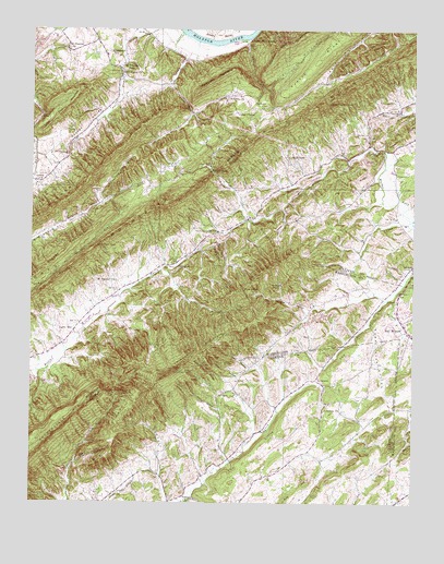
Lovelace, TN USGS Topographic Map
Click on map above to begin viewing in our Map Viewer.

This topographic map contains these locations and features:
Feature Name Type Latitude Longitude GNIS ID View Map
Back HollowValleyN36.4865°W82.6545°1276051View Map
Barrett HollowValleyN36.4550°W82.7271°1647042View Map
Bear HollowValleyN36.3857°W82.7348°1276617View Map
Beech Creek ChurchChurchN36.4065°W82.7454°1308408View Map
Beech Grove Church (historical)ChurchN36.4879°W82.6513°1308410View Map
Bethany ChurchChurchN36.3757°W82.6971°1305116View Map
Big Double BranchStreamN36.4551°W82.7265°1277288View Map
Big RidgeRidgeN36.3920°W82.7221°1277367View Map
Big RidgeRidgeN36.4582°W82.6468°1277368View Map
Blair GapGapN36.4632°W82.6915°1305280View Map
Blair GapPopulated PlaceN36.4504°W82.6796°1314692View Map
Blair Gap BranchStreamN36.4504°W82.6796°1277643View Map
Canebrake MountainSummitN36.4868°W82.6918°1279544View Map
Cedar ChapelChurchN36.4784°W82.6838°1280006View Map
Chimneytop MountainSummitN36.4082°W82.7068°1280484View Map
Chimneytop School (historical)SchoolN36.4043°W82.6857°1309220View Map
Commissioner District 2CivilN36.4961°W82.7369°2463930View Map
ConkintownPopulated PlaceN36.4662°W82.6635°1314879View Map
Crawford HollowValleyN36.4348°W82.6529°1646890View Map
Dark HollowValleyN36.3998°W82.6877°1282053View Map
Dixon HollowValleyN36.4530°W82.6683°1282524View Map
Dunkard ChurchChurchN36.4798°W82.6746°1283185View Map
Dykes MillPopulated PlaceN36.4382°W82.7029°1314991View Map
Fall BranchStreamN36.4290°W82.6338°1269569View Map
Fall Branch CemeteryCemeteryN36.4251°W82.6299°1321286View Map
Fall Branch United Methodist ChurchChurchN36.4248°W82.6299°1321287View Map
Front HollowValleyN36.4862°W82.6541°1284976View Map
GoshenPopulated PlaceN36.4654°W82.7396°1315136View Map
Goshen ChurchChurchN36.4601°W82.7479°1285719View Map
Goshen MountainRidgeN36.4526°W82.7438°1285722View Map
Goshen ValleyValleyN36.4839°W82.7190°1285726View Map
Goshen Valley Volunteer Fire Department Station 1BuildingN36.4993°W82.7302°2654975View Map
Goshen Valley Volunteer Fire Department Station 2BuildingN36.4213°W82.7355°2654961View Map
HarbourPopulated PlaceN36.4595°W82.6402°1303279View Map
Hensley HollowValleyN36.4252°W82.6596°1287471View Map
Holiness ChurchChurchN36.4823°W82.6827°1288044View Map
Horse CreekPopulated PlaceN36.4376°W82.6257°1646900View Map
Horse HollowValleyN36.3766°W82.6966°1288406View Map
Hunt GapGapN36.4782°W82.7468°1288722View Map
Kate HollowValleyN36.4574°W82.6795°1289913View Map
Kiner HollowValleyN36.4848°W82.6732°1290185View Map
Kyle HillSummitN36.3815°W82.6593°1290421View Map
Laurel RunStreamN36.4979°W82.6818°1290759View Map
Laurel Run CliffsCliffN36.4979°W82.6765°1290760View Map
Lickskillet BranchStreamN36.4554°W82.7265°1291254View Map
Light HollowValleyN36.4134°W82.7388°1647056View Map
Light MillLocaleN36.4209°W82.7354°1291268View Map
Limestone BranchStreamN36.4365°W82.7079°1291296View Map
Little Horse GapGapN36.4809°W82.6538°1291531View Map
Little MountainSummitN36.4373°W82.6724°1291585View Map
Little Pine MountainSummitN36.4787°W82.7399°1291610View Map
LovelacePopulated PlaceN36.4076°W82.6568°1315439View Map
Lovelace ChurchChurchN36.4007°W82.6535°1292134View Map
Lovelace School (historical)SchoolN36.4090°W82.6560°1643121View Map
Lynch BranchStreamN36.4498°W82.6263°1292333View Map
McFerrin ChurchChurchN36.4890°W82.7204°1293051View Map
McPheeter BendPopulated PlaceN36.4901°W82.7218°1315480View Map
McPheeter ChurchChurchN36.4957°W82.7388°1293058View Map
McPheeters Bend Elementary SchoolSchoolN36.4934°W82.7263°1293059View Map
Morrison CemeteryCemeteryN36.4287°W82.7263°1647057View Map
Mose HollowValleyN36.4054°W82.6771°1294478View Map
Mount Carmel ChurchChurchN36.4340°W82.7224°1294591View Map
Mountain View School (historical)SchoolN36.4712°W82.6927°1308496View Map
Murrell CemeteryCemeteryN36.4558°W82.6300°2746118View Map
Nathan PeakSummitN36.4320°W82.6715°1295254View Map
Oak Glen School (historical)SchoolN36.4218°W82.6613°1303193View Map
Oak Glenn CemeteryCemeteryN36.4312°W82.6454°1321342View Map
Oak Glenn Union CemeteryCemeteryN36.4215°W82.6610°1321343View Map
Oak Glenn Union Church (historical)ChurchN36.4218°W82.6610°1321344View Map
Old Fall Branch-Hooper CemeteryCemeteryN36.4259°W82.6282°1321349View Map
Onionbed RidgeRidgeN36.4432°W82.6713°1296438View Map
Pine RidgeRidgeN36.4098°W82.6929°1297580View Map
Pretty RidgeRidgeN36.4920°W82.6577°1298489View Map
Pyburn School (historical)SchoolN36.3773°W82.7274°1309221View Map
Simpsons School (historical)SchoolN36.4340°W82.7168°1308524View Map
Smith GapGapN36.4809°W82.7007°1270670View Map
Smith Gap CreekStreamN36.4990°W82.7015°1303681View Map
Solomons Temple Baptist ChurchChurchN36.4507°W82.6779°1642167View Map
Solomons Temple School (historical)SchoolN36.4534°W82.6688°1303376View Map
Sugar Tree HollowValleyN36.4223°W82.6395°1271704View Map
Tennessee Highway Patrol District Five HeadquartersBuildingN36.4039°W82.6269°2766055View Map
The CliffsCliffN36.3918°W82.6757°1304054View Map
The DoublesRidgeN36.4345°W82.7415°1272386View Map
Ugly HollowValleyN36.4107°W82.6756°1273159View Map
Upper Grassy ForkStreamN36.4554°W82.7265°1304278View Map
Walker Fork ChurchChurchN36.4687°W82.6377°1304338View Map
Wire KnobSummitN36.4315°W82.6813°1274894View Map
Wolf GapGapN36.4037°W82.7221°1274961View Map
Wolf Pen GapGapN36.4432°W82.7288°1274971View Map
Yankee CemeteryCemeteryN36.4568°W82.7290°1275227View Map

Note: Coordinates in the location and feature list above are referenced to NAD83 datum.


Copyright (C) 2008-2024 Ryan Niemi / Sunset Dynamics ... All Rights Reserved