TopoQuest Logo
Do you find TopoQuest useful?
Help keep TopoQuest running and adding new maps/features by donating!
Bitcoin:  19c7KJd3qBynnjoSw5npx9KScwjBe4ifkT
Litecoin:  LXs6TkuXGGXo1vDsWCkWVdjQX94eUKd6ui
Home View Maps Find Maps Find Places Resources & Links


Lowell, Idaho Topographic Map

USGS Map Title: Lowell, ID
USGS Map MRC: 46115B5
DRG (GeoTIFF) Download: o46115b5.tif


Neighboring USGS Topographic Map Quads:


  Musselshell, ID  
46115C6
 

  Boundary Peak, ID  
46115C5
 

  McLendon Butte, ID  
46115C4
 

  Syringa, ID  
46115B6
 

  Lowell, ID  
46115B5
 

  Coolwater Mountain, ID  
46115B4
 

  Lodge Point, ID  
46115A6
 

  Goddard Point, ID  
46115A5
 

  Stillman Point, ID  
46115A4


Map MRC Location:

N47°
W116°
N47°
W115°
H8 H7 H6 H5 H4 H3 H2 H1
G8 G7 G6 G5 G4 G3 G2 G1
F8 F7 F6 F5 F4 F3 F2 F1
E8 E7 E6 E5 E4 E3 E2 E1
D8 D7 D6 D5 D4 D3 D2 D1
C8 C7 C6 C5 C4 C3 C2 C1
B8 B7 B6 B5 B4 B3 B2 B1
A8 A7 A6 A5 A4 A3 A2 A1
N46°
W116°
N46°
W115°

Lowell, ID USGS 1:24K Topographic Map Preview:
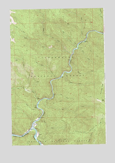
Lowell, ID USGS Topographic Map
Click on map above to begin viewing in our Map Viewer.

This topographic map contains these locations and features:
Feature Name Type Latitude Longitude GNIS ID View Map
Apgar CampgroundLocaleN46.2138°W115.5368°376679View Map
Apgar CreekStreamN46.2155°W115.5374°376680View Map
Cabin CreekStreamN46.2244°W115.6015°378654View Map
Canyon CreekStreamN46.2107°W115.5424°399818View Map
Cat CreekStreamN46.1702°W115.5693°379027View Map
Chance CreekStreamN46.2132°W115.5351°379178View Map
Chitwood MineMineN46.2041°W115.6179°379320View Map
Coolwater RidgeRidgeN46.1371°W115.5212°379660View Map
Deadman CreekStreamN46.2269°W115.5018°393794View Map
Dry PointCliffN46.2360°W115.5496°380890View Map
Glade CreekStreamN46.2202°W115.5271°382285View Map
Glade Creek CampgroundLocaleN46.2199°W115.5274°382286View Map
Handy CreekStreamN46.1919°W115.5515°382863View Map
Hellgate CreekStreamN46.2007°W115.5468°383069View Map
Icicle SpringSpringN46.1597°W115.5916°383598View Map
Idaho PointCliffN46.1638°W115.5037°383610View Map
Kerr CreekStreamN46.1669°W115.5765°384186View Map
Lochsa RiverStreamN46.1402°W115.5996°385022View Map
Lottie CreekStreamN46.1488°W115.5879°386194View Map
LowellPopulated PlaceN46.1441°W115.5957°396823View Map
Lowell CreekStreamN46.1591°W115.5907°386210View Map
Nut CreekStreamN46.1760°W115.6068°387892View Map
Pete King CreekStreamN46.1655°W115.5887°388360View Map
Rye Patch CreekStreamN46.1863°W115.5640°389761View Map
Selway RiverStreamN46.1402°W115.5996°390102View Map
South Fork Canyon CreekStreamN46.2116°W115.5529°390899View Map

Note: Coordinates in the location and feature list above are referenced to NAD83 datum.


Copyright (C) 2008-2025 Ryan Niemi / Sunset Dynamics ... All Rights Reserved