TopoQuest Logo
Do you find TopoQuest useful?
Help keep TopoQuest running and adding new maps/features by donating!
Bitcoin:  19c7KJd3qBynnjoSw5npx9KScwjBe4ifkT
Litecoin:  LXs6TkuXGGXo1vDsWCkWVdjQX94eUKd6ui
Home View Maps Find Maps Find Places Resources & Links


Syringa, Idaho Topographic Map

USGS Map Title: Syringa, ID
USGS Map MRC: 46115B6
DRG (GeoTIFF) Download: o46115b6.tif


Neighboring USGS Topographic Map Quads:


  Brown Creek Ridge, ID  
46115C7
 

  Musselshell, ID  
46115C6
 

  Boundary Peak, ID  
46115C5
 

  Glenwood, ID  
46115B7
 

  Syringa, ID  
46115B6
 

  Lowell, ID  
46115B5
 

  Big Cedar, ID  
46115A7
 

  Lodge Point, ID  
46115A6
 

  Goddard Point, ID  
46115A5


Map MRC Location:

N47°
W116°
N47°
W115°
H8 H7 H6 H5 H4 H3 H2 H1
G8 G7 G6 G5 G4 G3 G2 G1
F8 F7 F6 F5 F4 F3 F2 F1
E8 E7 E6 E5 E4 E3 E2 E1
D8 D7 D6 D5 D4 D3 D2 D1
C8 C7 C6 C5 C4 C3 C2 C1
B8 B7 B6 B5 B4 B3 B2 B1
A8 A7 A6 A5 A4 A3 A2 A1
N46°
W116°
N46°
W115°

Syringa, ID USGS 1:24K Topographic Map Preview:
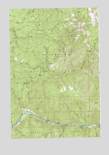
Syringa, ID USGS Topographic Map
Click on map above to begin viewing in our Map Viewer.

This topographic map contains these locations and features:
Feature Name Type Latitude Longitude GNIS ID View Map
Big HillSummitN46.1580°W115.6324°377548View Map
Big Hill RapidsRapidsN46.1386°W115.6875°377550View Map
Big Smith CreekStreamN46.1505°W115.7260°377588View Map
Bridge CreekStreamN46.1371°W115.6571°378220View Map
Decker CreekStreamN46.1363°W115.6301°380367View Map
Fan Creek SaddleGapN46.2460°W115.6549°381589View Map
Higgins CreekStreamN46.1894°W115.6504°383165View Map
Higgins HumpSummitN46.2080°W115.6404°396652View Map
Indian RapidsRapidsN46.1410°W115.7007°383707View Map
Jungle PointCliffN46.2005°W115.6860°384074View Map
Little Smith CreekStreamN46.1491°W115.7315°384955View Map
Lodge CreekStreamN46.1368°W115.6749°385028View Map
Nan CreekStreamN46.2307°W115.7471°387461View Map
Number One CreekStreamN46.1357°W115.7462°387889View Map
Placer CreekStreamN46.1816°W115.6371°388582View Map
Polar CreekStreamN46.1949°W115.6643°388662View Map
Rat CreekStreamN46.2218°W115.7393°389118View Map
Smith Creek Work CenterLocaleN46.1782°W115.7304°390683View Map
Smith MineMineN46.2157°W115.6304°390697View Map
Smith SaddleGapN46.1846°W115.7093°390704View Map
Stray CreekStreamN46.2224°W115.7399°391534View Map
Swan CreekStreamN46.1368°W115.7482°391717View Map
SyringaPopulated PlaceN46.1507°W115.7271°398211View Map
Three Devils CreekStreamN46.1357°W115.6437°392078View Map
Three Devils Picnic AreaParkN46.1355°W115.6462°392079View Map
Walde CreekStreamN46.1905°W115.6637°392778View Map
Walde MountainSummitN46.2457°W115.6340°392779View Map
Wild Goose CampgroundLocaleN46.1357°W115.6262°393418View Map

Note: Coordinates in the location and feature list above are referenced to NAD83 datum.


Copyright (C) 2008-2025 Ryan Niemi / Sunset Dynamics ... All Rights Reserved