TopoQuest Logo
Do you find TopoQuest useful?
Help keep TopoQuest running and adding new maps/features by donating!
Bitcoin:  19c7KJd3qBynnjoSw5npx9KScwjBe4ifkT
Litecoin:  LXs6TkuXGGXo1vDsWCkWVdjQX94eUKd6ui
Home View Maps Find Maps Find Places Resources & Links


Lower Bowns Reservoir, Utah Topographic Map

USGS Map Title: Lower Bowns Reservoir, UT
USGS Map MRC: 38111A3
DRG (GeoTIFF) Download: o38111a3.tif


Neighboring USGS Topographic Map Quads:


  Blind Lake, UT  
38111B4
 

  Grover, UT  
38111B3
 

  Golden Throne, UT  
38111B2
 

  Deer Creek Lake, UT  
38111A4
 

  Lower Bowns Reservoir, UT  
38111A3
 

  Bear Canyon, UT  
38111A2
 

  Boulder Town, UT  
37111H4
 

  Steep Creek Bench, UT  
37111H3
 

  Lamp Stand, UT  
37111H2


Map MRC Location:

N39°
W112°
N39°
W111°
H8 H7 H6 H5 H4 H3 H2 H1
G8 G7 G6 G5 G4 G3 G2 G1
F8 F7 F6 F5 F4 F3 F2 F1
E8 E7 E6 E5 E4 E3 E2 E1
D8 D7 D6 D5 D4 D3 D2 D1
C8 C7 C6 C5 C4 C3 C2 C1
B8 B7 B6 B5 B4 B3 B2 B1
A8 A7 A6 A5 A4 A3 A2 A1
N38°
W112°
N38°
W111°

Lower Bowns Reservoir, UT USGS 1:24K Topographic Map Preview:
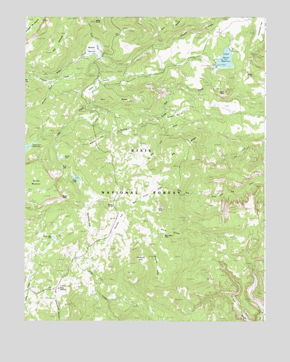
Lower Bowns Reservoir, UT USGS Topographic Map
Click on map above to begin viewing in our Map Viewer.

This topographic map contains these locations and features:
Feature Name Type Latitude Longitude GNIS ID View Map
Aspen PointSummitN38.0944°W111.2707°1425190View Map
Aspen SpringSpringN38.1015°W111.2573°1425191View Map
Bear FlatFlatN38.0986°W111.3741°1435088View Map
Behanin CreekStreamN38.0983°W111.3599°1438571View Map
Big RidgeRidgeN38.0703°W111.2952°1425537View Map
Blue GrassFlatN38.0328°W111.3027°1425798View Map
Blue Grass LakeLakeN38.0355°W111.3028°1435165View Map
Bowery FlatFlatN38.0717°W111.3424°1425914View Map
Bowns LakeLakeN38.0461°W111.3488°1425921View Map
Bowns PointCapeN38.0511°W111.3554°1437868View Map
Cons HoleBasinN38.0519°W111.2916°1426828View Map
Cons KnollSummitN38.0458°W111.3063°1426829View Map
Dry BenchBenchN38.0158°W111.2616°1427503View Map
Dunfey CreekStreamN38.0839°W111.3068°1427630View Map
Edmunds HoleBasinN38.0242°W111.3166°1427748View Map
Jorgenson FlatFlatN38.1241°W111.2513°1447571View Map
Keller KnollSummitN38.1230°W111.3388°1429310View Map
Long LakeLakeN38.0583°W111.3482°1429907View Map
Lower Bown CampgroundLocaleN38.1064°W111.2768°1454803View Map
Lower Bowns DamDamN38.1067°W111.2724°1434664View Map
Lower Bowns ReservoirReservoirN38.1077°W111.2711°1425922View Map
Oak Creek CampgroundLocaleN38.0886°W111.3418°1449991View Map
Oak Creek DamDamN38.0750°W111.3691°1434658View Map
Oak Creek Forest CampLocaleN38.0894°W111.3393°1430912View Map
Oak Creek ReservoirReservoirN38.0710°W111.3742°1437887View Map
Park RidgeRidgeN38.0908°W111.3260°1437883View Map
Parks PastureFlatN38.0967°W111.3366°1431116View Map
Pine Creek CampgroundLocaleN38.1025°W111.3354°1436130View Map
Pleasant Creek CampgroundLocaleN38.1008°W111.3379°1454863View Map
Point LookoutSummitN38.0136°W111.3574°1431355View Map
Pole Corral DrawValleyN38.0553°W111.3013°1431383View Map
Round LakeLakeN38.0675°W111.3550°1432024View Map
Roundup FlatFlatN38.0389°W111.3252°1432026View Map
Salt Lick DrawValleyN38.0848°W111.2699°1448962View Map
Sawmill BenchBenchN38.0844°W111.2968°1436323View Map
Scout LakeLakeN38.0632°W111.3560°1432284View Map
Spruce SpringSpringN38.0477°W111.3293°1436414View Map
Steep Creek LakeLakeN38.0345°W111.3603°1432944View Map
Sunflower FlatFlatN38.0497°W111.3391°1433065View Map
The TerraceCliffN38.1164°W111.3660°1446510View Map
Wildcat CreekStreamN38.1053°W111.3266°1434270View Map
Wildcat PastureFlatN38.1114°W111.3388°1434277View Map
Wildcat Ranger StationLocaleN38.1103°W111.3343°1434278View Map
Windmill RidgeRidgeN38.0261°W111.3068°1434387View Map

Note: Coordinates in the location and feature list above are referenced to NAD83 datum.


Copyright (C) 2008-2025 Ryan Niemi / Sunset Dynamics ... All Rights Reserved