TopoQuest Logo
Do you find TopoQuest useful?
Help keep TopoQuest running and adding new maps/features by donating!
Bitcoin:  19c7KJd3qBynnjoSw5npx9KScwjBe4ifkT
Litecoin:  LXs6TkuXGGXo1vDsWCkWVdjQX94eUKd6ui
Home View Maps Find Maps Find Places Resources & Links


Boulder Town, Utah Topographic Map

USGS Map Title: Boulder Town, UT
USGS Map MRC: 37111H4
DRG (GeoTIFF) Download: o37111h4.tif


Neighboring USGS Topographic Map Quads:


  Jacobs Reservoir, UT  
38111A5
 

  Deer Creek Lake, UT  
38111A4
 

  Lower Bowns Reservoir, UT  
38111A3
 

  Roger Peak, UT  
37111H5
 

  Boulder Town, UT  
37111H4
 

  Steep Creek Bench, UT  
37111H3
 

  Escalante, UT  
37111G5
 

  Calf Creek, UT  
37111G4
 

  King Bench, UT  
37111G3


Map MRC Location:

N38°
W112°
N38°
W111°
H8 H7 H6 H5 H4 H3 H2 H1
G8 G7 G6 G5 G4 G3 G2 G1
F8 F7 F6 F5 F4 F3 F2 F1
E8 E7 E6 E5 E4 E3 E2 E1
D8 D7 D6 D5 D4 D3 D2 D1
C8 C7 C6 C5 C4 C3 C2 C1
B8 B7 B6 B5 B4 B3 B2 B1
A8 A7 A6 A5 A4 A3 A2 A1
N37°
W112°
N37°
W111°

Boulder Town, UT USGS 1:24K Topographic Map Preview:
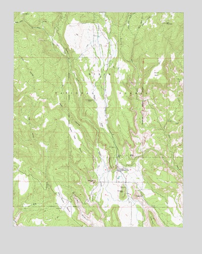
Boulder Town, UT USGS Topographic Map
Click on map above to begin viewing in our Map Viewer.

This topographic map contains these locations and features:
Feature Name Type Latitude Longitude GNIS ID View Map
Anasazi Historical SiteParkN37.9014°W111.4174°1454644View Map
Baker WashValleyN37.8892°W111.4377°1451181View Map
Balancing RockSummitN37.9017°W111.4413°1438342View Map
Bear CreekStreamN37.9717°W111.4605°1438459View Map
Big HollowValleyN37.8789°W111.4991°1438677View Map
Boulder CemeteryCemeteryN37.9215°W111.4257°1448163View Map
Boulder Elementary SchoolSchoolN37.9079°W111.4211°1448164View Map
Boulder Post OfficePost OfficeN37.9085°W111.4234°1455684View Map
Boulder TownPopulated PlaceN37.9083°W111.4229°1437510View Map
Boulder Volunteer Fire DepartmentBuildingN37.9084°W111.4236°2627391View Map
Deer MountainSummitN37.9936°W111.3891°1440389View Map
East Deer CreekStreamN37.9864°W111.4113°1440779View Map
Frisky CreekStreamN37.9319°W111.3896°1441244View Map
Garfield County AmbulanceBuildingN37.9085°W111.4237°2768438View Map
Garkane Hydroelectric PlantBuildingN37.9858°W111.4391°1451248View Map
Haws PastureFlatN37.9994°W111.4941°1441635View Map
Lizzie CreekStreamN37.9317°W111.3907°1442820View Map
Middle Deer CreekStreamN37.9864°W111.4113°1443332View Map
Nazer DrawValleyN37.9192°W111.4241°1443770View Map
Ormand PointCliffN37.9489°W111.4457°1444113View Map
Pretty Tree BenchBenchN37.9253°W111.4546°1444638View Map
Road DrawValleyN37.9944°W111.4924°1444999View Map
Road Draw CreekStreamN37.9944°W111.4924°1451342View Map
Sadies NipplePillarN37.9167°W111.4121°1445231View Map
Schoolhouse LedgeCliffN37.9100°W111.4277°1445372View Map
Short NeckCapeN37.9642°W111.3966°1445554View Map
Side HollowValleyN37.9214°W111.4413°1445569View Map
SugarloafSummitN37.8930°W111.4102°1446214View Map
Tailrace CanalCanalN37.9783°W111.4480°1446323View Map
The Church of Jesus Christ of Latter Day SaintsChurchN37.9078°W111.4188°1449353View Map
Thompson LedgeBenchN37.8980°W111.4193°1446545View Map
Town of BoulderCivilN37.9228°W111.4318°2411711View Map
West Deer CreekStreamN37.9864°W111.4113°1447123View Map

Note: Coordinates in the location and feature list above are referenced to NAD83 datum.


Copyright (C) 2008-2025 Ryan Niemi / Sunset Dynamics ... All Rights Reserved