TopoQuest Logo
Do you find TopoQuest useful?
Help keep TopoQuest running and adding new maps/features by donating!
Bitcoin:  19c7KJd3qBynnjoSw5npx9KScwjBe4ifkT
Litecoin:  LXs6TkuXGGXo1vDsWCkWVdjQX94eUKd6ui
Home View Maps Find Maps Find Places Resources & Links


Lower Colonias, New Mexico Topographic Map

USGS Map Title: Lower Colonias, NM
USGS Map MRC: 35105E5
DRG (GeoTIFF) Download: o35105e5.tif


Neighboring USGS Topographic Map Quads:


  Rosilla Peak, NM  
35105F6
 

  Honey Boy Ranch, NM  
35105F5
 

  El Porvenir, NM  
35105F4
 

  Pecos, NM  
35105E6
 

  Lower Colonias, NM  
35105E5
 

  San Geronimo, NM  
35105E4
 

  Rowe, NM  
35105D6
 

  North San Ysidro, NM  
35105D5
 

  San Jose, NM  
35105D4


Map MRC Location:

N36°
W106°
N36°
W105°
H8 H7 H6 H5 H4 H3 H2 H1
G8 G7 G6 G5 G4 G3 G2 G1
F8 F7 F6 F5 F4 F3 F2 F1
E8 E7 E6 E5 E4 E3 E2 E1
D8 D7 D6 D5 D4 D3 D2 D1
C8 C7 C6 C5 C4 C3 C2 C1
B8 B7 B6 B5 B4 B3 B2 B1
A8 A7 A6 A5 A4 A3 A2 A1
N35°
W106°
N35°
W105°

Lower Colonias, NM USGS 1:24K Topographic Map Preview:
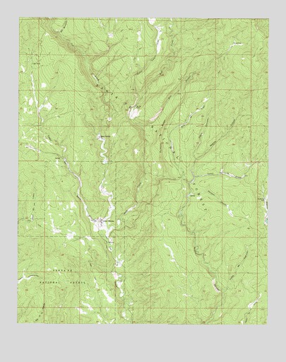
Lower Colonias, NM USGS Topographic Map
Click on map above to begin viewing in our Map Viewer.

This topographic map contains these locations and features:
Feature Name Type Latitude Longitude GNIS ID View Map
Apache SpringSpringN35.5525°W105.5394°913502View Map
Brazel ParkFlatN35.6142°W105.5178°904066View Map
Bull CreekStreamN35.5381°W105.5803°904181View Map
Caņon Cola y LargoValleyN35.5920°W105.5650°904641View Map
Caņon CorralesValleyN35.5678°W105.5370°904644View Map
Caņon de CuervitoValleyN35.5137°W105.5222°904577View Map
Caņon de la CuevaValleyN35.5603°W105.5367°904509View Map
Caņon Ojo SarcoValleyN35.5389°W105.5839°904674View Map
Chupadero SpringSpringN35.6181°W105.5656°913615View Map
Cicuye ArchArchN35.5717°W105.6017°2632198View Map
Corrales SpringSpringN35.5717°W105.5364°913494View Map
Flying Cloud RanchLocaleN35.5514°W105.5020°906315View Map
Hartman CanyonValleyN35.5534°W105.5389°906858View Map
Kay Bar RanchLocaleN35.5889°W105.5664°907508View Map
La Cueva Number Two SpringSpringN35.5612°W105.5315°913503View Map
La Cueve Number One SpringSpringN35.5629°W105.5233°913504View Map
Lower ColoniasPopulated PlaceN35.5417°W105.5836°908268View Map
Ojo SarcoSpringN35.6062°W105.6186°909328View Map
Pecos DivisionCivilN35.6066°W105.5101°1937566View Map
Rito Cola LargoStreamN35.5839°W105.5650°913082View Map
Rito Cola y LargoStreamN35.5920°W105.5650°898502View Map
Rito la VegaStreamN35.5575°W105.5400°910285View Map
Rito ManzanaresStreamN35.6181°W105.6050°910305View Map
Rito RuidosoStreamN35.5803°W105.5622°910317View Map
Ruidoso RidgeRidgeN35.5784°W105.5533°910471View Map
Santo Niņo CemeteryCemeteryN35.5423°W105.5863°910802View Map
Upper ColoniasPopulated PlaceN35.5764°W105.5845°911975View Map

Note: Coordinates in the location and feature list above are referenced to NAD83 datum.


Copyright (C) 2008-2025 Ryan Niemi / Sunset Dynamics ... All Rights Reserved