TopoQuest Logo
Do you find TopoQuest useful?
Help keep TopoQuest running and adding new maps/features by donating!
Bitcoin:  19c7KJd3qBynnjoSw5npx9KScwjBe4ifkT
Litecoin:  LXs6TkuXGGXo1vDsWCkWVdjQX94eUKd6ui
Home View Maps Find Maps Find Places Resources & Links


San Jose, New Mexico Topographic Map

USGS Map Title: San Jose, NM
USGS Map MRC: 35105D4
DRG (GeoTIFF) Download: o35105d4.tif


Neighboring USGS Topographic Map Quads:


  Lower Colonias, NM  
35105E5
 

  San Geronimo, NM  
35105E4
 

  Ojitos Frios, NM  
35105E3
 

  North San Ysidro, NM  
35105D5
 

  San Jose, NM  
35105D4
 

  Tecolote, NM  
35105D3
 

  Laguna Ortiz, NM  
35105C5
 

  Sena, NM  
35105C4
 

  Villanueva, NM  
35105C3


Map MRC Location:

N36°
W106°
N36°
W105°
H8 H7 H6 H5 H4 H3 H2 H1
G8 G7 G6 G5 G4 G3 G2 G1
F8 F7 F6 F5 F4 F3 F2 F1
E8 E7 E6 E5 E4 E3 E2 E1
D8 D7 D6 D5 D4 D3 D2 D1
C8 C7 C6 C5 C4 C3 C2 C1
B8 B7 B6 B5 B4 B3 B2 B1
A8 A7 A6 A5 A4 A3 A2 A1
N35°
W106°
N35°
W105°

San Jose, NM USGS 1:24K Topographic Map Preview:
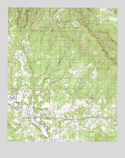
San Jose, NM USGS Topographic Map
Click on map above to begin viewing in our Map Viewer.

This topographic map contains these locations and features:
Feature Name Type Latitude Longitude GNIS ID View Map
Agua Caliente DitchCanalN35.3853°W105.4567°903003View Map
Commissary CreekStreamN35.4567°W105.4797°905285View Map
Corrales CreekStreamN35.4784°W105.4786°905380View Map
Dead HorseLocaleN35.4039°W105.3995°925103View Map
Dimis SpringSpringN35.4797°W105.3806°936513View Map
El AnconPopulated PlaceN35.3895°W105.4589°906029View Map
El Barro CreekStreamN35.4464°W105.4747°906033View Map
El RitoStreamN35.4062°W105.4767°906091View Map
La Madera CanyonValleyN35.4239°W105.4664°907679View Map
Los Caraneras CanyonValleyN35.4184°W105.4653°908198View Map
LuceroPopulated PlaceN35.3912°W105.4617°908301View Map
Lucero CanyonValleyN35.3978°W105.4789°908303View Map
Melton WindmillLocaleN35.4120°W105.4106°924847View Map
Mortandad CreekStreamN35.4848°W105.4411°908922View Map
Priest MineMineN35.4953°W105.4225°909856View Map
Ribera DamDamN35.3787°W105.4550°910153View Map
San Bacino DamDamN35.3973°W105.4708°910609View Map
San JosePopulated PlaceN35.3973°W105.4750°910633View Map
San Jose Census Designated PlaceCensusN35.3956°W105.4759°2629125View Map
San Jose DamDamN35.4120°W105.4900°910637View Map
San Jose Post Office (historical)Post OfficeN35.3973°W105.4750°937661View Map
San Miguel Del Bado Tract Number 10CivilN35.4112°W105.4228°910680View Map
San Miguel Del Bado Tract Number 3CivilN35.4178°W105.4992°910682View Map
SandsPopulated PlaceN35.4050°W105.4914°910762View Map
Sebadilla CreekStreamN35.4617°W105.4831°910895View Map
SohamPopulated PlaceN35.4156°W105.4942°911190View Map
Soham Census Designated PlaceCensusN35.4169°W105.4985°2584219View Map
Soham Post Office (historical)Post OfficeN35.4156°W105.4942°937758View Map
Telephone CanyonValleyN35.4042°W105.4314°911593View Map

Note: Coordinates in the location and feature list above are referenced to NAD83 datum.


Copyright (C) 2008-2025 Ryan Niemi / Sunset Dynamics ... All Rights Reserved