TopoQuest Logo
Do you find TopoQuest useful?
Help keep TopoQuest running and adding new maps/features by donating!
Bitcoin:  19c7KJd3qBynnjoSw5npx9KScwjBe4ifkT
Litecoin:  LXs6TkuXGGXo1vDsWCkWVdjQX94eUKd6ui
Home View Maps Find Maps Find Places Resources & Links


Lowman, Idaho Topographic Map

USGS Map Title: Lowman, ID
USGS Map MRC: 44115A5
DRG (GeoTIFF) Download: o44115a5.tif


Neighboring USGS Topographic Map Quads:


  Scott Creek, ID  
44115B6
 

  Miller Mountain West, ID  
44115B5
 

  Miller Mountain East, ID  
44115B4
 

  Pine Flat, ID  
44115A6
 

  Lowman, ID  
44115A5
 

  Jackson Peak, ID  
44115A4
 

  Sunset Mountain, ID  
43115H6
 

  Big Owl Creek, ID  
43115H5
 

  Bear River, ID  
43115H4


Map MRC Location:

N45°
W116°
N45°
W115°
H8 H7 H6 H5 H4 H3 H2 H1
G8 G7 G6 G5 G4 G3 G2 G1
F8 F7 F6 F5 F4 F3 F2 F1
E8 E7 E6 E5 E4 E3 E2 E1
D8 D7 D6 D5 D4 D3 D2 D1
C8 C7 C6 C5 C4 C3 C2 C1
B8 B7 B6 B5 B4 B3 B2 B1
A8 A7 A6 A5 A4 A3 A2 A1
N44°
W116°
N44°
W115°

Lowman, ID USGS 1:24K Topographic Map Preview:
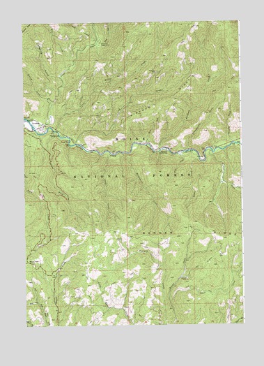
Lowman, ID USGS Topographic Map
Click on map above to begin viewing in our Map Viewer.

This topographic map contains these locations and features:
Feature Name Type Latitude Longitude GNIS ID View Map
Archie CreekStreamN44.0716°W115.5173°376695View Map
Ash CreekStreamN44.1182°W115.5826°376741View Map
BannerPopulated PlaceN44.0199°W115.5357°399359View Map
Banner MineMineN44.0185°W115.5323°376932View Map
Banner RidgeRidgeN44.0382°W115.5182°2791339View Map
Banner Ridge Recreation SiteLocaleN44.0227°W115.6073°400719View Map
Beaver Creek SummitSummitN44.0263°W115.6234°377264View Map
Boise National ForestForestN44.1249°W115.5673°400188View Map
Clear CreekStreamN44.0818°W115.6115°379391View Map
Emma CreekStreamN44.0680°W115.5245°381466View Map
Garden Valley DivisionCivilN44.1077°W115.5189°1936716View Map
Gotch CreekStreamN44.0088°W115.5420°382469View Map
Graney CreekStreamN44.0913°W115.6087°382515View Map
Green CreekStreamN44.0710°W115.5359°382630View Map
Huckleberry CreekStreamN44.0710°W115.5690°383499View Map
Kirkham CreekStreamN44.0721°W115.5470°384254View Map
Kirkham Hot SpringsSpringN44.0716°W115.5427°384256View Map
Kirkham Hot Springs CampgroundLocaleN44.0724°W115.5429°394032View Map
Kirkham RidgeRidgeN44.0910°W115.5495°384257View Map
Lice CreekStreamN44.0791°W115.6162°399105View Map
Lick CreekStreamN44.0749°W115.5959°384606View Map
Logging GulchValleyN44.1016°W115.6037°385979View Map
Lower Ranger StationLocaleN44.0763°W115.5984°386242View Map
LowmanPopulated PlaceN44.0835°W115.6207°396826View Map
Lowman Census Designated PlaceCensusN44.0786°W115.6205°2585576View Map
Lowman Elementary SchoolSchoolN44.0827°W115.6134°401542View Map
Lowman Ranger DistrictBuildingN44.0761°W115.5979°2619277View Map
Lowman Volunteer Fire Department Station 3BuildingN44.0822°W115.6133°2619136View Map
Lowman Work CenterLocaleN44.0741°W115.5915°394031View Map
Meadow CreekStreamN44.0749°W115.5054°386681View Map
Miller CreekStreamN44.0802°W115.6071°386970View Map
Mountain View CampgroundLocaleN44.0788°W115.6040°387299View Map
Park CreekStreamN44.1166°W115.5832°388209View Map
Park Creek CampgroundLocaleN44.1168°W115.5812°388212View Map
Pine CreekStreamN44.1093°W115.5959°388492View Map
Smokey CreekStreamN44.0802°W115.6079°390709View Map
Specimen MineMineN44.1043°W115.5493°391102View Map
Steep CreekStreamN44.0710°W115.5759°391408View Map
Warm CreekStreamN44.0749°W115.5545°392841View Map
Whangdoodle CreekStreamN44.0718°W115.5307°393273View Map

Note: Coordinates in the location and feature list above are referenced to NAD83 datum.


Copyright (C) 2008-2025 Ryan Niemi / Sunset Dynamics ... All Rights Reserved