TopoQuest Logo
Do you find TopoQuest useful?
Help keep TopoQuest running and adding new maps/features by donating!
Bitcoin:  19c7KJd3qBynnjoSw5npx9KScwjBe4ifkT
Litecoin:  LXs6TkuXGGXo1vDsWCkWVdjQX94eUKd6ui
Home View Maps Find Maps Find Places Resources & Links


Luray, Tennessee Topographic Map

USGS Map Title: Luray, TN
USGS Map MRC: 35088E5
DRG (GeoTIFF) Download: o35088e5.tif


Neighboring USGS Topographic Map Quads:


  Claybrook, TN  
35088F6
 

  Juno, TN  
35088F5
 

  Lexington, TN  
35088F4
 

  Beech Bluff, TN  
35088E6
 

  Luray, TN  
35088E5
 

  Life, TN  
35088E4
 

  Henderson, TN  
35088D6
 

  Jacks Creek, TN  
35088D5
 

  Enville, TN  
35088D4


Map MRC Location:

N36°
W89°
N36°
W88°
H8 H7 H6 H5 H4 H3 H2 H1
G8 G7 G6 G5 G4 G3 G2 G1
F8 F7 F6 F5 F4 F3 F2 F1
E8 E7 E6 E5 E4 E3 E2 E1
D8 D7 D6 D5 D4 D3 D2 D1
C8 C7 C6 C5 C4 C3 C2 C1
B8 B7 B6 B5 B4 B3 B2 B1
A8 A7 A6 A5 A4 A3 A2 A1
N35°
W89°
N35°
W88°

Luray, TN USGS 1:24K Topographic Map Preview:
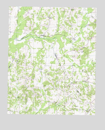
Luray, TN USGS Topographic Map
Click on map above to begin viewing in our Map Viewer.

This topographic map contains these locations and features:
Feature Name Type Latitude Longitude GNIS ID View Map
Bell BranchStreamN35.5892°W88.5598°1276906View Map
Bells Mill (historical)LocaleN35.5090°W88.5656°1316649View Map
Braye School (historical)SchoolN35.5142°W88.5981°1316651View Map
Brown CemeteryCemeteryN35.5528°W88.5517°1278531View Map
Brown ChurchChurchN35.5790°W88.5187°1278569View Map
Brown SchoolSchoolN35.5737°W88.5184°1278603View Map
Browns School (historical)SchoolN35.5456°W88.5326°1317450View Map
Buckley CemeteryCemeteryN35.5826°W88.5606°1278873View Map
Cawthon SchoolSchoolN35.5334°W88.5742°1279983View Map
Chester County Fire Department / Hill Top Volunteer Fire Department Station 520BuildingN35.5172°W88.5971°2654151View Map
Clarks Creek School (historical)SchoolN35.5120°W88.5428°1316660View Map
Commissioner District 2CivilN35.5082°W88.5540°2463905View Map
Cypress CreekStreamN35.5054°W88.5784°1281920View Map
Evans Mill (historical)LocaleN35.5681°W88.5453°1317473View Map
Friendship Baptist ChurchChurchN35.5192°W88.6073°1644621View Map
Frys Point CemeteryCemeteryN35.5137°W88.5564°1285004View Map
Frys Point ChurchChurchN35.5112°W88.5531°1285005View Map
Henderson County Fire Department Station 11BuildingN35.6069°W88.5662°2654230View Map
HuronPopulated PlaceN35.5881°W88.5323°1288774View Map
Huron Baptist ChurchChurchN35.5881°W88.5306°1317480View Map
Huron Post OfficePost OfficeN35.5876°W88.5317°1650820View Map
Jackson Range StationPopulated PlaceN35.5395°W88.5128°1289242View Map
Jones Creek 101-102-0 DamDamN35.5084°W88.6134°1301889View Map
Jones Creek LakeReservoirN35.5084°W88.6134°1301888View Map
Joyners Grove SchoolSchoolN35.5517°W88.5192°1289865View Map
LurayPopulated PlaceN35.5915°W88.5759°1292294View Map
Luray Division (historical)CensusN35.6237°W88.5203°1648774View Map
Luray Post OfficePost OfficeN35.5922°W88.5754°1650827View Map
Luray School (historical)SchoolN35.5912°W88.5764°1317486View Map
McCalls SchoolSchoolN35.5101°W88.5273°1293109View Map
Middle Fork ChurchChurchN35.5570°W88.5342°1293668View Map
Middle Fork CreekStreamN35.5898°W88.5570°1293669View Map
MifflinPopulated PlaceN35.5529°W88.5801°1293756View Map
Mifflin CemeteryCemeteryN35.5501°W88.5792°1644632View Map
Mifflin Memorial ParkParkN35.5515°W88.5776°1316689View Map
Mifflin Missionary Baptist ChurchChurchN35.5498°W88.5789°1644633View Map
Mifflin School (historical)SchoolN35.5495°W88.5787°1316690View Map
Mills-Darden CemeteryCemeteryN35.6137°W88.5053°1317493View Map
Mount Pleasant CemeteryCemeteryN35.5623°W88.6125°1644634View Map
Mount Pleasant ChurchChurchN35.5620°W88.6126°1294762View Map
New FriendshipPopulated PlaceN35.5184°W88.6073°1647364View Map
New Friendship SchoolSchoolN35.5187°W88.6078°1295483View Map
Ollies Grove SchoolSchoolN35.6231°W88.5364°1296430View Map
Robert Williams DamDamN35.5467°W88.5667°1301911View Map
Robert Williams LakeReservoirN35.5467°W88.5667°1301910View Map
Russell CrossroadsPopulated PlaceN35.6131°W88.5684°1315852View Map
Russells Cross Roads School (historical)SchoolN35.6145°W88.5676°1317523View Map
Spencer CreekStreamN35.5870°W88.6162°1270988View Map
Union Grove Church (historical)ChurchN35.5251°W88.6223°1316709View Map
Unity CemeteryCemeteryN35.5059°W88.5112°1644644View Map
Unity ChurchChurchN35.5051°W88.5103°1304267View Map
Willow BranchStreamN35.5092°W88.5609°1274755View Map

Note: Coordinates in the location and feature list above are referenced to NAD83 datum.


Copyright (C) 2008-2024 Ryan Niemi / Sunset Dynamics ... All Rights Reserved