TopoQuest Logo
Do you find TopoQuest useful?
Help keep TopoQuest running and adding new maps/features by donating!
Bitcoin:  19c7KJd3qBynnjoSw5npx9KScwjBe4ifkT
Litecoin:  LXs6TkuXGGXo1vDsWCkWVdjQX94eUKd6ui
Home View Maps Find Maps Find Places Resources & Links


Luttrell, Tennessee Topographic Map

USGS Map Title: Luttrell, TN
USGS Map MRC: 36083B6
DRG (GeoTIFF) Download: o36083b6.tif


Neighboring USGS Topographic Map Quads:


  Maynardville, TN  
36083C7
 

  Powder Springs, TN  
36083C6
 

  Dutch Valley, TN  
36083C5
 

  Graveston, TN  
36083B7
 

  Luttrell, TN  
36083B6
 

  Joppa, TN  
36083B5
 

  John Sevier, TN  
36083A7
 

  Mascot, TN  
36083A6
 

  New Market, TN  
36083A5


Map MRC Location:

N37°
W84°
N37°
W83°
H8 H7 H6 H5 H4 H3 H2 H1
G8 G7 G6 G5 G4 G3 G2 G1
F8 F7 F6 F5 F4 F3 F2 F1
E8 E7 E6 E5 E4 E3 E2 E1
D8 D7 D6 D5 D4 D3 D2 D1
C8 C7 C6 C5 C4 C3 C2 C1
B8 B7 B6 B5 B4 B3 B2 B1
A8 A7 A6 A5 A4 A3 A2 A1
N36°
W84°
N36°
W83°

Luttrell, TN USGS 1:24K Topographic Map Preview:
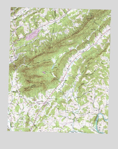
Luttrell, TN USGS Topographic Map
Click on map above to begin viewing in our Map Viewer.

This topographic map contains these locations and features:
Feature Name Type Latitude Longitude GNIS ID View Map
Ailor (historical)Populated PlaceN36.2426°W83.7335°1311774View Map
BlainePopulated PlaceN36.1543°W83.7041°1269358View Map
Blaine Police DepartmentBuildingN36.1529°W83.7006°2766036View Map
Blaine Post OfficePost OfficeN36.1558°W83.7026°1651592View Map
Blaine Volunteer Fire DepartmentBuildingN36.1350°W83.7167°2654991View Map
Block House ChurchChurchN36.1537°W83.7082°1269363View Map
Booker HollowValleyN36.2476°W83.7480°1278861View Map
Brock CemeteryCemeteryN36.2379°W83.6955°1269379View Map
Brown SchoolSchoolN36.1465°W83.6813°1269384View Map
Cedar Ford ChurchChurchN36.2081°W83.7444°1269429View Map
Chamberlain CemeteryCemeteryN36.1305°W83.7446°1269438View Map
ChesneyPopulated PlaceN36.2301°W83.7124°1647824View Map
Chesney School (historical)SchoolN36.2292°W83.7121°1320394View Map
Chestnut FlatFlatN36.2495°W83.6343°1269447View Map
City of BlaineCivilN36.1479°W83.6944°2403874View Map
Clinch ValleyValleyN36.2072°W83.7423°1269473View Map
Commissioner District 2CivilN36.2205°W83.7345°2463980View Map
Commissioner District 3CivilN36.1772°W83.6416°2464146View Map
Crooked RunStreamN36.1929°W83.7494°1269502View Map
Davis CemeteryCemeteryN36.1587°W83.6991°1269518View Map
Donehew HeadSummitN36.2093°W83.6982°1269530View Map
Donehew HollowValleyN36.2191°W83.7137°1269531View Map
Dungeon HollowValleyN36.2132°W83.6487°1269546View Map
Dyer BranchStreamN36.1479°W83.7499°1269548View Map
Dyer CemeteryCemeteryN36.2331°W83.7052°1269549View Map
Flat Creek ValleyValleyN36.2125°W83.7452°1269578View Map
Frost BranchStreamN36.1662°W83.6841°1269589View Map
Hamilton Gap BranchStreamN36.2476°W83.7480°1269618View Map
Heatherly SpringSpringN36.1474°W83.6360°1650529View Map
Hickie CemeteryCemeteryN36.2409°W83.7460°1269639View Map
Highland SpringsPopulated PlaceN36.2295°W83.6427°1314265View Map
Highland Springs BranchStreamN36.2245°W83.6332°1303468View Map
Highland Springs Cove DamDamN36.2234°W83.6432°1302429View Map
Highland Springs Cove LakeReservoirN36.2234°W83.6431°1302428View Map
Highlands (historical)Populated PlaceN36.2251°W83.6341°1310528View Map
Holiness ChurchChurchN36.2245°W83.7457°1320403View Map
Jarnagin CemeteryCemeteryN36.1970°W83.6718°1269687View Map
Jimtown HollowValleyN36.1932°W83.7311°1269692View Map
Kitts PointCliffN36.1676°W83.7277°1269706View Map
Laurel HollowValleyN36.1973°W83.6960°1269713View Map
Lea CreekStreamN36.1720°W83.6827°1269715View Map
Lea LakeReservoirN36.1905°W83.6952°1269716View Map
Lea Lake DamDamN36.1887°W83.6958°1307196View Map
Lea SpringsPopulated PlaceN36.1779°W83.6832°1314267View Map
Lea Springs Baptist ChurchChurchN36.1834°W83.6799°1644584View Map
Lea Springs CemeteryCemeteryN36.1801°W83.6832°1317675View Map
Leas CreekStreamN36.1684°W83.6868°1310534View Map
Lick BranchStreamN36.1631°W83.6693°1269722View Map
Little CreekStreamN36.2054°W83.7413°1269733View Map
Little Flat CreekStreamN36.1270°W83.7457°1269737View Map
Little Valley CemeteryCemeteryN36.1770°W83.6657°1317676View Map
Little Valley ChurchChurchN36.1768°W83.6655°1317677View Map
Little Valley SchoolSchoolN36.1768°W83.6660°1269750View Map
LuttrellPopulated PlaceN36.1995°W83.7419°1303493View Map
Luttrell Division (historical)CensusN36.2348°W83.7344°1648989View Map
Luttrell Post OfficePost OfficeN36.2029°W83.7441°1651445View Map
Luttrell Volunteer Fire DepartmentBuildingN36.2249°W83.7432°2654418View Map
Maples (historical)Populated PlaceN36.1840°W83.6624°1310539View Map
McKinney CemeteryCemeteryN36.1545°W83.7143°1269791View Map
Melton FieldAirportN36.1506°W83.7335°2675542View Map
Mitchell CemeteryCemeteryN36.1531°W83.6641°1269810View Map
Mitchell FordCrossingN36.1615°W83.6641°1314270View Map
Mouth of Richalnd CemeteryCemeteryN36.1367°W83.6657°1317681View Map
Mouth of Richland Baptist ChurchChurchN36.1387°W83.6682°1644593View Map
Mynatt CemeteryCemeteryN36.1597°W83.7351°1269824View Map
Nance CemeteryCemeteryN36.1306°W83.6363°1269825View Map
Nance FerryCrossingN36.1281°W83.6382°1303507View Map
Nances IslandIslandN36.1334°W83.6410°1644595View Map
Nances ShoalsBarN36.1362°W83.6393°1644596View Map
Needham HollowValleyN36.2143°W83.7218°1269826View Map
New Hope ChurchChurchN36.1476°W83.6780°1269828View Map
Perrin HollowPopulated PlaceN36.1465°W83.6346°1310552View Map
Perrin HollowValleyN36.1463°W83.6356°1269849View Map
Perrin Hollow CemeteryCemeteryN36.1484°W83.6380°1269850View Map
Perrin Hollow School (historical)SchoolN36.1490°W83.6363°1316628View Map
Poor ValleyValleyN36.1857°W83.6957°1303523View Map
Powder Spring GapGapN36.2412°W83.6457°1269874View Map
Promised Land HollowValleyN36.1842°W83.6597°1269878View Map
Race Track BluffCliffN36.1390°W83.6410°1269883View Map
Red HouseLocaleN36.2068°W83.6566°1303534View Map
Red House Baptist ChurchChurchN36.2073°W83.6585°1644602View Map
Red House CemeteryCemeteryN36.2090°W83.6557°1317689View Map
Red House School (historical)SchoolN36.2048°W83.6610°1644603View Map
Republic QuarryMineN36.2137°W83.7427°1320429View Map
Rhetts ViewSummitN36.1726°W83.7068°1303536View Map
RichlandPopulated PlaceN36.1376°W83.6655°1314273View Map
Richland CreekStreamN36.1268°W83.6668°1269892View Map
Richland School (historical)SchoolN36.1368°W83.6643°1316633View Map
Richland ValleyValleyN36.1543°W83.6993°1269894View Map
Rush Strong SchoolSchoolN36.1554°W83.7063°1303547View Map
Rutledge Division (historical)CensusN36.1706°W83.6555°1648714View Map
Shields CoveValleyN36.1845°W83.6963°1270060View Map
Shipe CemeteryCemeteryN36.1256°W83.7071°1270115View Map
Signal PointCliffN36.1759°W83.7243°1270260View Map
Silo HollowValleyN36.2455°W83.6811°1270271View Map
Smith BranchStreamN36.1829°W83.6766°1270567View Map
Smith HollowValleyN36.1843°W83.6592°1647361View Map
Smith Hollow BranchStreamN36.1843°W83.6599°1270696View Map
Spencer HollowValleyN36.1620°W83.6654°1270990View Map
Spout Spring BranchStreamN36.1604°W83.6660°1271036View Map
Stillhouse HollowValleyN36.1917°W83.7276°1271427View Map
Stone CemeteryCemeteryN36.1326°W83.6685°1271484View Map
Stones Mill (historical)LocaleN36.1462°W83.6621°1316641View Map
Sulphur SpringSpringN36.1786°W83.6879°1271799View Map
Texas HollowValleyN36.2465°W83.7461°1272351View Map
Town of LuttrellCivilN36.2099°W83.7477°2406061View Map
Vineyard CemeteryCemeteryN36.1617°W83.6452°1273476View Map
Wallop HollowValleyN36.2259°W83.7439°1273704View Map
Wildcat SpurRidgeN36.1951°W83.7088°1274556View Map
Willow Spring ChurchChurchN36.1912°W83.7263°1274770View Map
WIMZ-FM (Knoxville)TowerN36.1351°W83.7246°1640102View Map
Woods Gap BranchStreamN36.2395°W83.7427°1304673View Map
Wyrick ChapelChurchN36.2351°W83.7177°1275218View Map
Zachary CemeteryCemeteryN36.1368°W83.7308°1275347View Map
ZacharytownPopulated PlaceN36.1393°W83.7277°1314554View Map

Note: Coordinates in the location and feature list above are referenced to NAD83 datum.


Copyright (C) 2008-2025 Ryan Niemi / Sunset Dynamics ... All Rights Reserved