TopoQuest Logo
Do you find TopoQuest useful?
Help keep TopoQuest running and adding new maps/features by donating!
Bitcoin:  19c7KJd3qBynnjoSw5npx9KScwjBe4ifkT
Litecoin:  LXs6TkuXGGXo1vDsWCkWVdjQX94eUKd6ui
Home View Maps Find Maps Find Places Resources & Links


Lyerly, Georgia Topographic Map

USGS Map Title: Lyerly, GA
USGS Map MRC: 34085D4
DRG (GeoTIFF) Download: o34085d4.tif


Neighboring USGS Topographic Map Quads:


  Valley Head, AL  
34085E5
 

  Dougherty Gap, GA  
34085E4
 

  Trion, GA  
34085E3
 

  Jamestown, AL  
34085D5
 

  Lyerly, GA  
34085D4
 

  Summerville, GA  
34085D3
 

  Gaylesville, AL  
34085C5
 

  Chattoogaville, GA  
34085C4
 

  Rock Mountain, GA  
34085C3


Map MRC Location:

N35°
W86°
N35°
W85°
H8 H7 H6 H5 H4 H3 H2 H1
G8 G7 G6 G5 G4 G3 G2 G1
F8 F7 F6 F5 F4 F3 F2 F1
E8 E7 E6 E5 E4 E3 E2 E1
D8 D7 D6 D5 D4 D3 D2 D1
C8 C7 C6 C5 C4 C3 C2 C1
B8 B7 B6 B5 B4 B3 B2 B1
A8 A7 A6 A5 A4 A3 A2 A1
N34°
W86°
N34°
W85°

Lyerly, GA USGS 1:24K Topographic Map Preview:
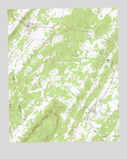
Lyerly, GA USGS Topographic Map
Click on map above to begin viewing in our Map Viewer.

This topographic map contains these locations and features:
Feature Name Type Latitude Longitude GNIS ID View Map
AlpinePopulated PlaceN34.4559°W85.4916°331030View Map
Alpine ChurchChurchN34.4615°W85.4836°354289View Map
Alpine CreekStreamN34.4398°W85.4963°113047View Map
Ami CemeteryCemeteryN34.4692°W85.4972°310512View Map
Angus McLeod ParkParkN34.4076°W85.4033°344417View Map
BerrytonPopulated PlaceN34.4501°W85.3863°354559View Map
Berryton Baptist ChurchChurchN34.4490°W85.3855°344419View Map
Berryton CemeteryCemeteryN34.4570°W85.3852°311121View Map
Berryton Church of GodChurchN34.4470°W85.3922°344420View Map
City of MenloCivilN34.4835°W85.4776°2404242View Map
Clarks CreekStreamN34.3790°W85.3755°355176View Map
Dirtseller MountainSummitN34.3956°W85.4609°355503View Map
Dry BranchStreamN34.4540°W85.4997°117506View Map
Fairview (historical)Populated PlaceN34.4859°W85.4361°344442View Map
Faith TempleChurchN34.4381°W85.4063°314068View Map
First Baptist Church of LyerlyChurchN34.4065°W85.4063°344445View Map
Fosters Store (historical)LocaleN34.4176°W85.4527°344450View Map
Gamble CemeteryCemeteryN34.4851°W85.4033°314496View Map
Gamble SpringSpringN34.4812°W85.4058°314498View Map
Hair LakeReservoirN34.4921°W85.3936°315010View Map
Hair Lake DamDamN34.4909°W85.3933°337134View Map
Hair SpringSpringN34.4954°W85.3969°315011View Map
Jones ChapelChurchN34.4295°W85.3844°344459View Map
Lawrence CemeteryCemeteryN34.4926°W85.4738°316692View Map
LyerlyPopulated PlaceN34.4040°W85.4033°332285View Map
Lyerly CemeteryCemeteryN34.4095°W85.3966°317495View Map
Lyerly City HallBuildingN34.4062°W85.4047°344462View Map
Lyerly Elementary SchoolSchoolN34.4055°W85.4095°344463View Map
Lyerly High School (historical)SchoolN34.4054°W85.4091°344464View Map
Lyerly Volunteer Fire DepartmentBuildingN34.4054°W85.4059°2604296View Map
MenloPopulated PlaceN34.4848°W85.4763°332373View Map
Menlo CemeteryCemeteryN34.4776°W85.4880°344467View Map
Menlo Elementary SchoolSchoolN34.4768°W85.4752°344468View Map
Menlo ParkParkN34.4854°W85.4775°344470View Map
Menlo Volunteer Fire DepartmentBuildingN34.4859°W85.4761°2604292View Map
Mineral Springs (historical)Populated PlaceN34.4890°W85.4855°344471View Map
Moseley SpringsSpringN34.3965°W85.4811°318511View Map
Mosteller CreekStreamN34.3959°W85.4066°318539View Map
Mount Bethel ChurchChurchN34.3970°W85.4105°318564View Map
Oak Hill ChurchChurchN34.4095°W85.4669°319834View Map
PerennialPopulated PlaceN34.4537°W85.4158°332640View Map
Perennial SpringsSpringN34.4554°W85.4197°320384View Map
Perrennial Springs Baptist ChurchChurchN34.4529°W85.4197°344477View Map
Pleasant Green Church Memorial MonumentCemeteryN34.4820°W85.4066°320793View Map
Pleasant Green Presbyterian Church (historical)ChurchN34.4820°W85.4063°344478View Map
Starkville (historical)Populated PlaceN34.3881°W85.4922°136985View Map
Summerville State Fish HatcheryLocaleN34.4737°W85.4080°323744View Map
Taliaferro (historical)Populated PlaceN34.3790°W85.3938°344503View Map
Taliaferro CreekStreamN34.3840°W85.4105°329919View Map
Taliaferro SpringsSpringN34.3795°W85.3933°323888View Map
Thomas ChapelChurchN34.3959°W85.4127°324079View Map
Town of LyerlyCivilN34.4034°W85.4041°2406062View Map

Note: Coordinates in the location and feature list above are referenced to NAD83 datum.


Copyright (C) 2008-2025 Ryan Niemi / Sunset Dynamics ... All Rights Reserved