TopoQuest Logo
Do you find TopoQuest useful?
Help keep TopoQuest running and adding new maps/features by donating!
Bitcoin:  19c7KJd3qBynnjoSw5npx9KScwjBe4ifkT
Litecoin:  LXs6TkuXGGXo1vDsWCkWVdjQX94eUKd6ui
Home View Maps Find Maps Find Places Resources & Links


Lynchs Corner, North Carolina Topographic Map

USGS Map Title: Lynchs Corner, NC
USGS Map MRC: 36076D4
DRG (GeoTIFF) Download: o36076d4.tif


Neighboring USGS Topographic Map Quads:


  Sunbury, NC  
36076D5
 

  Lynchs Corner, NC  
36076D4
 

  South Mills, NC  
36076D3
 

  Hobbsville, NC  
36076C5
 

  Chapanoke, NC  
36076C4
 

  Pasquotank, NC  
36076C3


Map MRC Location:

N37°
W77°
N37°
W76°
H8 H7 H6 H5 H4 H3 H2 H1
G8 G7 G6 G5 G4 G3 G2 G1
F8 F7 F6 F5 F4 F3 F2 F1
E8 E7 E6 E5 E4 E3 E2 E1
D8 D7 D6 D5 D4 D3 D2 D1
C8 C7 C6 C5 C4 C3 C2 C1
B8 B7 B6 B5 B4 B3 B2 B1
A8 A7 A6 A5 A4 A3 A2 A1
N36°
W77°
N36°
W76°

Lynchs Corner, NC USGS 1:24K Topographic Map Preview:
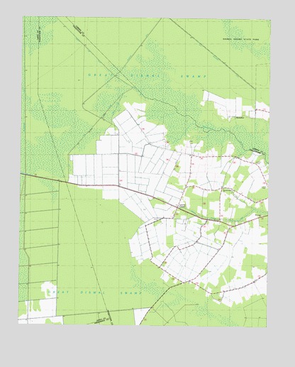
Lynchs Corner, NC USGS Topographic Map
Click on map above to begin viewing in our Map Viewer.

This topographic map contains these locations and features:
Feature Name Type Latitude Longitude GNIS ID View Map
Dike DitchCanalN36.4329°W76.4758°1000914View Map
Dike LegCanalN36.4640°W76.4519°1000915View Map
HorseshoePopulated PlaceN36.4602°W76.3933°1025406View Map
Insurance DitchCanalN36.4827°W76.4449°1002701View Map
Lambs Grove Baptist ChurchChurchN36.4444°W76.4188°2505699View Map
Lynchs CornerPopulated PlaceN36.4229°W76.4211°1025502View Map
Mount Carmel ChurchChurchN36.4204°W76.3780°1003268View Map
Newland Drainage CanalCanalN36.4188°W76.3974°1025578View Map
Pasquotank Newland Volunteer Fire DepartmentBuildingN36.4167°W76.3959°2638709View Map
Ramoth Gilead ChurchChurchN36.4310°W76.3972°1003267View Map
TadmoreLocaleN36.4488°W76.4297°1003192View Map
Township of NewlandCivilN36.4051°W76.4096°1027025View Map

Note: Coordinates in the location and feature list above are referenced to NAD83 datum.


Copyright (C) 2008-2025 Ryan Niemi / Sunset Dynamics ... All Rights Reserved