TopoQuest Logo
Do you find TopoQuest useful?
Help keep TopoQuest running and adding new maps/features by donating!
Bitcoin:  19c7KJd3qBynnjoSw5npx9KScwjBe4ifkT
Litecoin:  LXs6TkuXGGXo1vDsWCkWVdjQX94eUKd6ui
Home View Maps Find Maps Find Places Resources & Links


Madison, Virginia Topographic Map

USGS Map Title: Madison, VA
USGS Map MRC: 38078D3
DRG (GeoTIFF) Download: o38078d3.tif


Neighboring USGS Topographic Map Quads:


  Big Meadows, VA  
38078E4
 

  Old Rag Mountain, VA  
38078E3
 

  Woodville, VA  
38078E2
 

  Fletcher, VA  
38078D4
 

  Madison, VA  
38078D3
 

  Brightwood, VA  
38078D2
 

  Stanardsville, VA  
38078C4
 

  Rochelle, VA  
38078C3
 

  Madison Mills, VA  
38078C2


Map MRC Location:

N39°
W79°
N39°
W78°
H8 H7 H6 H5 H4 H3 H2 H1
G8 G7 G6 G5 G4 G3 G2 G1
F8 F7 F6 F5 F4 F3 F2 F1
E8 E7 E6 E5 E4 E3 E2 E1
D8 D7 D6 D5 D4 D3 D2 D1
C8 C7 C6 C5 C4 C3 C2 C1
B8 B7 B6 B5 B4 B3 B2 B1
A8 A7 A6 A5 A4 A3 A2 A1
N38°
W79°
N38°
W78°

Madison, VA USGS 1:24K Topographic Map Preview:
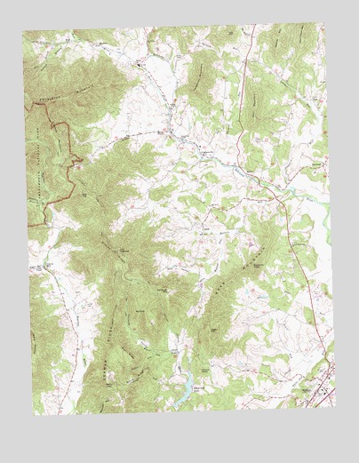
Madison, VA USGS Topographic Map
Click on map above to begin viewing in our Map Viewer.

This topographic map contains these locations and features:
Feature Name Type Latitude Longitude GNIS ID View Map
AylorPopulated PlaceN38.4348°W78.3019°1495213View Map
BaldtopSummitN38.4082°W78.3269°1462713View Map
BancoPopulated PlaceN38.4512°W78.2817°1495229View Map
Beamers HeadSummitN38.4210°W78.2825°1462866View Map
Beaver RunStreamN38.3899°W78.2592°1462969View Map
Berry CemeteryCemeteryN38.4554°W78.3144°1463103View Map
Berry MountainSummitN38.3836°W78.3433°1463109View Map
Blakey RidgeRidgeN38.4277°W78.3375°1463550View Map
Brown CemeteryCemeteryN38.4897°W78.3103°1463903View Map
Burnt RidgeRidgeN38.3833°W78.3409°1464141View Map
Carpenter MountainSummitN38.4826°W78.3007°1464454View Map
Cedar Hill CemeteryCemeteryN38.3873°W78.2516°1464625View Map
Chapman MountainSummitN38.4725°W78.3648°1495376View Map
Courtney HollowValleyN38.3935°W78.3197°1465321View Map
CriglersvillePopulated PlaceN38.4579°W78.3011°1465433View Map
Criglersville Elementary SchoolSchoolN38.4607°W78.3028°1494581View Map
Deal MountainSummitN38.4764°W78.2789°1495459View Map
Deal RidgeRidgeN38.3975°W78.3400°1465680View Map
Deep HollowValleyN38.4173°W78.3032°1465707View Map
Dry BranchStreamN38.4951°W78.3622°1465974View Map
DuetPopulated PlaceN38.4748°W78.2564°1495479View Map
Finks RunStreamN38.4532°W78.2872°1477050View Map
Finks RunStreamN38.4529°W78.2875°1494584View Map
Gaar MountainSummitN38.4008°W78.3007°1466937View Map
Gallihugh CemeteryCemeteryN38.4286°W78.2787°2053907View Map
Gallihugh MountainSummitN38.4150°W78.3179°1495574View Map
German RidgeRidgeN38.3835°W78.3432°1467051View Map
German Ridge Church (historical)ChurchN38.4023°W78.3328°1494585View Map
Gordon CemeteryCemeteryN38.3875°W78.2541°1467263View Map
Graves ChapelChurchN38.4229°W78.3703°1467402View Map
Graves MillPopulated PlaceN38.4226°W78.3675°1495610View Map
Hatter RunStreamN38.3751°W78.3058°1467830View Map
HaywoodPopulated PlaceN38.4535°W78.2522°1477402View Map
Jarrell CemeteryCemeteryN38.4110°W78.3514°1468646View Map
Jemima BranchStreamN38.4960°W78.3547°1468666View Map
Kinsey RunStreamN38.4235°W78.3681°1469032View Map
Leathers RunStreamN38.4460°W78.2656°1469230View Map
MadisonPopulated PlaceN38.3804°W78.2575°1498511View Map
Madison CountyCivilN38.4137°W78.2792°1494590View Map
Madison County Sheriff's OfficeBuildingN38.3800°W78.2570°2766954View Map
Madison County Sheriffs OfficeBuildingN38.3803°W78.2575°2075285View Map
Mount Olivet United Methodist ChurchChurchN38.4946°W78.3228°1471010View Map
Mount Pisgah Church (historical)ChurchN38.3929°W78.3064°1494594View Map
Mount Zion CemeteryCemeteryN38.4745°W78.3118°1494595View Map
Mount Zion ChurchChurchN38.4740°W78.3114°1471152View Map
Mulatto RunStreamN38.4446°W78.2647°1471243View Map
Oak Grove United Methodist ChurchChurchN38.4412°W78.2992°1471735View Map
Polecat BranchStreamN38.3940°W78.3136°1472581View Map
Quaker RunStreamN38.4660°W78.3144°1472888View Map
Rapidan DistrictCivilN38.3896°W78.3538°1927456View Map
Richards HollowValleyN38.4981°W78.3540°2705739View Map
Robertson DistrictCivilN38.4902°W78.2817°1927469View Map
Rose RiverStreamN38.4730°W78.3150°1473537View Map
Rose River ChurchChurchN38.4943°W78.3428°1473538View Map
Round HeadSummitN38.3880°W78.3055°1496172View Map
RuthPopulated PlaceN38.3943°W78.3139°1477707View Map
Ruth School (historical)SchoolN38.3851°W78.3225°1494602View Map
Sag TopSummitN38.4462°W78.3520°1496181View Map
Second Robertson CemeteryCemeteryN38.4286°W78.2659°1494603View Map
Second Robertson ChurchChurchN38.4279°W78.2664°1474149View Map
Shotwell RunStreamN38.4540°W78.2892°1474567View Map
Shotwell School (historical)SchoolN38.4918°W78.2942°1494605View Map
Staunton RiverStreamN38.4437°W78.3692°1475098View Map
Strother RunStreamN38.4962°W78.3525°1475256View Map
Sunnybrook ChapelChurchN38.4640°W78.3106°1475336View Map
Swift Ford School (historical)SchoolN38.4740°W78.3131°1494606View Map
SyriaPopulated PlaceN38.4879°W78.3261°1477801View Map
Syria Post OfficePost OfficeN38.4884°W78.3268°2766426View Map
The Flock of Madison ChurchChurchN38.3762°W78.2613°2426109View Map
Town of MadisonCivilN38.3790°W78.2586°2391281View Map
Utz HightopSummitN38.4277°W78.3375°1496346View Map
Utz HollowValleyN38.4972°W78.2803°1476129View Map
Utz MountainSummitN38.4975°W78.2897°1496347View Map
Waverly Yowell Elementary SchoolSchoolN38.3846°W78.2522°2465045View Map
White Oak DamDamN38.3799°W78.3100°1490365View Map
White Oak LakeReservoirN38.3791°W78.3128°1502158View Map
White Walnut RunStreamN38.4321°W78.2939°1476649View Map
Yager MountainSummitN38.4010°W78.3008°1496203View Map

Note: Coordinates in the location and feature list above are referenced to NAD83 datum.


Copyright (C) 2008-2024 Ryan Niemi / Sunset Dynamics ... All Rights Reserved