TopoQuest Logo
Do you find TopoQuest useful?
Help keep TopoQuest running and adding new maps/features by donating!
Bitcoin:  19c7KJd3qBynnjoSw5npx9KScwjBe4ifkT
Litecoin:  LXs6TkuXGGXo1vDsWCkWVdjQX94eUKd6ui
Home View Maps Find Maps Find Places Resources & Links


Woodville, Virginia Topographic Map

USGS Map Title: Woodville, VA
USGS Map MRC: 38078E2
DRG (GeoTIFF) Download: o38078e2.tif


Neighboring USGS Topographic Map Quads:


  Thornton Gap, VA  
38078F3
 

  Washington, VA  
38078F2
 

  Massies Corner, VA  
38078F1
 

  Old Rag Mountain, VA  
38078E3
 

  Woodville, VA  
38078E2
 

  Castleton, VA  
38078E1
 

  Madison, VA  
38078D3
 

  Brightwood, VA  
38078D2
 

  Culpeper West, VA  
38078D1


Map MRC Location:

N39°
W79°
N39°
W78°
H8 H7 H6 H5 H4 H3 H2 H1
G8 G7 G6 G5 G4 G3 G2 G1
F8 F7 F6 F5 F4 F3 F2 F1
E8 E7 E6 E5 E4 E3 E2 E1
D8 D7 D6 D5 D4 D3 D2 D1
C8 C7 C6 C5 C4 C3 C2 C1
B8 B7 B6 B5 B4 B3 B2 B1
A8 A7 A6 A5 A4 A3 A2 A1
N38°
W79°
N38°
W78°

Woodville, VA USGS 1:24K Topographic Map Preview:
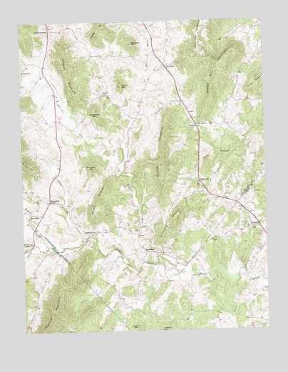
Woodville, VA USGS Topographic Map
Click on map above to begin viewing in our Map Viewer.

This topographic map contains these locations and features:
Feature Name Type Latitude Longitude GNIS ID View Map
Bald MountainSummitN38.5296°W78.2172°1500862View Map
Bessie Bell MountainSummitN38.6137°W78.1400°1463113View Map
BostonPopulated PlaceN38.5410°W78.1317°1477131View Map
Boston Post OfficePost OfficeN38.5419°W78.1285°2766161View Map
Buckners CornerPopulated PlaceN38.6218°W78.2353°1499178View Map
Butler MountainSummitN38.5671°W78.1792°1464176View Map
Chancellor MountainSummitN38.5651°W78.2147°1464723View Map
Fielding MountainSummitN38.6193°W78.2114°1466548View Map
Grindstone MountainSummitN38.5476°W78.1703°1467552View Map
HawlinPopulated PlaceN38.5957°W78.2081°1499537View Map
Hitt MountainSummitN38.5004°W78.1778°1499565View Map
Hughes RiverLocaleN38.5398°W78.2189°1468360View Map
Hughes RiverStreamN38.5237°W78.1697°1468361View Map
James H Fletcher BridgeBridgeN38.5418°W78.2439°1494588View Map
Jenkins OrchardLocaleN38.6136°W78.2078°2518909View Map
Jobbers MountainSummitN38.6060°W78.2275°1468749View Map
Kilbys CreekStreamN38.5385°W78.2158°1468991View Map
Mount Lebanon ChurchChurchN38.5835°W78.1592°1470924View Map
Nazareth ChurchChurchN38.5368°W78.1517°1471348View Map
Parish MountainSummitN38.5018°W78.1917°1472057View Map
Peola MillsPopulated PlaceN38.5473°W78.2461°1499856View Map
Popham RunStreamN38.5323°W78.2347°1472632View Map
Revercombs CornerPopulated PlaceN38.5526°W78.2364°1499952View Map
Rocky RunStreamN38.5257°W78.1947°1497898View Map
Rosser MountainSummitN38.5987°W78.1981°1473565View Map
Rosson Hollow RunStreamN38.5335°W78.2436°1473566View Map
Round HillPopulated PlaceN38.5598°W78.1581°1477702View Map
Schoolhouse MountainSummitN38.5893°W78.2131°1500038View Map
ScrabblePopulated PlaceN38.5821°W78.1594°1500042View Map
Shackelford Airport (historical)AirportN38.5907°W78.2283°1498818View Map
Shiloh Baptist ChurchChurchN38.6087°W78.1747°1673985View Map
Slate MillsPopulated PlaceN38.5315°W78.1828°1477761View Map
Slate Mills Baptist ChurchChurchN38.5315°W78.1808°1673986View Map
Slaughter MountainSummitN38.6160°W78.1922°1474681View Map
Stevenson Church (historical)ChurchN38.5007°W78.1331°1497911View Map
Stonewall-Hawthorne DistrictCivilN38.5988°W78.1514°1927526View Map
Turkey RidgeRidgeN38.5976°W78.1311°1475954View Map
Walden MountainSummitN38.5590°W78.2064°1500269View Map
WoodvillePopulated PlaceN38.6068°W78.1753°1500353View Map
Woodville Baptist ChurchChurchN38.6065°W78.1742°1673999View Map

Note: Coordinates in the location and feature list above are referenced to NAD83 datum.


Copyright (C) 2008-2025 Ryan Niemi / Sunset Dynamics ... All Rights Reserved