TopoQuest Logo
Do you find TopoQuest useful?
Help keep TopoQuest running and adding new maps/features by donating!
Bitcoin:  19c7KJd3qBynnjoSw5npx9KScwjBe4ifkT
Litecoin:  LXs6TkuXGGXo1vDsWCkWVdjQX94eUKd6ui
Home View Maps Find Maps Find Places Resources & Links


Magnolia West, Texas Topographic Map

USGS Map Title: Magnolia West, TX
USGS Map MRC: 30095B7
DRG (GeoTIFF) Download: o30095b7.tif


Neighboring USGS Topographic Map Quads:


  Stoneham, TX  
30095C8
 

  Plantersville, TX  
30095C7
 

  Keenan, TX  
30095C6
 

  Waller NW, TX  
30095B8
 

  Magnolia West, TX  
30095B7
 

  Magnolia East, TX  
30095B6
 

  Waller, TX  
30095A8
 

  Hockley, TX  
30095A7
 

  Rose Hill, TX  
30095A6


Map MRC Location:

N31°
W96°
N31°
W95°
H8 H7 H6 H5 H4 H3 H2 H1
G8 G7 G6 G5 G4 G3 G2 G1
F8 F7 F6 F5 F4 F3 F2 F1
E8 E7 E6 E5 E4 E3 E2 E1
D8 D7 D6 D5 D4 D3 D2 D1
C8 C7 C6 C5 C4 C3 C2 C1
B8 B7 B6 B5 B4 B3 B2 B1
A8 A7 A6 A5 A4 A3 A2 A1
N30°
W96°
N30°
W95°

Magnolia West, TX USGS 1:24K Topographic Map Preview:
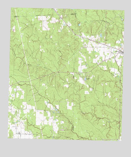
Magnolia West, TX USGS Topographic Map
Click on map above to begin viewing in our Map Viewer.

This topographic map contains these locations and features:
Feature Name Type Latitude Longitude GNIS ID View Map
Assembly of God ChurchChurchN30.1299°W95.8608°1329812View Map
Birch CreekStreamN30.1874°W95.8194°1330695View Map
Brushy CreekStreamN30.1255°W95.8002°1377726View Map
Club Lakeview LakeReservoirN30.1536°W95.8223°1862892View Map
Club Lakeview Lake DamDamN30.1535°W95.8219°1862891View Map
FetzerPopulated PlaceN30.2413°W95.8177°1378290View Map
J L Lyon Elementary SchoolSchoolN30.1369°W95.7533°2007483View Map
Kachel LakeReservoirN30.2253°W95.7756°1854418View Map
Kachel Lake DamDamN30.2269°W95.7752°1854417View Map
MagnoliaPopulated PlaceN30.2094°W95.7508°1340838View Map
Magnolia Elementary SchoolSchoolN30.2055°W95.7511°2007433View Map
Magnolia High SchoolSchoolN30.1949°W95.7530°2007434View Map
Magnolia Junior High SchoolSchoolN30.2102°W95.7519°2007435View Map
Magnolia Post OfficePost OfficeN30.2084°W95.7542°2731489View Map
Magnolia United Methodist ChurchChurchN30.2083°W95.7508°2023068View Map
Magnolia Volunteer Fire Department - First RespondersBuildingN30.2101°W95.7527°2334475View Map
Magnolia Volunteer Fire Department Station 183BuildingN30.1333°W95.7534°2334466View Map
Montgomery County Constable's Office Precinct 5BuildingN30.1991°W95.7539°2751499View Map
Montgomery County Hospital District Emergency Medical Services Station 67BuildingN30.1332°W95.7534°2720907View Map
Old Sanders CemeteryCemeteryN30.2258°W95.7852°1343225View Map
Threemile CreekStreamN30.1272°W95.7930°1376447View Map
Woodland LakeReservoirN30.1833°W95.7914°1854416View Map
Woodland Lake DamDamN30.1835°W95.7919°1854415View Map

Note: Coordinates in the location and feature list above are referenced to NAD83 datum.


Copyright (C) 2008-2024 Ryan Niemi / Sunset Dynamics ... All Rights Reserved