TopoQuest Logo
Do you find TopoQuest useful?
Help keep TopoQuest running and adding new maps/features by donating!
Bitcoin:  19c7KJd3qBynnjoSw5npx9KScwjBe4ifkT
Litecoin:  LXs6TkuXGGXo1vDsWCkWVdjQX94eUKd6ui
Home View Maps Find Maps Find Places Resources & Links


Mahnomen, Minnesota Topographic Map

USGS Map Title: Mahnomen, MN
USGS Map MRC: 47095C8
DRG (GeoTIFF) Download: o47095c8.tif


Neighboring USGS Topographic Map Quads:


  Faith NE, MN  
47096D1
 

  Bejou, MN  
47095D8
 

  Mahnomen NE, MN  
47095D7
 

  Faith, MN  
47096C1
 

  Mahnomen, MN  
47095C8
 

  Beaulieu, MN  
47095C7
 

  Flom NE, MN  
47096B1
 

  Waubun, MN  
47095B8
 

  Ogema NE, MN  
47095B7


Map MRC Location:

N48°
W96°
N48°
W95°
H8 H7 H6 H5 H4 H3 H2 H1
G8 G7 G6 G5 G4 G3 G2 G1
F8 F7 F6 F5 F4 F3 F2 F1
E8 E7 E6 E5 E4 E3 E2 E1
D8 D7 D6 D5 D4 D3 D2 D1
C8 C7 C6 C5 C4 C3 C2 C1
B8 B7 B6 B5 B4 B3 B2 B1
A8 A7 A6 A5 A4 A3 A2 A1
N47°
W96°
N47°
W95°

Mahnomen, MN USGS 1:24K Topographic Map Preview:
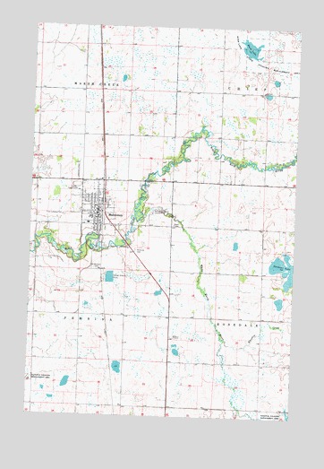
Mahnomen, MN USGS Topographic Map
Click on map above to begin viewing in our Map Viewer.

This topographic map contains these locations and features:
Feature Name Type Latitude Longitude GNIS ID View Map
Assembly of God ChurchChurchN47.3219°W95.9681°2082510View Map
Bethlehem Lutheran ChurchChurchN47.3150°W95.9758°2082514View Map
City of MahnomenCivilN47.3145°W95.9673°2395817View Map
First Lutheran CemeteryCemeteryN47.3141°W95.9848°643658View Map
First Lutheran ChurchChurchN47.3172°W95.9694°2082512View Map
Gardner LakeLakeN47.2980°W95.8762°644036View Map
MahnomenPopulated PlaceN47.3152°W95.9687°647385View Map
MahnomenLocaleN47.3211°W95.9661°2082515View Map
Mahnomen City HallBuildingN47.3144°W95.9694°2082502View Map
Mahnomen City HallBuildingN47.3144°W95.9694°2082503View Map
Mahnomen County AirportAirportN47.2589°W95.9300°660269View Map
Mahnomen County and Village Hospital HeliportAirportN47.3116°W95.9742°660270View Map
Mahnomen County Country ClubLocaleN47.3155°W95.9423°659884View Map
Mahnomen County CourthouseBuildingN47.3181°W95.9689°2082509View Map
Mahnomen County JailBuildingN47.3178°W95.9695°2758636View Map
Mahnomen County Sheriff's OfficeBuildingN47.3178°W95.9693°2082508View Map
Mahnomen Health CenterHospitalN47.3117°W95.9729°2082506View Map
Mahnomen Health Center AmbulanceBuildingN47.3121°W95.9729°2721311View Map
Mahnomen High SchoolSchoolN47.3136°W95.9714°2082504View Map
Mahnomen Mobile Home ParkPopulated PlaceN47.3153°W95.9683°2082516View Map
Mahnomen Post OfficePost OfficeN47.3167°W95.9678°2082500View Map
Mahnomen Public LibraryBuildingN47.3144°W95.9694°2082501View Map
Mahnomen Volunteer Fire DepartmentBuildingN47.3144°W95.9683°2666367View Map
Meritcare Mahnomen ClinicHospitalN47.3117°W95.9725°2082505View Map
Nee Gon Nee Lutheran ChurchChurchN47.3250°W95.9692°2082513View Map
Riverland Census Designated PlaceCensusN47.3219°W95.9511°2583779View Map
Riverside CemeteryCemeteryN47.3033°W95.9503°650127View Map
Rush LakeLakeN47.3684°W95.8980°650404View Map
Rush Lake State Wildlife Management AreaParkN47.3636°W95.8978°650411View Map
Saint Michael's Catholic ChurchChurchN47.3108°W95.9689°2082511View Map
Saint Michael's SchoolSchoolN47.3108°W95.9700°2082507View Map
Saint Michaels CemeteryCemeteryN47.2972°W95.9698°650915View Map
Whiskey CreekStreamN47.2747°W95.9075°654064View Map
White Earth RiverStreamN47.3125°W95.9487°654081View Map

Note: Coordinates in the location and feature list above are referenced to NAD83 datum.


Copyright (C) 2008-2025 Ryan Niemi / Sunset Dynamics ... All Rights Reserved