TopoQuest Logo
Do you find TopoQuest useful?
Help keep TopoQuest running and adding new maps/features by donating!
Bitcoin:  19c7KJd3qBynnjoSw5npx9KScwjBe4ifkT
Litecoin:  LXs6TkuXGGXo1vDsWCkWVdjQX94eUKd6ui
Home View Maps Find Maps Find Places Resources & Links


Waubun, Minnesota Topographic Map

USGS Map Title: Waubun, MN
USGS Map MRC: 47095B8
DRG (GeoTIFF) Download: o47095b8.tif


Neighboring USGS Topographic Map Quads:


  Faith, MN  
47096C1
 

  Mahnomen, MN  
47095C8
 

  Beaulieu, MN  
47095C7
 

  Flom NE, MN  
47096B1
 

  Waubun, MN  
47095B8
 

  Ogema NE, MN  
47095B7
 

  Flom SE, MN  
47096A1
 

  Ogema, MN  
47095A8
 

  White Earth, MN  
47095A7


Map MRC Location:

N48°
W96°
N48°
W95°
H8 H7 H6 H5 H4 H3 H2 H1
G8 G7 G6 G5 G4 G3 G2 G1
F8 F7 F6 F5 F4 F3 F2 F1
E8 E7 E6 E5 E4 E3 E2 E1
D8 D7 D6 D5 D4 D3 D2 D1
C8 C7 C6 C5 C4 C3 C2 C1
B8 B7 B6 B5 B4 B3 B2 B1
A8 A7 A6 A5 A4 A3 A2 A1
N47°
W96°
N47°
W95°

Waubun, MN USGS 1:24K Topographic Map Preview:
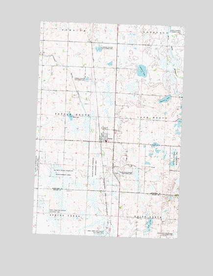
Waubun, MN USGS Topographic Map
Click on map above to begin viewing in our Map Viewer.

This topographic map contains these locations and features:
Feature Name Type Latitude Longitude GNIS ID View Map
Circle of Faith Congregational ChurchChurchN47.1839°W95.9417°2082523View Map
City of WaubunCivilN47.1839°W95.9401°2397219View Map
Fish LakeLakeN47.1334°W95.8995°643692View Map
Haddeland Mobile Home ParkPopulated PlaceN47.1806°W95.9389°2082518View Map
Mahnomen County Waterfowl Production AreaParkN47.2474°W95.9184°2765383View Map
Moore LakeLakeN47.1949°W95.9714°648065View Map
Saint Ann's Catholic ChurchChurchN47.1817°W95.9381°2082524View Map
Saint Anns CemeteryCemeteryN47.1872°W95.9345°650508View Map
Santwire LakeLakeN47.2228°W95.9111°651208View Map
Tamarac Wetland DamDamN47.1700°W95.8853°1776991View Map
Trinity Lutheran ChurchChurchN47.1842°W95.9417°2082522View Map
WaubunPopulated PlaceN47.1805°W95.9392°653849View Map
WaubunLocaleN47.1814°W95.9439°2082517View Map
Waubun CemeteryCemeteryN47.1661°W95.9336°653850View Map
Waubun CemeteryCemeteryN47.1797°W95.9389°2082499View Map
Waubun Fire DepartmentBuildingN47.1814°W95.9441°2666366View Map
Waubun High SchoolSchoolN47.1894°W95.9403°2082525View Map
Waubun LakeLakeN47.2068°W95.8901°653851View Map
Waubun Police DepartmentBuildingN47.1806°W95.9389°2082520View Map
Waubun Post OfficePost OfficeN47.1806°W95.9389°2082519View Map
Waubun State Wildlife Management AreaParkN47.1616°W95.9753°653852View Map
White Earth State Wildlife Management AreaParkN47.1275°W95.8778°654083View Map

Note: Coordinates in the location and feature list above are referenced to NAD83 datum.


Copyright (C) 2008-2024 Ryan Niemi / Sunset Dynamics ... All Rights Reserved