TopoQuest Logo
Do you find TopoQuest useful?
Help keep TopoQuest running and adding new maps/features by donating!
Bitcoin:  19c7KJd3qBynnjoSw5npx9KScwjBe4ifkT
Litecoin:  LXs6TkuXGGXo1vDsWCkWVdjQX94eUKd6ui
Home View Maps Find Maps Find Places Resources & Links


Mahogany Ridge, California Topographic Map

USGS Map Title: Mahogany Ridge, CA
USGS Map MRC: 41120E5
DRG (GeoTIFF) Download: o41120e5.tif


Neighboring USGS Topographic Map Quads:


  Whittemore Ridge, CA  
41120F6
 

  Dead Horse Reservoir, CA  
41120F5
 

  Lauer Reservoir, CA  
41120F4
 

  Big Sage Reservoir, CA  
41120E6
 

  Mahogany Ridge, CA  
41120E5
 

  Surprise Station, CA  
41120E4
 

  Rattlesnake Butte, CA  
41120D6
 

  Alturas, CA  
41120D5
 

  Dorris Reservoir, CA  
41120D4


Map MRC Location:

N42°
W121°
N42°
W120°
H8 H7 H6 H5 H4 H3 H2 H1
G8 G7 G6 G5 G4 G3 G2 G1
F8 F7 F6 F5 F4 F3 F2 F1
E8 E7 E6 E5 E4 E3 E2 E1
D8 D7 D6 D5 D4 D3 D2 D1
C8 C7 C6 C5 C4 C3 C2 C1
B8 B7 B6 B5 B4 B3 B2 B1
A8 A7 A6 A5 A4 A3 A2 A1
N41°
W121°
N41°
W120°

Mahogany Ridge, CA USGS 1:24K Topographic Map Preview:
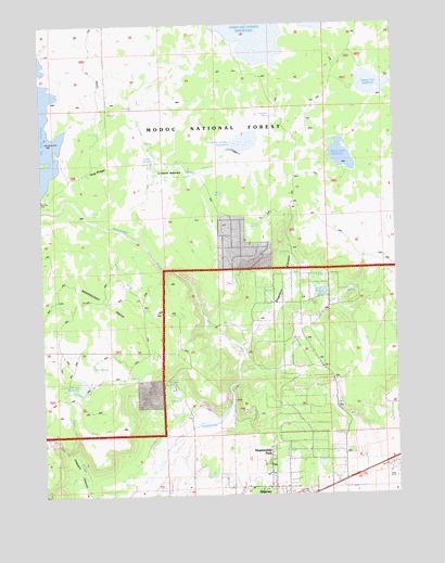
Mahogany Ridge, CA USGS Topographic Map
Click on map above to begin viewing in our Map Viewer.

This topographic map contains these locations and features:
Feature Name Type Latitude Longitude GNIS ID View Map
Big Dobe South 129-002 DamDamN41.6213°W120.5597°1663743View Map
Daphnedale ParkPopulated PlaceN41.5091°W120.5450°1658375View Map
Daphnedale Park Census Designated PlaceCensusN41.5089°W120.5507°2582990View Map
Emigrant SpringSpringN41.6004°W120.5438°223189View Map
Emigrant Spring ReservoirReservoirN41.5936°W120.5537°1665954View Map
Hidden SpringSpringN41.5800°W120.5649°1665959View Map
Hillside SpringsSpringN41.5279°W120.5808°1665960View Map
Hog RidgeRidgeN41.5874°W120.6066°225412View Map
Indian SpringSpringN41.5341°W120.6091°252574View Map
Indian Spring ReservoirReservoirN41.5291°W120.6124°251990View Map
KCNO-AM (Alturas)TowerN41.5018°W120.5013°1662546View Map
Kelley SpringsSpringN41.5893°W120.5855°251998View Map
Mahogany RidgeRidgeN41.5513°W120.6061°227953View Map
Pretty Tree ReservoirReservoirN41.6088°W120.5086°231049View Map
Raker and Thomas ReservoirsReservoirN41.6233°W120.5460°267153View Map
Rattlesnake DitchCanalN41.5060°W120.5944°253189View Map
Swanson CanyonValleyN41.5388°W120.5550°1665977View Map
West Rock CreekStreamN41.5110°W120.6155°237518View Map
Wood Flat ReservoirReservoirN41.5897°W120.5196°238110View Map

Note: Coordinates in the location and feature list above are referenced to NAD83 datum.


Copyright (C) 2008-2024 Ryan Niemi / Sunset Dynamics ... All Rights Reserved