TopoQuest Logo
Do you find TopoQuest useful?
Help keep TopoQuest running and adding new maps/features by donating!
Bitcoin:  19c7KJd3qBynnjoSw5npx9KScwjBe4ifkT
Litecoin:  LXs6TkuXGGXo1vDsWCkWVdjQX94eUKd6ui
Home View Maps Find Maps Find Places Resources & Links


Big Sage Reservoir, California Topographic Map

USGS Map Title: Big Sage Reservoir, CA
USGS Map MRC: 41120E6
DRG (GeoTIFF) Download: o41120e6.tif


Neighboring USGS Topographic Map Quads:


  Boles Meadow East, CA  
41120F7
 

  Whittemore Ridge, CA  
41120F6
 

  Dead Horse Reservoir, CA  
41120F5
 

  Jacks Butte, CA  
41120E7
 

  Big Sage Reservoir, CA  
41120E6
 

  Mahogany Ridge, CA  
41120E5
 

  Canby, CA  
41120D7
 

  Rattlesnake Butte, CA  
41120D6
 

  Alturas, CA  
41120D5


Map MRC Location:

N42°
W121°
N42°
W120°
H8 H7 H6 H5 H4 H3 H2 H1
G8 G7 G6 G5 G4 G3 G2 G1
F8 F7 F6 F5 F4 F3 F2 F1
E8 E7 E6 E5 E4 E3 E2 E1
D8 D7 D6 D5 D4 D3 D2 D1
C8 C7 C6 C5 C4 C3 C2 C1
B8 B7 B6 B5 B4 B3 B2 B1
A8 A7 A6 A5 A4 A3 A2 A1
N41°
W121°
N41°
W120°

Big Sage Reservoir, CA USGS 1:24K Topographic Map Preview:
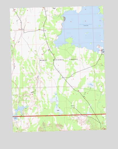
Big Sage Reservoir, CA USGS Topographic Map
Click on map above to begin viewing in our Map Viewer.

This topographic map contains these locations and features:
Feature Name Type Latitude Longitude GNIS ID View Map
Alturas DivisionCivilN41.6181°W120.6930°1935008View Map
Big Sage 55-000 DamDamN41.5782°W120.6261°1663464View Map
Big Sage CampgroundLocaleN41.5799°W120.6291°1655119View Map
Big Sage DamDamN41.5782°W120.6266°219247View Map
Big Sage ReservoirReservoirN41.6043°W120.6513°219248View Map
Cummings Reservoir Number 1 148 DamDamN41.5166°W120.6444°1663755View Map
Devils Garden Airport (historical)AirportN41.5221°W120.6650°276358View Map
Essex ReservoirReservoirN41.5247°W120.7414°1663732View Map
Kelley ReservoirReservoirN41.5269°W120.6920°251997View Map
Lower Cummings ReservoirReservoirN41.5162°W120.6478°1663756View Map
Mill SpringSpringN41.6155°W120.6924°252001View Map
Modoc CountyCivilN41.5898°W120.7250°277289View Map
Porcupine RimCliffN41.5952°W120.7380°230944View Map
Rock SpringSpringN41.5281°W120.6368°256028View Map
S X 112 DamDamN41.5116°W120.7477°1663731View Map
Salisbury GulchValleyN41.5266°W120.7425°252578View Map
Upper Cummings ReservoirReservoirN41.5455°W120.6448°236880View Map

Note: Coordinates in the location and feature list above are referenced to NAD83 datum.


Copyright (C) 2008-2025 Ryan Niemi / Sunset Dynamics ... All Rights Reserved