TopoQuest Logo
Do you find TopoQuest useful?
Help keep TopoQuest running and adding new maps/features by donating!
Bitcoin:  19c7KJd3qBynnjoSw5npx9KScwjBe4ifkT
Litecoin:  LXs6TkuXGGXo1vDsWCkWVdjQX94eUKd6ui
Home View Maps Find Maps Find Places Resources & Links


Maloney Hill, Montana Topographic Map

USGS Map Title: Maloney Hill, MT
USGS Map MRC: 47106E8
DRG (GeoTIFF) Download: o47106e8.tif


Neighboring USGS Topographic Map Quads:


  Harper Camp, MT  
47107F1
 

  Peterson Point, MT  
47106F8
 

  Little Buffalo Hill, MT  
47106F7
 

  Trumbo Ranch, MT  
47107E1
 

  Maloney Hill, MT  
47106E8
 

  Buffalo Hill, MT  
47106E7
 

  Biscuit Butte, MT  
47107D1
 

  Jordan NW, MT  
47106D8
 

  Jordan NE, MT  
47106D7


Map MRC Location:

N48°
W107°
N48°
W106°
H8 H7 H6 H5 H4 H3 H2 H1
G8 G7 G6 G5 G4 G3 G2 G1
F8 F7 F6 F5 F4 F3 F2 F1
E8 E7 E6 E5 E4 E3 E2 E1
D8 D7 D6 D5 D4 D3 D2 D1
C8 C7 C6 C5 C4 C3 C2 C1
B8 B7 B6 B5 B4 B3 B2 B1
A8 A7 A6 A5 A4 A3 A2 A1
N47°
W107°
N47°
W106°

Maloney Hill, MT USGS 1:24K Topographic Map Preview:
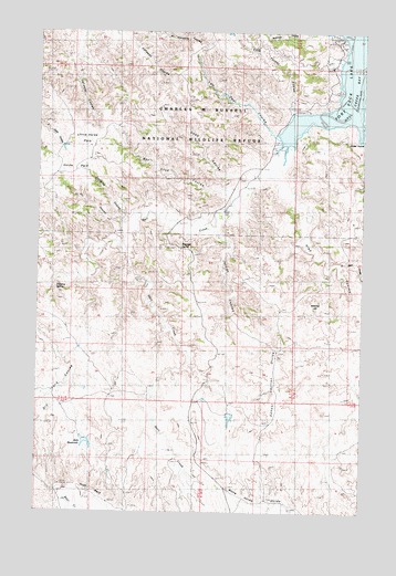
Maloney Hill, MT USGS Topographic Map
Click on map above to begin viewing in our Map Viewer.

This topographic map contains these locations and features:
Feature Name Type Latitude Longitude GNIS ID View Map
Bay Stud CouleeValleyN47.5836°W106.9253°768566View Map
Cold Turkey CouleeValleyN47.6014°W106.9017°770020View Map
Deep CouleeValleyN47.5867°W106.9217°770544View Map
Dripping SpringSpringN47.5584°W106.9934°770750View Map
East Ried CouleeValleyN47.5647°W106.8840°771106View Map
Fir CouleeValleyN47.5756°W106.9670°771365View Map
Hart CreekStreamN47.5681°W106.9662°772182View Map
Hell CreekStreamN47.6225°W106.8765°772326View Map
Hell Creek Recreation AreaParkN47.6158°W106.8878°772327View Map
Hell Creek State ParkParkN47.6167°W106.8923°1715948View Map
Hogs BackRidgeN47.5039°W106.9745°772457View Map
Horse ParkFlatN47.5889°W106.9873°772559View Map
Jade ReservoirReservoirN47.5184°W106.9809°800087View Map
Jasper CouleeValleyN47.5950°W106.8751°772798View Map
Jordan CouleeValleyN47.5731°W106.9303°772904View Map
Kapache CouleeValleyN47.5758°W106.9648°772937View Map
Little Horse ParkFlatN47.5983°W106.9817°773455View Map
Maloney HillSummitN47.5525°W106.8923°773848View Map
Manaige SpringSpringN47.5691°W106.9456°773855View Map
Ried CouleeValleyN47.5867°W106.9076°775763View Map
School Section DivideRidgeN47.5317°W106.9084°776275View Map
Two Deer CouleeValleyN47.5978°W106.9103°777869View Map
White Horse DivideRidgeN47.5042°W106.9253°778388View Map

Note: Coordinates in the location and feature list above are referenced to NAD83 datum.


Copyright (C) 2008-2024 Ryan Niemi / Sunset Dynamics ... All Rights Reserved