TopoQuest Logo
Do you find TopoQuest useful?
Help keep TopoQuest running and adding new maps/features by donating!
Bitcoin:  19c7KJd3qBynnjoSw5npx9KScwjBe4ifkT
Litecoin:  LXs6TkuXGGXo1vDsWCkWVdjQX94eUKd6ui
Home View Maps Find Maps Find Places Resources & Links


Peterson Point, Montana Topographic Map

USGS Map Title: Peterson Point, MT
USGS Map MRC: 47106F8
DRG (GeoTIFF) Download: o47106f8.tif


Neighboring USGS Topographic Map Quads:


  Murray Hill, MT  
47107G1
 

  Brown Pass, MT  
47106G8
 

  Middle Eighth Coulee, MT  
47106G7
 

  Harper Camp, MT  
47107F1
 

  Peterson Point, MT  
47106F8
 

  Little Buffalo Hill, MT  
47106F7
 

  Trumbo Ranch, MT  
47107E1
 

  Maloney Hill, MT  
47106E8
 

  Buffalo Hill, MT  
47106E7


Map MRC Location:

N48°
W107°
N48°
W106°
H8 H7 H6 H5 H4 H3 H2 H1
G8 G7 G6 G5 G4 G3 G2 G1
F8 F7 F6 F5 F4 F3 F2 F1
E8 E7 E6 E5 E4 E3 E2 E1
D8 D7 D6 D5 D4 D3 D2 D1
C8 C7 C6 C5 C4 C3 C2 C1
B8 B7 B6 B5 B4 B3 B2 B1
A8 A7 A6 A5 A4 A3 A2 A1
N47°
W107°
N47°
W106°

Peterson Point, MT USGS 1:24K Topographic Map Preview:
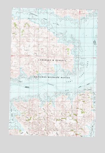
Peterson Point, MT USGS Topographic Map
Click on map above to begin viewing in our Map Viewer.

This topographic map contains these locations and features:
Feature Name Type Latitude Longitude GNIS ID View Map
22N37E04CCBC01 WellWellN47.6900°W106.9873°824542View Map
23N37E20DABA01 WellWellN47.7381°W106.9909°824757View Map
Bighorn CouleeValleyN47.6522°W106.9528°768843View Map
Cole CreekStreamN47.6633°W106.9403°770021View Map
Coyote CouleeValleyN47.6443°W106.9830°770248View Map
Getaway CouleeValleyN47.6284°W106.9762°771745View Map
McKinnon CouleeValleyN47.6255°W106.8934°774032View Map
Ninth Point School (historical)SchoolN47.7092°W106.8837°1819499View Map
North Getaway CouleeValleyN47.6256°W106.9676°774830View Map
Peterson PointCapeN47.6692°W106.8890°775176View Map
Rattlesnake CouleeValleyN47.6566°W106.9096°775581View Map
Snow Creek BayBayN47.6333°W106.9987°800090View Map
South Getaway CouleeValleyN47.6286°W106.9809°791098View Map
Sutherland CreekStreamN47.7414°W106.9590°777349View Map
Sutherland Creek BayBayN47.7397°W106.9479°800082View Map

Note: Coordinates in the location and feature list above are referenced to NAD83 datum.


Copyright (C) 2008-2025 Ryan Niemi / Sunset Dynamics ... All Rights Reserved