TopoQuest Logo
Do you find TopoQuest useful?
Help keep TopoQuest running and adding new maps/features by donating!
Bitcoin:  19c7KJd3qBynnjoSw5npx9KScwjBe4ifkT
Litecoin:  LXs6TkuXGGXo1vDsWCkWVdjQX94eUKd6ui
Home View Maps Find Maps Find Places Resources & Links


Manchester, Kansas Topographic Map

USGS Map Title: Manchester, KS
USGS Map MRC: 39097A3
DRG (GeoTIFF) Download: o39097a3.tif


Neighboring USGS Topographic Map Quads:


  Manchester NW, KS  
39097B4
 

  Longford, KS  
39097B3
 

  Industry, KS  
39097B2
 

  Vine Creek, KS  
39097A4
 

  Manchester, KS  
39097A3
 

  Buckeye, KS  
39097A2
 

  Niles, KS  
38097H4
 

  Solomon, KS  
38097H3
 

  Abilene, KS  
38097H2


Map MRC Location:

N40°
W98°
N40°
W97°
H8 H7 H6 H5 H4 H3 H2 H1
G8 G7 G6 G5 G4 G3 G2 G1
F8 F7 F6 F5 F4 F3 F2 F1
E8 E7 E6 E5 E4 E3 E2 E1
D8 D7 D6 D5 D4 D3 D2 D1
C8 C7 C6 C5 C4 C3 C2 C1
B8 B7 B6 B5 B4 B3 B2 B1
A8 A7 A6 A5 A4 A3 A2 A1
N39°
W98°
N39°
W97°

Manchester, KS USGS 1:24K Topographic Map Preview:
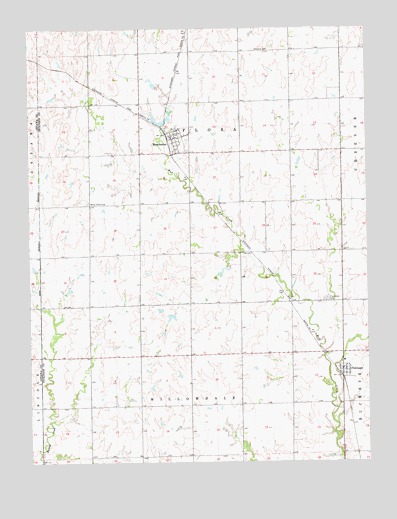
Manchester, KS USGS Topographic Map
Click on map above to begin viewing in our Map Viewer.

This topographic map contains these locations and features:
Feature Name Type Latitude Longitude GNIS ID View Map
City of ManchesterCivilN39.0920°W97.3214°2395828View Map
Keystone (historical)LocaleN39.1144°W97.2970°482131View Map
Keystone CemeteryCemeteryN39.1187°W97.2918°476475View Map
Longford Rural Fire District 1 Station 5BuildingN39.0930°W97.3216°2111566View Map
Longford Rural Fire District 1 Station 6BuildingN39.0266°W97.2602°2111567View Map
ManchesterPopulated PlaceN39.0947°W97.3247°476474View Map
Manchester Wastewater PlantLocaleN39.0863°W97.3230°2693510View Map
Poplar Hill (historical)LocaleN39.0686°W97.3350°482130View Map
Prairiedale CemeteryCemeteryN39.0468°W97.2656°476479View Map
TalmagePopulated PlaceN39.0250°W97.2606°476481View Map
Talmage Census Designated PlaceCensusN39.0269°W97.2597°2583508View Map
Talmage Post OfficePost OfficeN39.0267°W97.2598°2693990View Map
Talmage United Methodist ChurchChurchN39.0264°W97.2572°2689551View Map
Talmage Wastewater PlantLocaleN39.0301°W97.2645°2693573View Map
Team Marketing Alliance Grain Elevator Number 46LocaleN39.0220°W97.2593°2695251View Map
The Lord's ChapelChurchN39.0290°W97.2593°2690936View Map
Township of FloraCivilN39.0890°W97.3154°476309View Map
Township of WillowdaleCivilN39.0019°W97.3157°476476View Map
White Cloud CemeteryCemeteryN39.0746°W97.3534°476478View Map

Note: Coordinates in the location and feature list above are referenced to NAD83 datum.


Copyright (C) 2008-2025 Ryan Niemi / Sunset Dynamics ... All Rights Reserved