TopoQuest Logo
Do you find TopoQuest useful?
Help keep TopoQuest running and adding new maps/features by donating!
Bitcoin:  19c7KJd3qBynnjoSw5npx9KScwjBe4ifkT
Litecoin:  LXs6TkuXGGXo1vDsWCkWVdjQX94eUKd6ui
Home View Maps Find Maps Find Places Resources & Links


Solomon, Kansas Topographic Map

USGS Map Title: Solomon, KS
USGS Map MRC: 38097H3
DRG (GeoTIFF) Download: o38097h3.tif


Neighboring USGS Topographic Map Quads:


  Vine Creek, KS  
39097A4
 

  Manchester, KS  
39097A3
 

  Buckeye, KS  
39097A2
 

  Niles, KS  
38097H4
 

  Solomon, KS  
38097H3
 

  Abilene, KS  
38097H2
 

  Kipp, KS  
38097G4
 

  Holland, KS  
38097G3
 

  Abilene SW, KS  
38097G2


Map MRC Location:

N39°
W98°
N39°
W97°
H8 H7 H6 H5 H4 H3 H2 H1
G8 G7 G6 G5 G4 G3 G2 G1
F8 F7 F6 F5 F4 F3 F2 F1
E8 E7 E6 E5 E4 E3 E2 E1
D8 D7 D6 D5 D4 D3 D2 D1
C8 C7 C6 C5 C4 C3 C2 C1
B8 B7 B6 B5 B4 B3 B2 B1
A8 A7 A6 A5 A4 A3 A2 A1
N38°
W98°
N38°
W97°

Solomon, KS USGS 1:24K Topographic Map Preview:
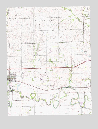
Solomon, KS USGS Topographic Map
Click on map above to begin viewing in our Map Viewer.

This topographic map contains these locations and features:
Feature Name Type Latitude Longitude GNIS ID View Map
Abilene Water PlantLocaleN38.9254°W97.2525°2693258View Map
Buchanan (historical)LocaleN38.9083°W97.3170°482475View Map
City of SolomonCivilN38.9214°W97.3693°2395908View Map
First Presbyterian ChurchChurchN38.9191°W97.3730°2690577View Map
Greatlife Golf and Fitness Chisholm Trail Golf CourseLocaleN38.9475°W97.2660°2694498View Map
Johnson Community CenterLocaleN38.9592°W97.2606°476665View Map
King Solomon CampLocaleN38.9367°W97.3364°476663View Map
Magnolia LakeReservoirN38.9248°W97.2821°476662View Map
Prairie Mound CemeteryCemeteryN38.9197°W97.3527°476661View Map
Redbud LakeReservoirN38.9140°W97.2821°476658View Map
Sand SpringPopulated PlaceN38.9069°W97.2839°476659View Map
Sand SpringSpringN38.9069°W97.2842°480910View Map
SolomonPopulated PlaceN38.9194°W97.3711°476660View Map
Solomon City HallBuildingN38.9164°W97.3717°2693019View Map
Solomon Elementary SchoolSchoolN38.9232°W97.3691°2497409View Map
Solomon High SchoolSchoolN38.9226°W97.3696°2497594View Map
Solomon Post OfficePost OfficeN38.9162°W97.3719°2693975View Map
Solomon Public LibraryBuildingN38.9190°W97.3704°2694881View Map
Solomon RiverStreamN38.9036°W97.3692°482755View Map
Solomon United Methodist ChurchChurchN38.9193°W97.3727°2690271View Map
Solomon Volunteer Fire DepartmentBuildingN38.9255°W97.3724°2111892View Map
Solomon Wastewater Treatment FacilityLocaleN38.9100°W97.3701°2691998View Map
Township of LincolnCivilN38.9148°W97.3171°476656View Map
Willowdale ChurchChurchN38.9803°W97.3156°476664View Map

Note: Coordinates in the location and feature list above are referenced to NAD83 datum.


Copyright (C) 2008-2025 Ryan Niemi / Sunset Dynamics ... All Rights Reserved