TopoQuest Logo
Do you find TopoQuest useful?
Help keep TopoQuest running and adding new maps/features by donating!
Bitcoin:  19c7KJd3qBynnjoSw5npx9KScwjBe4ifkT
Litecoin:  LXs6TkuXGGXo1vDsWCkWVdjQX94eUKd6ui
Home View Maps Find Maps Find Places Resources & Links


Bayview, Idaho Topographic Map

USGS Map Title: Bayview, ID
USGS Map MRC: 47116H5
DRG (GeoTIFF) Download: o47116h5.tif


Neighboring USGS Topographic Map Quads:


  Careywood, ID  
48116A6
 

  Cocolalla, ID  
48116A5
 

  Minerva Peak, ID  
48116A4
 

  Athol, ID  
47116H6
 

  Bayview, ID  
47116H5
 

  Lakeview, ID  
47116H4
 

  Hayden Lake, ID  
47116G6
 

  Spades Mountain, ID  
47116G5
 

  Cataract Peak, ID  
47116G4


Map MRC Location:

N48°
W117°
N48°
W116°
H8 H7 H6 H5 H4 H3 H2 H1
G8 G7 G6 G5 G4 G3 G2 G1
F8 F7 F6 F5 F4 F3 F2 F1
E8 E7 E6 E5 E4 E3 E2 E1
D8 D7 D6 D5 D4 D3 D2 D1
C8 C7 C6 C5 C4 C3 C2 C1
B8 B7 B6 B5 B4 B3 B2 B1
A8 A7 A6 A5 A4 A3 A2 A1
N47°
W117°
N47°
W116°

Bayview, ID USGS 1:24K Topographic Map Preview:
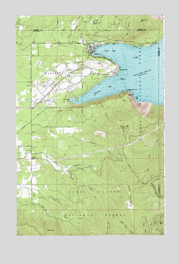
Bayview, ID USGS Topographic Map
Click on map above to begin viewing in our Map Viewer.

This topographic map contains these locations and features:
Feature Name Type Latitude Longitude GNIS ID View Map
Barker CreekStreamN47.9291°W116.5710°376959View Map
BayviewPopulated PlaceN47.9802°W116.5602°396083View Map
Bayview CreekStreamN47.9860°W116.5691°377054View Map
Bayview Post OfficePost OfficeN47.9843°W116.5658°2766797View Map
Beaver Bay Swim AreaLocaleN47.9546°W116.5699°401214View Map
Bennion GampgroundLocaleN47.9682°W116.5655°401215View Map
Bernard PeakSummitN47.9355°W116.5341°377402View Map
Bernard PointCliffN47.9546°W116.5308°377403View Map
Blackwell PointCapeN47.9688°W116.5388°377837View Map
Brig CampgroundLocaleN47.9652°W116.5794°401211View Map
Bunco CornersLocaleN47.9185°W116.6124°378501View Map
Button Hook Group CampLocaleN47.9560°W116.5746°401213View Map
Cape Horn PeakSummitN47.9955°W116.5219°396227View Map
Cat CreekStreamN47.9555°W116.5391°379028View Map
Cedar SaddleGapN47.8813°W116.6219°394578View Map
Chilco MountainSummitN47.8916°W116.5302°379273View Map
Eagle Boat LaunchLocaleN47.9652°W116.5460°401321View Map
Echo BayBayN47.9527°W116.5216°381234View Map
Farragut State ParkParkN47.9671°W116.5827°381605View Map
Farragut Wildlife Management AreaReserveN47.9718°W116.5416°401334View Map
Gilmore CampLocaleN47.9596°W116.5749°401355View Map
Green CreekStreamN47.8999°W116.6113°382632View Map
Green MountainSummitN47.8774°W116.5966°396588View Map
Hill CampgroundLocaleN47.9710°W116.5771°401387View Map
Idlewilde BayBayN47.9582°W116.5491°383620View Map
Kestrel CampgroundLocaleN47.9571°W116.5935°401533View Map
Leiberg-Athol TrailTrailN47.9132°W116.5849°393936View Map
Locust Grove Picnic AreaLocaleN47.9718°W116.5574°401549View Map
Naval Training Station Farragut (historical)MilitaryN47.9639°W116.5864°2098289View Map
Nighthawk CampgroundLocaleN47.9599°W116.5908°401020View Map
North Fork Sage CreekStreamN47.8857°W116.5941°387768View Map
Old Doe DrawValleyN47.9852°W116.5358°387927View Map
Old Maid CreekStreamN47.9955°W116.5649°387929View Map
Peterson CampgroundLocaleN47.9702°W116.5869°401078View Map
Roush CreekStreamN47.9138°W116.5852°389678View Map
Salee CreekStreamN47.9902°W116.5777°389844View Map
Sawpit CreekStreamN47.9524°W116.5560°389987View Map
Scenic BayBayN47.9785°W116.5433°390005View Map
Scott CampgroundLocaleN47.9660°W116.5958°401674View Map
Snowberry CampgroundLocaleN47.9680°W116.5510°401676View Map
Steamboat RockCapeN47.9568°W116.5308°391392View Map
Sunrise Day Use AreaLocaleN47.9688°W116.5438°401675View Map
The Old Maids ClearingFlatN47.9955°W116.5613°391980View Map
Thimbleberry Group AreaLocaleN47.9574°W116.5985°399256View Map
Timberlake Fire Protection District Station 4BuildingN47.9496°W116.6127°2619173View Map
Timberlake Fire Protection District Station 5BuildingN47.9834°W116.5636°2619174View Map
Trapper CreekStreamN47.9138°W116.5852°392345View Map
Waldron CampgroundLocaleN47.9588°W116.5921°399613View Map
Ward CampgroundLocaleN47.9646°W116.5741°399615View Map
Whitetail CampgroundLocaleN47.9638°W116.5621°399612View Map
Willow Day Use AreaLocaleN47.9696°W116.5413°399614View Map

Note: Coordinates in the location and feature list above are referenced to NAD83 datum.


Copyright (C) 2008-2025 Ryan Niemi / Sunset Dynamics ... All Rights Reserved