TopoQuest Logo
Do you find TopoQuest useful?
Help keep TopoQuest running and adding new maps/features by donating!
Bitcoin:  19c7KJd3qBynnjoSw5npx9KScwjBe4ifkT
Litecoin:  LXs6TkuXGGXo1vDsWCkWVdjQX94eUKd6ui
Home View Maps Find Maps Find Places Resources & Links


Marble Head, Michigan Topographic Map

USGS Map Title: Marble Head, MI
USGS Map MRC: 45083H5
DRG (GeoTIFF) Download: o45083h5.tif


Neighboring USGS Topographic Map Quads:


  Drummond, MI  
46083A6
 

  Drummond SE, MI  
46083A5


  Meade Island, MI  
45083H6
 

  Marble Head, MI  
45083H5


Map MRC Location:

N46°
W84°
N46°
W83°
H8 H7 H6 H5 H4 H3 H2 H1
G8 G7 G6 G5 G4 G3 G2 G1
F8 F7 F6 F5 F4 F3 F2 F1
E8 E7 E6 E5 E4 E3 E2 E1
D8 D7 D6 D5 D4 D3 D2 D1
C8 C7 C6 C5 C4 C3 C2 C1
B8 B7 B6 B5 B4 B3 B2 B1
A8 A7 A6 A5 A4 A3 A2 A1
N45°
W84°
N45°
W83°

Marble Head, MI USGS 1:24K Topographic Map Preview:
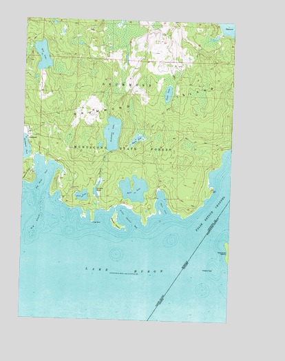
Marble Head, MI USGS Topographic Map
Click on map above to begin viewing in our Map Viewer.

This topographic map contains these locations and features:
Feature Name Type Latitude Longitude GNIS ID View Map
Bass CoveBayN45.9234°W83.5405°620677View Map
Bass LakeLakeN45.9297°W83.5580°620710View Map
Beaver PondLakeN45.9504°W83.5573°620951View Map
Big ShoalBarN45.9142°W83.6161°621351View Map
Big Shoal BeachBeachN45.9389°W83.6019°2356322View Map
Big Shoal CoveBayN45.9345°W83.6119°621352View Map
Clear LakeLakeN45.9697°W83.5388°623426View Map
Dickenson CreekStreamN45.9206°W83.5783°624657View Map
Dickenson LakeLakeN45.9526°W83.5717°624658View Map
Dry LakeLakeN45.9845°W83.6143°624900View Map
Jarvinen Marsh LakeLakeN45.9269°W83.5800°629214View Map
Johns Wood Post Office (historical)Post OfficeN45.9508°W83.6222°2354362View Map
JohnswoodPopulated PlaceN45.9509°W83.6222°1617648View Map
Little Shelter BayBayN45.9175°W83.5611°630763View Map
Long PointCapeN45.9181°W83.5822°630992View Map
Pine LakeLakeN45.9267°W83.5890°634966View Map
Scammon Post Office (historical)Post OfficeN45.9356°W83.6172°2354324View Map
Shelter IslandIslandN45.9167°W83.5694°637733View Map
Sitgreaves BayBayN45.9970°W83.5008°638018View Map

Note: Coordinates in the location and feature list above are referenced to NAD83 datum.


Copyright (C) 2008-2025 Ryan Niemi / Sunset Dynamics ... All Rights Reserved