TopoQuest Logo
Do you find TopoQuest useful?
Help keep TopoQuest running and adding new maps/features by donating!
Bitcoin:  19c7KJd3qBynnjoSw5npx9KScwjBe4ifkT
Litecoin:  LXs6TkuXGGXo1vDsWCkWVdjQX94eUKd6ui
Home View Maps Find Maps Find Places Resources & Links


Meade Island, Michigan Topographic Map

USGS Map Title: Meade Island, MI
USGS Map MRC: 45083H6
DRG (GeoTIFF) Download: o45083h6.tif


Neighboring USGS Topographic Map Quads:


  Burnt Island, MI  
46083A7
 

  Drummond, MI  
46083A6
 

  Drummond SE, MI  
46083A5
 

  Whitney Bay, MI  
45083H7
 

  Meade Island, MI  
45083H6
 

  Marble Head, MI  
45083H5


Map MRC Location:

N46°
W84°
N46°
W83°
H8 H7 H6 H5 H4 H3 H2 H1
G8 G7 G6 G5 G4 G3 G2 G1
F8 F7 F6 F5 F4 F3 F2 F1
E8 E7 E6 E5 E4 E3 E2 E1
D8 D7 D6 D5 D4 D3 D2 D1
C8 C7 C6 C5 C4 C3 C2 C1
B8 B7 B6 B5 B4 B3 B2 B1
A8 A7 A6 A5 A4 A3 A2 A1
N45°
W84°
N45°
W83°

Meade Island, MI USGS 1:24K Topographic Map Preview:
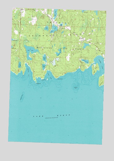
Meade Island, MI USGS Topographic Map
Click on map above to begin viewing in our Map Viewer.

This topographic map contains these locations and features:
Feature Name Type Latitude Longitude GNIS ID View Map
Beaver Dam PondLakeN45.9591°W83.6863°620921View Map
Canoe BayBayN45.9372°W83.6975°622695View Map
Canoe LakeLakeN45.9461°W83.7058°622696View Map
Canoe PointCapeN45.9345°W83.7067°622698View Map
Drummond Island Lutheran ChurchChurchN45.9992°W83.7494°2356332View Map
Drummond Lookout TowerTowerN45.9825°W83.6842°1623327View Map
Finnish CemeteryCemeteryN45.9722°W83.6536°625973View Map
Holdridge ShoalBarN45.9161°W83.7331°628417View Map
Horseshoe ReefBarN45.9272°W83.6622°628634View Map
Knutsen LakeLakeN45.9467°W83.7379°629834View Map
LincolnPopulated PlaceN45.9739°W83.6564°630441View Map
Maki LakeLakeN45.9819°W83.7038°631343View Map
Marl LakeLakeN45.9991°W83.6917°631592View Map
Meade IslandIslandN45.9450°W83.6372°632046View Map
Miller LakeLakeN45.9811°W83.6939°632383View Map
Nasi LakeLakeN45.9855°W83.6844°633224View Map
Pats LakeLakeN45.9526°W83.7227°634460View Map
Scammon CoveBayN45.9500°W83.6292°1623190View Map
Scammon PointCapeN45.9350°W83.6253°637313View Map
Seamans PointCapeN45.9359°W83.6878°637502View Map
Toivola LakeLakeN45.9523°W83.6506°1614925View Map
Traverse PointCapeN45.9314°W83.7156°1615047View Map
Vanio LakeLakeN45.9459°W83.7050°1615513View Map
Warners CoveBayN45.9400°W83.7258°1615780View Map

Note: Coordinates in the location and feature list above are referenced to NAD83 datum.


Copyright (C) 2008-2025 Ryan Niemi / Sunset Dynamics ... All Rights Reserved