TopoQuest Logo
Do you find TopoQuest useful?
Help keep TopoQuest running and adding new maps/features by donating!
Bitcoin:  19c7KJd3qBynnjoSw5npx9KScwjBe4ifkT
Litecoin:  LXs6TkuXGGXo1vDsWCkWVdjQX94eUKd6ui
Home View Maps Find Maps Find Places Resources & Links


Maria Reservoir, Colorado Topographic Map

USGS Map Title: Maria Reservoir, CO
USGS Map MRC: 37104F6
DRG (GeoTIFF) Download: o37104f6.tif


Neighboring USGS Topographic Map Quads:


  Huerfano Butte, CO  
37104G7
 

  Lascar, CO  
37104G6
 

  Capps Springs, CO  
37104G5
 

  Walsenburg North, CO  
37104F7
 

  Maria Reservoir, CO  
37104F6
 

  Cucharas Reservoir, CO  
37104F5
 

  Walsenburg South, CO  
37104E7
 

  Pryor, CO  
37104E6
 

  Pryor SE, CO  
37104E5


Map MRC Location:

N38°
W105°
N38°
W104°
H8 H7 H6 H5 H4 H3 H2 H1
G8 G7 G6 G5 G4 G3 G2 G1
F8 F7 F6 F5 F4 F3 F2 F1
E8 E7 E6 E5 E4 E3 E2 E1
D8 D7 D6 D5 D4 D3 D2 D1
C8 C7 C6 C5 C4 C3 C2 C1
B8 B7 B6 B5 B4 B3 B2 B1
A8 A7 A6 A5 A4 A3 A2 A1
N37°
W105°
N37°
W104°

Maria Reservoir, CO USGS 1:24K Topographic Map Preview:
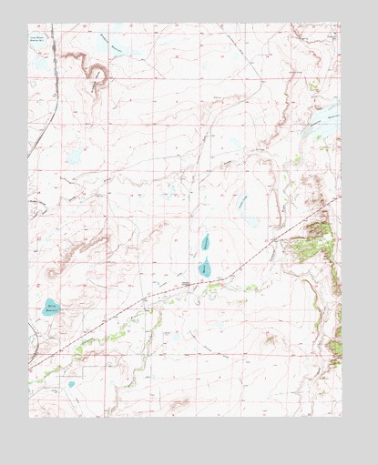
Maria Reservoir, CO USGS Topographic Map
Click on map above to begin viewing in our Map Viewer.

This topographic map contains these locations and features:
Feature Name Type Latitude Longitude GNIS ID View Map
Ballejos DitchCanalN37.6447°W104.7396°2711041View Map
Bradford MesaSummitN37.7311°W104.7242°194262View Map
Bustos CemeteryCemeteryN37.6516°W104.6964°194270View Map
Crane-Holmes Number 2 DamDamN37.7464°W104.7433°200208View Map
Crane-Holmes Reservoir Number 2ReservoirN37.7448°W104.7466°194261View Map
Cuchara JunctionPopulated PlaceN37.6670°W104.6861°194265View Map
Duran DitchCanalN37.6672°W104.6828°194266View Map
Gomez DitchCanalN37.6322°W104.7128°194260View Map
Gordon ArroyoStreamN37.6911°W104.7430°194235View Map
Holita DamDamN37.6595°W104.7380°200212View Map
Holita ReservoirReservoirN37.6597°W104.7415°194269View Map
Maria DamDamN37.6831°W104.6791°200194View Map
Maria ReservoirReservoirN37.6755°W104.6801°194264View Map
Pictou ArroyoStreamN37.6914°W104.7419°194237View Map
Sandy ArroyoStreamN37.7064°W104.6450°194263View Map
Santa Clara CreekStreamN37.6747°W104.6530°194272View Map
Sharps Orchard DamDamN37.6367°W104.7372°199090View Map
Sharps Orchard ReservoirReservoirN37.6367°W104.7372°199091View Map
Valdez CemeteryCemeteryN37.6689°W104.6730°194267View Map
Valdez LakeLakeN37.6932°W104.6650°194268View Map
Walsen ArroyoStreamN37.6614°W104.6955°194271View Map
Walsenburg DivisionCivilN37.6940°W104.7457°1935590View Map

Note: Coordinates in the location and feature list above are referenced to NAD83 datum.


Copyright (C) 2008-2025 Ryan Niemi / Sunset Dynamics ... All Rights Reserved