TopoQuest Logo
Do you find TopoQuest useful?
Help keep TopoQuest running and adding new maps/features by donating!
Bitcoin:  19c7KJd3qBynnjoSw5npx9KScwjBe4ifkT
Litecoin:  LXs6TkuXGGXo1vDsWCkWVdjQX94eUKd6ui
Home View Maps Find Maps Find Places Resources & Links


Marietta, Minnesota Topographic Map

USGS Map Title: Marietta, MN
USGS Map MRC: 45096A4
DRG (GeoTIFF) Download: o45096a4.tif


Neighboring USGS Topographic Map Quads:


  Milbank East, SD  
45096B5
 

  Rosen, MN  
45096B4
 

  Bellingham, MN  
45096B3
 

  Revillo, SD  
45096A5
 

  Marietta, MN  
45096A4
 

  Haydenville, MN  
45096A3
 

  Clear Lake NE, SD  
44096H5
 

  Gary NW, MN  
44096H4
 

  Mount Wickham, MN  
44096H3


Map MRC Location:

N46°
W97°
N46°
W96°
H8 H7 H6 H5 H4 H3 H2 H1
G8 G7 G6 G5 G4 G3 G2 G1
F8 F7 F6 F5 F4 F3 F2 F1
E8 E7 E6 E5 E4 E3 E2 E1
D8 D7 D6 D5 D4 D3 D2 D1
C8 C7 C6 C5 C4 C3 C2 C1
B8 B7 B6 B5 B4 B3 B2 B1
A8 A7 A6 A5 A4 A3 A2 A1
N45°
W97°
N45°
W96°

Marietta, MN USGS 1:24K Topographic Map Preview:
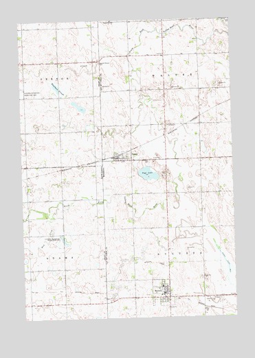
Marietta, MN USGS Topographic Map
Click on map above to begin viewing in our Map Viewer.

This topographic map contains these locations and features:
Feature Name Type Latitude Longitude GNIS ID View Map
Augusta CemeteryCemeteryN45.0225°W96.4164°639514View Map
Augustana Lutheran ChurchChurchN45.0083°W96.4172°2065891View Map
City of MariettaCivilN45.0105°W96.4189°2395006View Map
City of NassauCivilN45.0677°W96.4418°2395158View Map
Kaufman SloughGutN45.0964°W96.4767°1255911View Map
MariettaPopulated PlaceN45.0083°W96.4176°647534View Map
Marietta (historical)LocaleN45.0097°W96.4181°2065893View Map
Marietta (historical)LocaleN45.0097°W96.4181°2066530View Map
Marietta Ambulance ServiceBuildingN45.0083°W96.4181°2721218View Map
Marietta ClinicHospitalN45.0083°W96.4172°2065890View Map
Marietta ClinicHospitalN45.0083°W96.4172°2066527View Map
Marietta Fire DepartmentBuildingN45.0112°W96.4180°2666277View Map
Marietta Post OfficePost OfficeN45.0083°W96.4172°2065888View Map
Marietta Post OfficePost OfficeN45.0083°W96.4172°2066525View Map
Mud CreekStreamN45.0475°W96.4798°1256588View Map
NassauPopulated PlaceN45.0664°W96.4398°648430View Map
NassauLocaleN45.0681°W96.4444°2065885View Map
NassauLocaleN45.0681°W96.4444°2066522View Map
Nassau Fire DepartmentBuildingN45.0670°W96.4422°2666279View Map
Nassau Post OfficePost OfficeN45.0664°W96.4394°2065886View Map
Nassau Post OfficePost OfficeN45.0664°W96.4394°2066523View Map
Pegg LakeLakeN45.0603°W96.4254°649225View Map
Saint James Catholic ChurchChurchN45.0664°W96.4394°2065887View Map
Saint James Catholic ChurchChurchN45.0664°W96.4394°2066524View Map
Saint James CemeteryCemeteryN45.0658°W96.4242°650617View Map
Saint John's Lutheran ChurchChurchN45.0083°W96.4172°2065889View Map
Saint John's Lutheran ChurchChurchN45.0083°W96.4172°2066526View Map
School Number 107 (historical)SchoolN45.1106°W96.4150°2118316View Map
Swedish Mission CemeteryCemeteryN45.1069°W96.4527°1258473View Map
Township of AugustaCivilN45.0230°W96.4024°663478View Map
Township of WalterCivilN45.1101°W96.4026°665904View Map
Trinity CemeteryCemeteryN45.1245°W96.3757°653300View Map
United Church of ChristChurchN45.0008°W96.4172°2065892View Map
United Church of ChristChurchN45.0008°W96.4172°2066529View Map

Note: Coordinates in the location and feature list above are referenced to NAD83 datum.


Copyright (C) 2008-2025 Ryan Niemi / Sunset Dynamics ... All Rights Reserved