TopoQuest Logo
Do you find TopoQuest useful?
Help keep TopoQuest running and adding new maps/features by donating!
Bitcoin:  19c7KJd3qBynnjoSw5npx9KScwjBe4ifkT
Litecoin:  LXs6TkuXGGXo1vDsWCkWVdjQX94eUKd6ui
Home View Maps Find Maps Find Places Resources & Links


Bellingham, Minnesota Topographic Map

USGS Map Title: Bellingham, MN
USGS Map MRC: 45096B3
DRG (GeoTIFF) Download: o45096b3.tif


Neighboring USGS Topographic Map Quads:


  Ortonville, MN  
45096C4
 

  Odessa, MN  
45096C3
 

  Artichoke Lake, MN  
45096C2
 

  Rosen, MN  
45096B4
 

  Bellingham, MN  
45096B3
 

  Correll, MN  
45096B2
 

  Marietta, MN  
45096A4
 

  Haydenville, MN  
45096A3
 

  Madison, MN  
45096A2


Map MRC Location:

N46°
W97°
N46°
W96°
H8 H7 H6 H5 H4 H3 H2 H1
G8 G7 G6 G5 G4 G3 G2 G1
F8 F7 F6 F5 F4 F3 F2 F1
E8 E7 E6 E5 E4 E3 E2 E1
D8 D7 D6 D5 D4 D3 D2 D1
C8 C7 C6 C5 C4 C3 C2 C1
B8 B7 B6 B5 B4 B3 B2 B1
A8 A7 A6 A5 A4 A3 A2 A1
N45°
W97°
N45°
W96°

Bellingham, MN USGS 1:24K Topographic Map Preview:
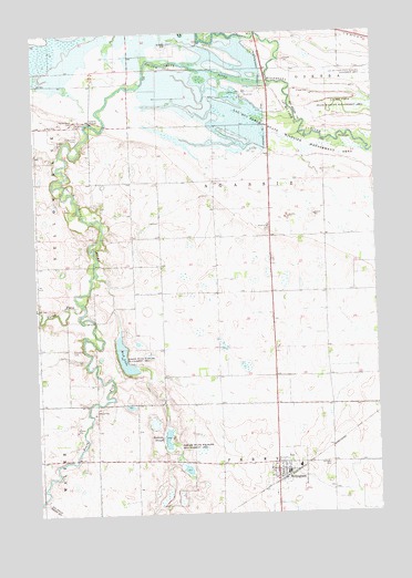
Bellingham, MN USGS Topographic Map
Click on map above to begin viewing in our Map Viewer.

This topographic map contains these locations and features:
Feature Name Type Latitude Longitude GNIS ID View Map
BellinghamLocaleN45.1344°W96.2842°2065902View Map
BellinghamPopulated PlaceN45.1361°W96.2876°639896View Map
Bellingham CemeteryCemeteryN45.1389°W96.2778°2065859View Map
Bellingham Fire DepartmentBuildingN45.1358°W96.2847°2666321View Map
Bellingham Post OfficePost OfficeN45.1363°W96.2842°2065901View Map
Big Stone Lake-Whetstone RiverReservoirN45.2483°W96.2920°1776801View Map
Big Stone National Wildlife RefugeParkN45.2407°W96.3567°2765203View Map
Boehnke SloughLakeN45.1441°W96.3281°640323View Map
City of BellinghamCivilN45.1364°W96.2841°2394122View Map
Highway 75 DamDamN45.2483°W96.2920°1776800View Map
Highway 75 DamDamN45.2327°W96.2901°644963View Map
Immanuel CemeteryCemeteryN45.2227°W96.3584°645352View Map
Immanuel Church (historical)ChurchN45.2261°W96.3606°2118323View Map
Kibler State Wildlife Management AreaParkN45.1419°W96.3251°646134View Map
Kibler State Wildlife Management AreaParkN45.1630°W96.3409°646135View Map
Lac Qui Parle State Wildlife Management AreaParkN45.2308°W96.2606°646306View Map
Mud LakeLakeN45.1659°W96.3430°648233View Map
North Fork Yellow Bank RiverStreamN45.1797°W96.3584°648643View Map
Saint Paul's Lutheran ChurchChurchN45.1361°W96.2872°2065900View Map
Saint Paul's Lutheran ChurchChurchN45.1361°W96.2872°2066537View Map
Saint Pauls CemeteryCemeteryN45.1375°W96.2678°650986View Map
Saint Peter's Lutheran ChurchChurchN45.1361°W96.2872°2065899View Map
Saint Peter's Lutheran ChurchChurchN45.1361°W96.2872°2066536View Map
Salem CemeteryCemeteryN45.1677°W96.3623°651095View Map
School Number 19 (historical)SchoolN45.2372°W96.3478°2118295View Map
School Number 20 (historical)SchoolN45.2008°W96.3297°2118297View Map
School Number 22 (historical)SchoolN45.2406°W96.3081°2118296View Map
School Number 50 (historical)SchoolN45.1683°W96.3744°2118299View Map
School Number 85 (historical)SchoolN45.1314°W96.3394°2118300View Map
South Fork Yellow Bank RiverStreamN45.1797°W96.3587°652306View Map
Township of AgassizCivilN45.1981°W96.2975°663385View Map
United Methodist ChurchChurchN45.1361°W96.2872°2065898View Map
United Methodist ChurchChurchN45.1361°W96.2872°2066535View Map
Yellow Bank CemeteryCemeteryN45.2266°W96.3601°654413View Map
Yellow Bank RiverStreamN45.2366°W96.2864°654414View Map

Note: Coordinates in the location and feature list above are referenced to NAD83 datum.


Copyright (C) 2008-2025 Ryan Niemi / Sunset Dynamics ... All Rights Reserved