TopoQuest Logo
Do you find TopoQuest useful?
Help keep TopoQuest running and adding new maps/features by donating!
Bitcoin:  19c7KJd3qBynnjoSw5npx9KScwjBe4ifkT
Litecoin:  LXs6TkuXGGXo1vDsWCkWVdjQX94eUKd6ui
Home View Maps Find Maps Find Places Resources & Links


Marilee, Texas Topographic Map

USGS Map Title: Marilee, TX
USGS Map MRC: 33096D7
DRG (GeoTIFF) Download: o33096d7.tif


Neighboring USGS Topographic Map Quads:


  Collinsville, TX  
33096E8
 

  Ethel, TX  
33096E7
 

  Dorchester, TX  
33096E6
 

  Pilot Point, TX  
33096D8
 

  Marilee, TX  
33096D7
 

  Gunter, TX  
33096D6
 

  Aubrey, TX  
33096C8
 

  Celina, TX  
33096C7
 

  Weston, TX  
33096C6


Map MRC Location:

N34°
W97°
N34°
W96°
H8 H7 H6 H5 H4 H3 H2 H1
G8 G7 G6 G5 G4 G3 G2 G1
F8 F7 F6 F5 F4 F3 F2 F1
E8 E7 E6 E5 E4 E3 E2 E1
D8 D7 D6 D5 D4 D3 D2 D1
C8 C7 C6 C5 C4 C3 C2 C1
B8 B7 B6 B5 B4 B3 B2 B1
A8 A7 A6 A5 A4 A3 A2 A1
N33°
W97°
N33°
W96°

Marilee, TX USGS 1:24K Topographic Map Preview:
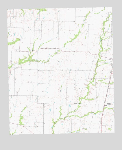
Marilee, TX USGS Topographic Map
Click on map above to begin viewing in our Map Viewer.

This topographic map contains these locations and features:
Feature Name Type Latitude Longitude GNIS ID View Map
Bear CreekStreamN33.4484°W96.8522°1351668View Map
Bridges FieldAirportN33.4817°W96.8396°1387644View Map
Clarks BranchStreamN33.3921°W96.8069°1373122View Map
Gunter CemeteryCemeteryN33.4287°W96.7778°1358527View Map
Hunt Lake Number 1ReservoirN33.4328°W96.8034°1865081View Map
Hunt Lake Number 1 DamDamN33.4334°W96.8036°1865080View Map
Hunt Lake Number 2ReservoirN33.4384°W96.8353°1865083View Map
Hunt Lake Number 2 DamDamN33.4384°W96.8353°1865082View Map
MarileePopulated PlaceN33.4037°W96.7614°1380142View Map
Mc Manus FieldAirportN33.4520°W96.8349°2675899View Map
Mount Carmel ChurchChurchN33.4573°W96.8431°1363238View Map
Soil Conservation Service Site 1 DamDamN33.4784°W96.7603°1858435View Map
Soil Conservation Service Site 1 ReservoirReservoirN33.4784°W96.7603°1858436View Map
Soil Conservation Service Site 10 DamDamN33.4101°W96.8103°1858421View Map
Soil Conservation Service Site 10 ReservoirReservoirN33.4101°W96.8103°1858422View Map
Soil Conservation Service Site 11 DamDamN33.3951°W96.8136°1856473View Map
Soil Conservation Service Site 11 ReservoirReservoirN33.3951°W96.8136°1856474View Map
Soil Conservation Service Site 12 DamDamN33.3901°W96.8219°1856475View Map
Soil Conservation Service Site 12 ReservoirReservoirN33.3901°W96.8219°1856476View Map
Soil Conservation Service Site 2 DamDamN33.4601°W96.7619°1858433View Map
Soil Conservation Service Site 2 ReservoirReservoirN33.4601°W96.7619°1858434View Map
Soil Conservation Service Site 3 DamDamN33.4301°W96.7719°1858431View Map
Soil Conservation Service Site 3 ReservoirReservoirN33.4301°W96.7719°1858432View Map
Soil Conservation Service Site 4 DamDamN33.4251°W96.7686°1858429View Map
Soil Conservation Service Site 4 ReservoirReservoirN33.4251°W96.7686°1858430View Map
Soil Conservation Service Site 5 DamDamN33.4201°W96.7686°1858427View Map
Soil Conservation Service Site 5 ReservoirReservoirN33.4201°W96.7686°1858428View Map
Soil Conservation Service Site 6 DamDamN33.4084°W96.7769°1858425View Map
Soil Conservation Service Site 6 ReservoirReservoirN33.4084°W96.7769°1858426View Map
Soil Conservation Service Site 7 DamDamN33.4118°W96.7919°1858423View Map
Soil Conservation Service Site 7 ReservoirReservoirN33.4118°W96.7919°1858424View Map
Soil Conservation Service Site 8b DamDamN33.3984°W96.7569°1856469View Map
Soil Conservation Service Site 8b ReservoirReservoirN33.3984°W96.7569°1856470View Map
Soil Conservation Service Site 9 DamDamN33.3868°W96.7819°1856471View Map
Soil Conservation Service Site 9 ReservoirReservoirN33.3868°W96.7819°1856472View Map
Walnut ForkStreamN33.3896°W96.8158°1370815View Map

Note: Coordinates in the location and feature list above are referenced to NAD83 datum.


Copyright (C) 2008-2024 Ryan Niemi / Sunset Dynamics ... All Rights Reserved