TopoQuest Logo
Do you find TopoQuest useful?
Help keep TopoQuest running and adding new maps/features by donating!
Bitcoin:  19c7KJd3qBynnjoSw5npx9KScwjBe4ifkT
Litecoin:  LXs6TkuXGGXo1vDsWCkWVdjQX94eUKd6ui
Home View Maps Find Maps Find Places Resources & Links


Dorchester, Texas Topographic Map

USGS Map Title: Dorchester, TX
USGS Map MRC: 33096E6
DRG (GeoTIFF) Download: o33096e6.tif


Neighboring USGS Topographic Map Quads:


  Sadler, TX  
33096F7
 

  Sherman NW, TX  
33096F6
 

  Sherman, TX  
33096F5
 

  Ethel, TX  
33096E7
 

  Dorchester, TX  
33096E6
 

  Howe, TX  
33096E5
 

  Marilee, TX  
33096D7
 

  Gunter, TX  
33096D6
 

  Van Alstyne, TX  
33096D5


Map MRC Location:

N34°
W97°
N34°
W96°
H8 H7 H6 H5 H4 H3 H2 H1
G8 G7 G6 G5 G4 G3 G2 G1
F8 F7 F6 F5 F4 F3 F2 F1
E8 E7 E6 E5 E4 E3 E2 E1
D8 D7 D6 D5 D4 D3 D2 D1
C8 C7 C6 C5 C4 C3 C2 C1
B8 B7 B6 B5 B4 B3 B2 B1
A8 A7 A6 A5 A4 A3 A2 A1
N33°
W97°
N33°
W96°

Dorchester, TX USGS 1:24K Topographic Map Preview:
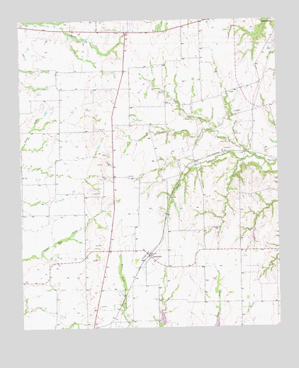
Dorchester, TX USGS Topographic Map
Click on map above to begin viewing in our Map Viewer.

This topographic map contains these locations and features:
Feature Name Type Latitude Longitude GNIS ID View Map
Church of GodChurchN33.6096°W96.6611°2019634View Map
City of DorchesterCivilN33.5192°W96.6983°2412441View Map
City of SouthmaydCivilN33.6236°W96.7079°2411946View Map
DorchesterPopulated PlaceN33.5304°W96.6894°1356164View Map
Dorchester City OfficeBuildingN33.5307°W96.6894°2754055View Map
Herman Baker Park TrailTrailN33.6190°W96.6336°2033519View Map
McKinstry SpringsSpringN33.5918°W96.6919°1998563View Map
Mormon Grove (historical)Populated PlaceN33.5618°W96.6989°1385442View Map
Mormon Grove Post Office (historical)Post OfficeN33.5618°W96.6989°1385441View Map
Soil Conservation Service Site 10a DamDamN33.6218°W96.6319°1863138View Map
Soil Conservation Service Site 10a ReservoirReservoirN33.6218°W96.6319°1863139View Map
Soil Conservation Service Site 18 DamDamN33.5018°W96.6819°1858419View Map
Soil Conservation Service Site 18 ReservoirReservoirN33.5018°W96.6819°1858420View Map
South Branch Choctaw CreekStreamN33.5698°W96.6364°1368637View Map
SperryPopulated PlaceN33.5307°W96.7086°1377152View Map
TXAerosport AerodromeAirportN33.5377°W96.6798°2676590View Map

Note: Coordinates in the location and feature list above are referenced to NAD83 datum.


Copyright (C) 2008-2025 Ryan Niemi / Sunset Dynamics ... All Rights Reserved