TopoQuest Logo
Do you find TopoQuest useful?
Help keep TopoQuest running and adding new maps/features by donating!
Bitcoin:  19c7KJd3qBynnjoSw5npx9KScwjBe4ifkT
Litecoin:  LXs6TkuXGGXo1vDsWCkWVdjQX94eUKd6ui
Home View Maps Find Maps Find Places Resources & Links


Mark West Springs, California Topographic Map

USGS Map Title: Mark West Springs, CA
USGS Map MRC: 38122E6
DRG (GeoTIFF) Download: o38122e6.tif


Neighboring USGS Topographic Map Quads:


  Jimtown, CA  
38122F7
 

  Mount Saint Helena, CA  
38122F6
 

  Detert Reservoir, CA  
38122F5
 

  Healdsburg, CA  
38122E7
 

  Mark West Springs, CA  
38122E6
 

  Calistoga, CA  
38122E5
 

  Sebastopol, CA  
38122D7
 

  Santa Rosa, CA  
38122D6
 

  Kenwood, CA  
38122D5


Map MRC Location:

N39°
W123°
N39°
W122°
H8 H7 H6 H5 H4 H3 H2 H1
G8 G7 G6 G5 G4 G3 G2 G1
F8 F7 F6 F5 F4 F3 F2 F1
E8 E7 E6 E5 E4 E3 E2 E1
D8 D7 D6 D5 D4 D3 D2 D1
C8 C7 C6 C5 C4 C3 C2 C1
B8 B7 B6 B5 B4 B3 B2 B1
A8 A7 A6 A5 A4 A3 A2 A1
N38°
W123°
N38°
W122°

Mark West Springs, CA USGS 1:24K Topographic Map Preview:
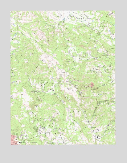
Mark West Springs, CA USGS Topographic Map
Click on map above to begin viewing in our Map Viewer.

This topographic map contains these locations and features:
Feature Name Type Latitude Longitude GNIS ID View Map
Alpine SchoolSchoolN38.5055°W122.6442°218172View Map
Bald HillsSummitN38.6007°W122.7114°218577View Map
Bidwell CreekStreamN38.6082°W122.6939°219108View Map
Bosch Number 2 2429 DamDamN38.5566°W122.7494°1664369View Map
Chalk MountainSummitN38.5594°W122.6683°1658255View Map
Deadhorse CreekStreamN38.5407°W122.6355°222108View Map
Devils KitchenSummitN38.5785°W122.6825°1658411View Map
Dina Bob Lake 1426 DamDamN38.6166°W122.6878°1664320View Map
Franz ValleyValleyN38.5932°W122.6814°223841View Map
Franz Valley School (historical)SchoolN38.5813°W122.6500°1675915View Map
Frog LakeReservoirN38.5726°W122.6346°223955View Map
Gates CanyonValleyN38.5207°W122.6572°224098View Map
Heritage SchoolSchoolN38.5821°W122.6253°1657234View Map
Horse HillRidgeN38.5719°W122.7186°225609View Map
Humbug CreekStreamN38.5202°W122.6589°225753View Map
John B Riebli Elementary SchoolSchoolN38.5012°W122.7419°1799301View Map
Knights Valley Volunteer Fire CompanyBuildingN38.6200°W122.6754°2623760View Map
KXFX-FM (Santa Rosa)TowerN38.5085°W122.6625°1665120View Map
Lake OrthReservoirN38.5691°W122.6534°230120View Map
Mallacomes or Moristul Y Plan De Agua CalienCivilN38.6169°W122.6478°245409View Map
Mark West Creek RancheriaLocaleN38.5274°W122.7308°228119View Map
Mark West Shale QuarryMineN38.5567°W122.6544°2680206View Map
Mark West SpringsPopulated PlaceN38.5491°W122.7203°228121View Map
Mill CreekStreamN38.5469°W122.6980°228667View Map
Murray 3427 DamDamN38.6116°W122.7461°1664385View Map
Petrified ForestLocaleN38.5560°W122.6389°230582View Map
Porter CreekStreamN38.5482°W122.7042°230952View Map
Redwood Adventist AcademySchoolN38.5024°W122.7386°2517971View Map
Redwood HillSummitN38.5349°W122.7197°1659490View Map
Riebli School (historical)SchoolN38.5080°W122.7186°1675921View Map
Rincon Valley Fire Protection District Alpine StationBuildingN38.5152°W122.6557°2624260View Map
Storybook Mountain VineyardsLocaleN38.5996°W122.6430°1800204View Map
SugarloafSummitN38.5394°W122.6317°1659900View Map
Tarwater School (historical)SchoolN38.5563°W122.6944°1675924View Map
Telegraph HillSummitN38.5716°W122.7008°1659966View Map
Towibalyla 424 DamDamN38.6249°W122.6611°1663882View Map
Van Buren CreekStreamN38.5119°W122.6389°236996View Map
Wallas School (historical)SchoolN38.5005°W122.6867°1675925View Map
Weeks CreekStreamN38.5091°W122.6492°237399View Map

Note: Coordinates in the location and feature list above are referenced to NAD83 datum.


Copyright (C) 2008-2025 Ryan Niemi / Sunset Dynamics ... All Rights Reserved