TopoQuest Logo
Do you find TopoQuest useful?
Help keep TopoQuest running and adding new maps/features by donating!
Bitcoin:  19c7KJd3qBynnjoSw5npx9KScwjBe4ifkT
Litecoin:  LXs6TkuXGGXo1vDsWCkWVdjQX94eUKd6ui
Home View Maps Find Maps Find Places Resources & Links


Detert Reservoir, California Topographic Map

USGS Map Title: Detert Reservoir, CA
USGS Map MRC: 38122F5
DRG (GeoTIFF) Download: o38122f5.tif


Neighboring USGS Topographic Map Quads:


  Whispering Pines, CA  
38122G6
 

  Middletown, CA  
38122G5
 

  Jericho Valley, CA  
38122G4
 

  Mount Saint Helena, CA  
38122F6
 

  Detert Reservoir, CA  
38122F5
 

  Aetna Springs, CA  
38122F4
 

  Mark West Springs, CA  
38122E6
 

  Calistoga, CA  
38122E5
 

  Saint Helena, CA  
38122E4


Map MRC Location:

N39°
W123°
N39°
W122°
H8 H7 H6 H5 H4 H3 H2 H1
G8 G7 G6 G5 G4 G3 G2 G1
F8 F7 F6 F5 F4 F3 F2 F1
E8 E7 E6 E5 E4 E3 E2 E1
D8 D7 D6 D5 D4 D3 D2 D1
C8 C7 C6 C5 C4 C3 C2 C1
B8 B7 B6 B5 B4 B3 B2 B1
A8 A7 A6 A5 A4 A3 A2 A1
N38°
W123°
N38°
W122°

Detert Reservoir, CA USGS 1:24K Topographic Map Preview:
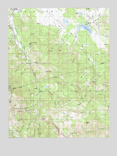
Detert Reservoir, CA USGS Topographic Map
Click on map above to begin viewing in our Map Viewer.

This topographic map contains these locations and features:
Feature Name Type Latitude Longitude GNIS ID View Map
7-M Ranch Airport (historical)AirportN38.7163°W122.5686°1653740View Map
Aetna Extension MineMineN38.6660°W122.5105°218003View Map
Bateman CreekStreamN38.6693°W122.5286°218725View Map
Bear ValleyValleyN38.6492°W122.5608°218888View Map
Bradford CreekStreamN38.7018°W122.6003°219757View Map
Bullion MineMineN38.7030°W122.6117°220132View Map
California Department of Forestry and Fire Station MiddletownBuildingN38.7482°W122.6206°2622160View Map
Cassidy CreekStreamN38.7199°W122.5397°220682View Map
Cedar CanyonValleyN38.6691°W122.5225°220757View Map
Corona MineMineN38.6693°W122.5411°221577View Map
Dead Horse FlatFlatN38.7468°W122.6122°222098View Map
Detert Lake 392 DamDamN38.7266°W122.5228°1663852View Map
Detert ReservoirReservoirN38.7298°W122.5304°253211View Map
Foley Number 1 392-003 DamDamN38.7432°W122.5344°1663854View Map
Foley Number 2 392-004 DamDamN38.7482°W122.5244°1663855View Map
Grizzly CreekStreamN38.6921°W122.5975°224629View Map
Guenoc WineryLocaleN38.7352°W122.5264°1766194View Map
Hoffman CreekStreamN38.6966°W122.5969°225383View Map
Hole in the RockArchN38.6519°W122.6122°2709985View Map
Ivanhoe MineMineN38.6682°W122.5072°1675907View Map
KBBF-FM (Santa Rosa)TowerN38.6563°W122.6161°1665122View Map
Kidd CanyonValleyN38.6696°W122.5289°226568View Map
Kimball CanyonValleyN38.6271°W122.6128°226575View Map
Lake BordeauxLakeN38.7446°W122.5378°1657217View Map
Magnola MineMineN38.7099°W122.5622°227939View Map
Maple SpringSpringN38.6291°W122.5475°228061View Map
McGuire PeakSummitN38.7074°W122.5750°228378View Map
Mirabel (historical)Populated PlaceN38.6999°W122.6017°1766202View Map
Mirabel MineMineN38.7002°W122.6017°228817View Map
Oat HillSummitN38.6841°W122.5147°1656195View Map
Oat Hill Extension MineMineN38.6785°W122.5186°229907View Map
Oat Hill MineMineN38.6749°W122.5280°229908View Map
Oat Hill School (historical)SchoolN38.6838°W122.5219°1675908View Map
Otto MineMineN38.7035°W122.6139°230149View Map
Plymouth MineMineN38.6968°W122.5911°230833View Map
Rattlesnake SpringSpringN38.6721°W122.5897°231275View Map
Red HillSummitN38.6410°W122.6142°231332View Map
Robert Louis Stevenson State ParkParkN38.6549°W122.5967°231674View Map
Saint Marys CreekStreamN38.7241°W122.6144°232215View Map
Silverado MineMineN38.6521°W122.6044°233150View Map
Snelly PeakSummitN38.7243°W122.5958°234759View Map
Sugarloaf MountainSummitN38.6391°W122.5303°235668View Map
Swartz CanyonValleyN38.6338°W122.5044°235878View Map
Table MountainSummitN38.6802°W122.5361°235958View Map
Table RockSummitN38.6430°W122.5797°235963View Map
The PalisadesRangeN38.6360°W122.5675°236208View Map
Three PeaksSummitN38.6877°W122.5744°236313View Map
Toyon MineMineN38.6743°W122.5061°236492View Map
Troutdale CreekStreamN38.6669°W122.5886°236573View Map
Twin PeaksSummitN38.6485°W122.5328°236711View Map
Twin Peaks MineMineN38.6621°W122.5344°236712View Map
Van Ness CreekStreamN38.6682°W122.5867°237011View Map
White PointCliffN38.6835°W122.5691°237653View Map
Wilkinson CreekStreamN38.7143°W122.6100°237832View Map

Note: Coordinates in the location and feature list above are referenced to NAD83 datum.


Copyright (C) 2008-2024 Ryan Niemi / Sunset Dynamics ... All Rights Reserved