TopoQuest Logo
Do you find TopoQuest useful?
Help keep TopoQuest running and adding new maps/features by donating!
Bitcoin:  19c7KJd3qBynnjoSw5npx9KScwjBe4ifkT
Litecoin:  LXs6TkuXGGXo1vDsWCkWVdjQX94eUKd6ui
Home View Maps Find Maps Find Places Resources & Links


Marley Creek, Oregon Topographic Map

USGS Map Title: Marley Creek, OR
USGS Map MRC: 45118B4
DRG (GeoTIFF) Download: o45118b4.tif


Neighboring USGS Topographic Map Quads:


  Bally Mountain, OR  
45118C5
 

  McIntyre Creek, OR  
45118C4
 

  Kamela SE, OR  
45118C3
 

  Sullivan Gulch, OR  
45118B5
 

  Marley Creek, OR  
45118B4
 

  Little Beaver Creek, OR  
45118B3
 

  Tower Mountain, OR  
45118A5
 

  Fly Valley, OR  
45118A4
 

  Limber Jim Creek, OR  
45118A3


Map MRC Location:

N46°
W119°
N46°
W118°
H8 H7 H6 H5 H4 H3 H2 H1
G8 G7 G6 G5 G4 G3 G2 G1
F8 F7 F6 F5 F4 F3 F2 F1
E8 E7 E6 E5 E4 E3 E2 E1
D8 D7 D6 D5 D4 D3 D2 D1
C8 C7 C6 C5 C4 C3 C2 C1
B8 B7 B6 B5 B4 B3 B2 B1
A8 A7 A6 A5 A4 A3 A2 A1
N45°
W119°
N45°
W118°

Marley Creek, OR USGS 1:24K Topographic Map Preview:
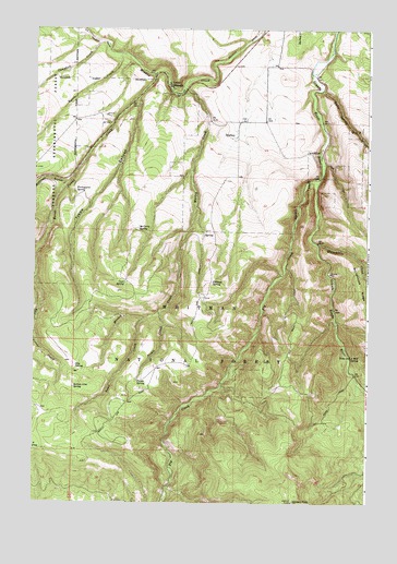
Marley Creek, OR USGS Topographic Map
Click on map above to begin viewing in our Map Viewer.

This topographic map contains these locations and features:
Feature Name Type Latitude Longitude GNIS ID View Map
Battle CreekStreamN45.2432°W118.4686°1137586View Map
Blue Mountain SpringSpringN45.2396°W118.4519°1158573View Map
Burnt Corral CreekStreamN45.2376°W118.4563°1138987View Map
Cabbage SpringSpringN45.1830°W118.4339°1118436View Map
Camp ElkanahPopulated PlaceN45.2349°W118.4500°1136117View Map
Campbell CreekStreamN45.2462°W118.4769°1139283View Map
Coon SpringSpringN45.1828°W118.4663°1119243View Map
East Burnt Corral CreekStreamN45.1846°W118.5000°1120280View Map
Fly CreekStreamN45.2096°W118.3944°1142270View Map
Fly RidgeRidgeN45.1590°W118.4050°1167282View Map
Johnson RockSummitN45.1254°W118.4033°1122493View Map
Johnson Rock Lookout TowerTowerN45.1257°W118.4036°1116659View Map
Marley CreekStreamN45.2349°W118.4450°1123773View Map
McCarty SpringSpringN45.1970°W118.4614°1123903View Map
Otis SpringSpringN45.1610°W118.4848°1125060View Map
Pickle CreekStreamN45.1751°W118.4530°1125356View Map
Pickle SpringSpringN45.1572°W118.4615°1125357View Map
Portuguese SpringSpringN45.2065°W118.4846°1125589View Map
Section Line SpringSpringN45.1554°W118.4852°1126725View Map
Spool Cart Recreation SiteLocaleN45.2040°W118.3955°1638085View Map
StarkeyPopulated PlaceN45.2215°W118.4258°1136785View Map
Starkey CemeteryCemeteryN45.2443°W118.4052°1129459View Map
Starkey Post Office (historical)Post OfficeN45.2215°W118.4258°1165986View Map
Sullivan GulchValleyN45.2093°W118.4883°1150573View Map
Swan CreekStreamN45.1735°W118.4586°1127804View Map
Time and a Half Campground (historical)LocaleN45.1593°W118.3802°1167268View Map
Time and a Half SpringSpringN45.1634°W118.3817°1128111View Map
Tybow CanyonValleyN45.2318°W118.4619°1128389View Map
Warm Spring CreekStreamN45.2346°W118.3933°1128647View Map
Whitehorse CreekStreamN45.1937°W118.3947°1129011View Map

Note: Coordinates in the location and feature list above are referenced to NAD83 datum.


Copyright (C) 2008-2024 Ryan Niemi / Sunset Dynamics ... All Rights Reserved