TopoQuest Logo
Do you find TopoQuest useful?
Help keep TopoQuest running and adding new maps/features by donating!
Bitcoin:  19c7KJd3qBynnjoSw5npx9KScwjBe4ifkT
Litecoin:  LXs6TkuXGGXo1vDsWCkWVdjQX94eUKd6ui
Home View Maps Find Maps Find Places Resources & Links


Marquez, Texas Topographic Map

USGS Map Title: Marquez, TX
USGS Map MRC: 31096B3
DRG (GeoTIFF) Download: o31096b3.tif


Neighboring USGS Topographic Map Quads:


  Oletha, TX  
31096C4
 

  Round Prairie, TX  
31096C3
 

  Jewett, TX  
31096C2
 

  Bald Prairie, TX  
31096B4
 

  Marquez, TX  
31096B3
 

  Margie, TX  
31096B2
 

  Franklin, TX  
31096A4
 

  Camp Creek Lake, TX  
31096A3
 

  Hilltop Lakes, TX  
31096A2


Map MRC Location:

N32°
W97°
N32°
W96°
H8 H7 H6 H5 H4 H3 H2 H1
G8 G7 G6 G5 G4 G3 G2 G1
F8 F7 F6 F5 F4 F3 F2 F1
E8 E7 E6 E5 E4 E3 E2 E1
D8 D7 D6 D5 D4 D3 D2 D1
C8 C7 C6 C5 C4 C3 C2 C1
B8 B7 B6 B5 B4 B3 B2 B1
A8 A7 A6 A5 A4 A3 A2 A1
N31°
W97°
N31°
W96°

Marquez, TX USGS 1:24K Topographic Map Preview:
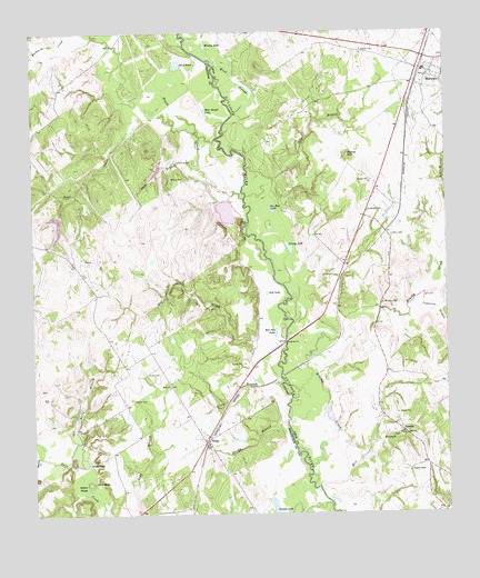
Marquez, TX USGS Topographic Map
Click on map above to begin viewing in our Map Viewer.

This topographic map contains these locations and features:
Feature Name Type Latitude Longitude GNIS ID View Map
Alum BranchStreamN31.1574°W96.2994°1351054View Map
Alum PondLakeN31.1380°W96.3589°1351059View Map
Antelope LakeReservoirN31.1998°W96.3677°1858462View Map
Antelope Lake DamDamN31.2018°W96.3669°1858461View Map
Artesian LakeReservoirN31.2032°W96.3169°1862989View Map
Artesian Lake DamDamN31.2052°W96.3152°1862988View Map
Bateman CemeteryCemeteryN31.1871°W96.2830°1351586View Map
Bear CreekStreamN31.2235°W96.3250°1351681View Map
Bear Rough LakeLakeN31.2299°W96.3225°1351699View Map
Brushy CemeteryCemeteryN31.1799°W96.2697°1353028View Map
Brushy CreekStreamN31.1366°W96.2916°1353050View Map
Brushy LakeLakeN31.2465°W96.3224°1353076View Map
City of MarquezCivilN31.2361°W96.2574°2411039View Map
Coles BranchStreamN31.2446°W96.3744°1354779View Map
Copperas BranchStreamN31.1818°W96.2572°1354973View Map
Duck PondLakeN31.2417°W96.3311°1356400View Map
Golf LakeLakeN31.1825°W96.3044°1358132View Map
Goston PondsLakeN31.1332°W96.3601°1358210View Map
Grassy LakeLakeN31.1941°W96.2976°1358313View Map
Grassy LakeLakeN31.1259°W96.3021°1358317View Map
Holly BranchStreamN31.1441°W96.3614°1359433View Map
Holly CemeteryCemeteryN31.1618°W96.3405°1359437View Map
Holly ChurchChurchN31.1585°W96.3341°1359439View Map
Jay Hue LakeLakeN31.2040°W96.3027°1360182View Map
Kaster CemeteryCemeteryN31.1546°W96.3447°1360496View Map
Kirk HolesLakeN31.1335°W96.3572°1360697View Map
Lake BranchStreamN31.1263°W96.3430°1360835View Map
MarquezPopulated PlaceN31.2393°W96.2536°1362193View Map
Marquez City OfficesBuildingN31.2395°W96.2561°2753774View Map
Marquez Post OfficePost OfficeN31.2414°W96.2583°2731877View Map
Marquez Volunteer Fire DepartmentBuildingN31.2391°W96.2562°2552154View Map
Mill BranchStreamN31.1318°W96.2894°1362848View Map
Mineral CreekStreamN31.1405°W96.3739°1362944View Map
Payne HillSummitN31.2182°W96.2797°1364912View Map
Red Oak CreekStreamN31.1694°W96.2990°1366193View Map
Red Oak LakeLakeN31.1723°W96.3020°1366199View Map
RidgePopulated PlaceN31.1455°W96.3219°1366443View Map
Shesky BranchStreamN31.1474°W96.2989°1368139View Map
Shop BranchStreamN31.2066°W96.3114°1368224View Map
Sour BranchStreamN31.2074°W96.3105°1368617View Map
Steele CreekStreamN31.2068°W96.3114°1369147View Map
VenetiaPopulated PlaceN31.1468°W96.2647°1380714View Map
Watson ChapelChurchN31.1360°W96.2616°1370937View Map
Wind SloughGutN31.2380°W96.3136°1371745View Map
Winn CemeteryCemeteryN31.1971°W96.2666°1371807View Map
Wolf LakeReservoirN31.2137°W96.3378°1865315View Map
Wolf Lake DamDamN31.2152°W96.3369°1865314View Map

Note: Coordinates in the location and feature list above are referenced to NAD83 datum.


Copyright (C) 2008-2025 Ryan Niemi / Sunset Dynamics ... All Rights Reserved