TopoQuest Logo
Do you find TopoQuest useful?
Help keep TopoQuest running and adding new maps/features by donating!
Bitcoin:  19c7KJd3qBynnjoSw5npx9KScwjBe4ifkT
Litecoin:  LXs6TkuXGGXo1vDsWCkWVdjQX94eUKd6ui
Home View Maps Find Maps Find Places Resources & Links


Jewett, Texas Topographic Map

USGS Map Title: Jewett, TX
USGS Map MRC: 31096C2
DRG (GeoTIFF) Download: o31096c2.tif


Neighboring USGS Topographic Map Quads:


  Farrar, TX  
31096D3
 

  Donie, TX  
31096D2
 

  Buffalo, TX  
31096D1
 

  Round Prairie, TX  
31096C3
 

  Jewett, TX  
31096C2
 

  Robbins, TX  
31096C1
 

  Marquez, TX  
31096B3
 

  Margie, TX  
31096B2
 

  Spring Seat, TX  
31096B1


Map MRC Location:

N32°
W97°
N32°
W96°
H8 H7 H6 H5 H4 H3 H2 H1
G8 G7 G6 G5 G4 G3 G2 G1
F8 F7 F6 F5 F4 F3 F2 F1
E8 E7 E6 E5 E4 E3 E2 E1
D8 D7 D6 D5 D4 D3 D2 D1
C8 C7 C6 C5 C4 C3 C2 C1
B8 B7 B6 B5 B4 B3 B2 B1
A8 A7 A6 A5 A4 A3 A2 A1
N31°
W97°
N31°
W96°

Jewett, TX USGS 1:24K Topographic Map Preview:
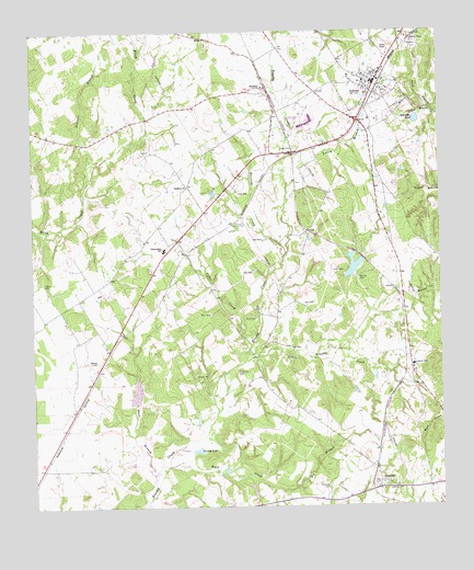
Jewett, TX USGS Topographic Map
Click on map above to begin viewing in our Map Viewer.

This topographic map contains these locations and features:
Feature Name Type Latitude Longitude GNIS ID View Map
Big BranchStreamN31.2552°W96.1775°1352031View Map
Birch CreekStreamN31.3388°W96.2325°1352214View Map
Brushy LakeLakeN31.2648°W96.2007°1353077View Map
Buck CreekStreamN31.2599°W96.2105°1353127View Map
Burleson CemeteryCemeteryN31.2552°W96.1600°1353329View Map
Carver SchoolSchoolN31.2871°W96.1339°1353908View Map
Cedar CreekStreamN31.2927°W96.1827°1354057View Map
City of JewettCivilN31.3626°W96.1455°2410142View Map
ConcordPopulated PlaceN31.2568°W96.1444°1379583View Map
Ephesus ChurchChurchN31.3343°W96.2019°1357045View Map
Independent SchoolSchoolN31.3180°W96.2091°1359912View Map
JewettPopulated PlaceN31.3616°W96.1441°1360250View Map
Jewett City HallBuildingN31.3616°W96.1459°2753211View Map
Jewett Police DepartmentBuildingN31.3615°W96.1458°2739310View Map
Jewett Post OfficePost OfficeN31.3663°W96.1411°2731700View Map
Jewett Volunteer Fire DepartmentBuildingN31.3617°W96.1457°2552251View Map
Jewett-Marquez DivisionCivilN31.2713°W96.2235°1938869View Map
K and L TransportBuildingN31.3682°W96.1420°2656011View Map
Little Brushy CreekStreamN31.2880°W96.1850°1361290View Map
McMillin CemeteryCemeteryN31.2855°W96.1872°1362512View Map
Miles FieldAirportN31.3130°W96.2205°1386957View Map
Moores CemeteryCemeteryN31.3100°W96.1502°1363125View Map
Morris Lazy K Ranch AirportAirportN31.2666°W96.2184°1387158View Map
Mustang CreekStreamN31.3163°W96.1719°1363530View Map
NewbyPopulated PlaceN31.3602°W96.1783°1380251View Map
Peoples CemeteryCemeteryN31.2888°W96.2305°1365050View Map
Rose LakeReservoirN31.3128°W96.1518°1859071View Map
Rose Lake DamDamN31.3102°W96.1536°1859070View Map
Sand BranchStreamN31.3543°W96.1275°1367559View Map
Sardis ChurchChurchN31.3730°W96.1947°1367777View Map
Shaw BranchStreamN31.2574°W96.2116°1368069View Map
Starrett BranchStreamN31.3321°W96.2339°1369129View Map
Swindler PondLakeN31.3516°W96.1322°1369490View Map
Taylor CemeteryCemeteryN31.3091°W96.2472°1369640View Map
Yellow BranchStreamN31.3382°W96.1719°1372032View Map

Note: Coordinates in the location and feature list above are referenced to NAD83 datum.


Copyright (C) 2008-2025 Ryan Niemi / Sunset Dynamics ... All Rights Reserved